Notes
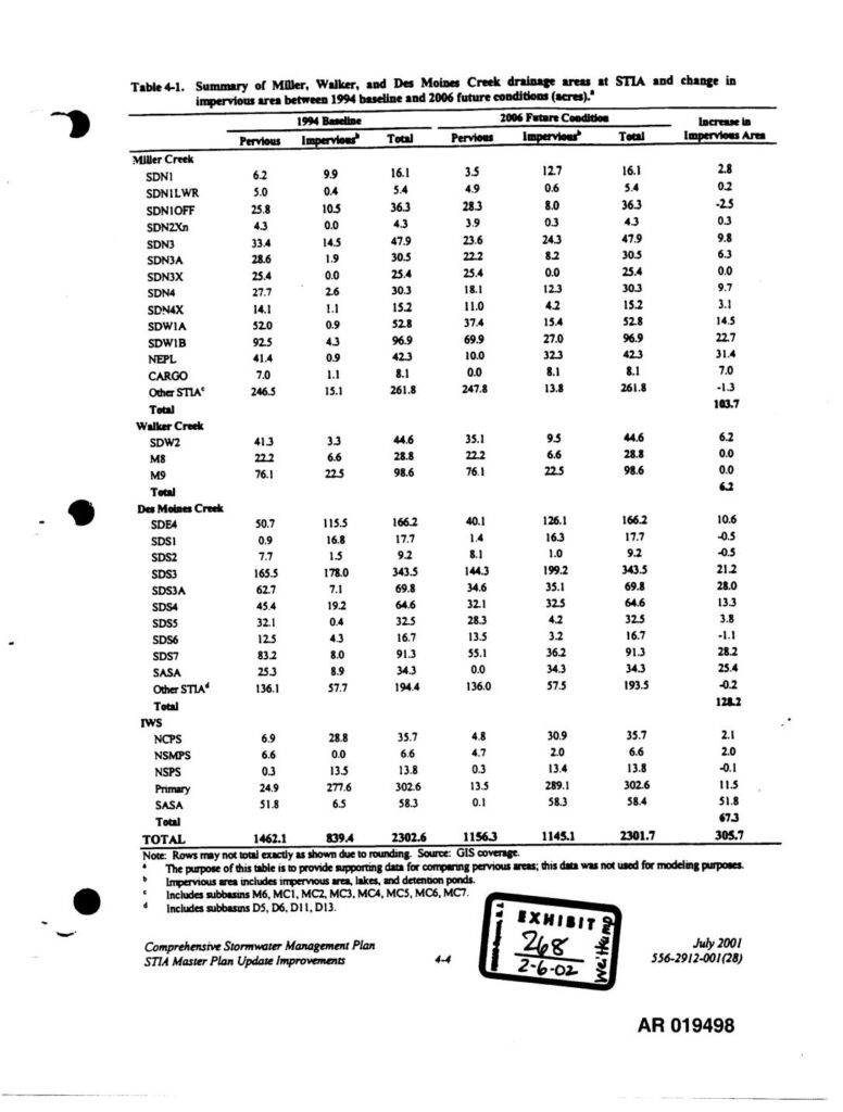
Exhibit 268 (AR 019498) from the PCHB Third Runway EIS administrative record. Table 4-1 from the Comprehensive Stormwater Management Plan, STIA Master Plan Update Improvements (July 2001, document 556-2912-001(28)). Provides drainage subbasin acreage data for Miller Creek, Walker Creek, and Des Moines Creek at Seattle-Tacoma International Airport, comparing 1994 baseline pervious and impervious areas against 2006 future conditions. Subbasins tabulated include SDN1, SDN1LWR, SDN1OFF, SDN2Xn, SDN3, SDN3A, SDN3X, SDN4, SDN4X, SDW1A, SDW1B, NEPL, CARGO, SDW2, M8, M9, SDE4, SDS1, SDS2, SDS3, SDS3A, SDS4, SDS5, SDS6, SDS7, SASA, NCPS, NSMPS, NSPS, Primary. Total increase in impervious area across all drainages is 305.7 acres. Impervious area includes impervious surfaces, lakes, and detention ponds. Filed as Exhibit 268 dated 2-6-02 in PCHB proceedings.