Notes
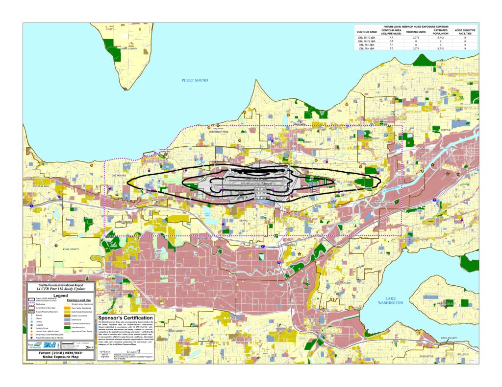
Future (2018) Noise Exposure Map (NEM) and Noise Compatibility Program (NCP) for Seattle-Tacoma International Airport, prepared by Landrum & Brown for the Port of Seattle as part of the 14 CFR Part 150 Study Update, dated October 23, 2013. Signed by Elizabeth Leavitt, Director of Aviation Planning and Environmental Programs, Port of Seattle. Map displays DNL 65, 70, and 75 dBA noise exposure contours projected for 2018, covering 7.3 square miles with 3,771 housing units and an estimated population of 9,712 within the DNL 65+ dBA contour. Shows existing land uses (residential, commercial/industrial, institutional, schools, churches, hospitals, nursing homes, libraries) across jurisdictions including Seattle, Burien, SeaTac, Tukwila, Des Moines, Normandy Park, Renton, Kent, Federal Way, and King County. Includes airport permanent noise monitors, temporary noise monitoring sites, and NRHP-listed historic sites. Runway configuration shown: 16L/16C/16R and 34L/34C/34R.