TagNEPA(390)
-
 2024-10-22
Port of Seattle Commission 2024 10 22 SM 11a SAMP EA Presentation
A Port of Seattle Commission Agenda Memorandum (Item 11a, meeting date October 22, 2024), authored by Sarah Cox and Steve Rybolt of Aviation Environment and Sustainability and addressed to Executive Director Stephen P. Metruck, summarizing the Draft NEPA Environmental Assessment findings for the Sustainable Airport Master Plan Near-Term Projects and announcing a 45-day public comment period from October 21 to December 5, 2024. -
2024_10_22_SM_Packet_Supplemental (11a SAMP EA Presentation)_46
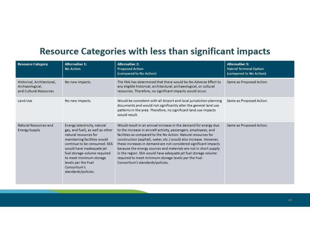
Slide 43 from a Seattle-Tacoma International Airport (SEA) environmental impact document compares three alternatives — No Action, Proposed Action, and Hybrid Terminal Option — across resource categories including Historical/Archaeological/Cultural Resources, Land Use, and Natural Resources and Energy Supply. The FAA determined no adverse effects to historical or cultural resources under the Proposed Action, and noted that SEA would have adequate jet fuel storage under Alternatives 2 and 3 but inadequate storage under the No Action alternative. -
2024_10_22_SM_Packet_Supplemental (11a SAMP EA Presentation)_47
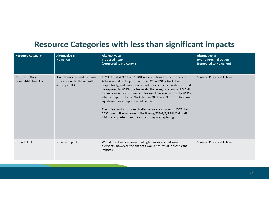
Slide 44 from a Sea-Tac Airport (SEA) Environmental Impact Statement presentation comparing noise and visual effects impacts across three alternatives: No Action, Proposed Action, and Hybrid Terminal Option. Key findings indicate that while the 65 DNL noise contour would be larger under the Proposed Action in 2032 and 2037, no significant noise impacts would occur, and noise contours shrink by 2037 due to quieter Boeing 737 MAX aircraft. -
2024_10_22_SM_Packet_Supplemental (11a SAMP EA Presentation)_45
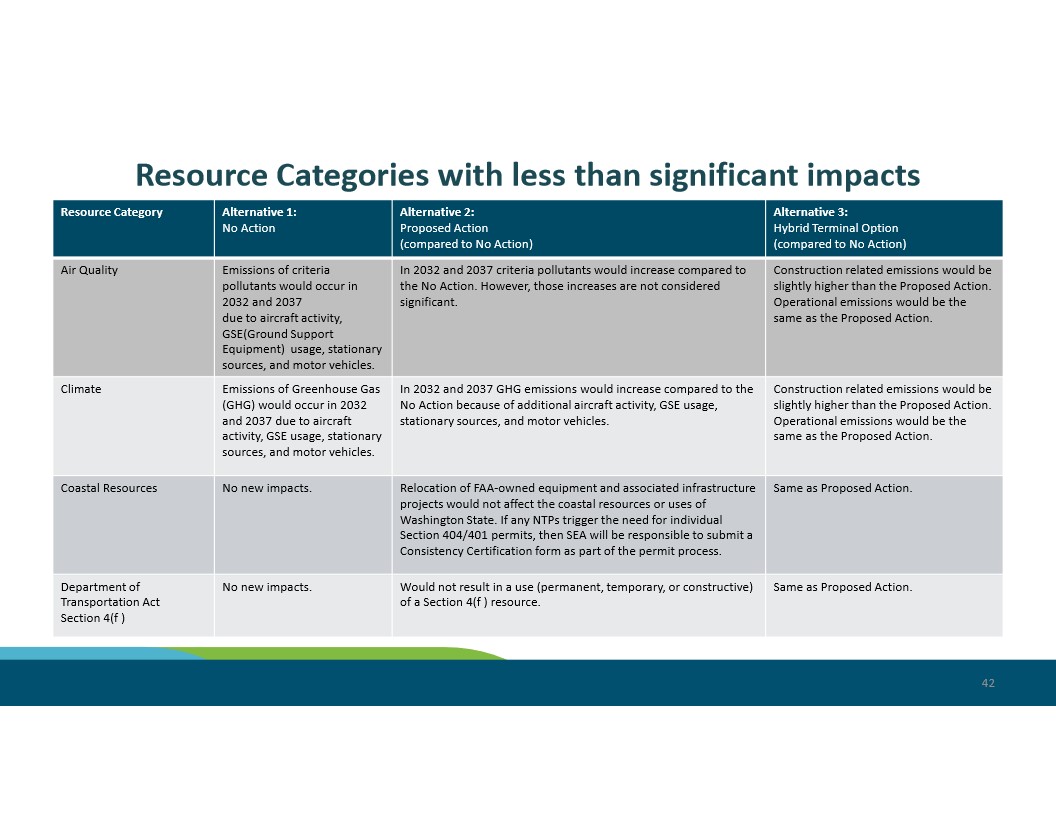
Slide 42 from a Sea-Tac Airport environmental review presentation comparing impacts across three alternatives (No Action, Proposed Action, and Hybrid Terminal Option) for resource categories including Air Quality, Climate, Coastal Resources, and Department of Transportation Act Section 4(f). The slide indicates that criteria pollutant and GHG emissions would increase under Alternatives 2 and 3 compared to No Action but are not considered significant, and that Coastal Resources and Section 4(f) resources would not be adversely affected. -
2024_10_22_SM_Packet_Supplemental (11a SAMP EA Presentation)_44
A teal-background section divider slide bearing the heading 'Additional Information' in white text, numbered page 41. The slide uses a color-bar footer in light blue and green consistent with a corporate or governmental presentation template. -
2024_10_22_SM_Packet_Supplemental (11a SAMP EA Presentation)_43
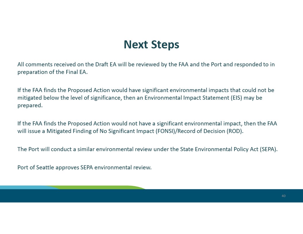
This presentation slide outlines the next steps in the FAA and Port of Seattle environmental review process for a proposed action at Sea-Tac Airport. Steps include FAA review of Draft EA comments, potential preparation of an Environmental Impact Statement (EIS) or issuance of a Mitigated FONSI/ROD, and Port of Seattle SEPA environmental review approval. -
2024_10_22_SM_Packet_Supplemental (11a SAMP EA Presentation)_42
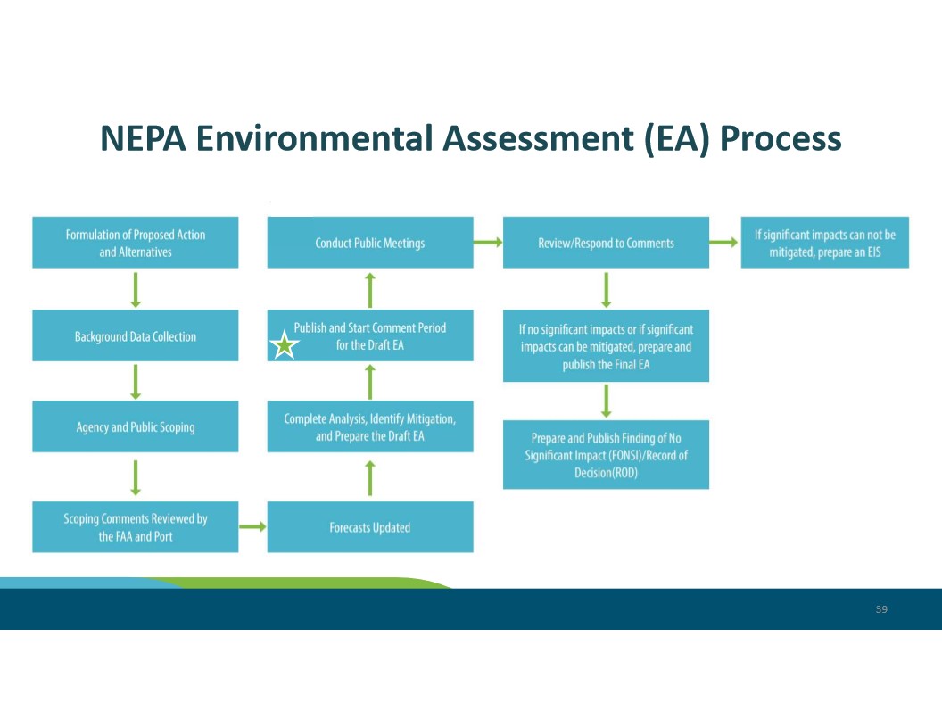
This slide (page 39) depicts the step-by-step NEPA Environmental Assessment process, beginning with Formulation of Proposed Action and Alternatives and proceeding through Background Data Collection, Agency and Public Scoping, Forecasts Updated, Draft EA preparation, public comment period, and culminating in either a Finding of No Significant Impact (FONSI)/Record of Decision (ROD) or, if significant impacts cannot be mitigated, preparation of an Environmental Impact Statement (EIS). A star icon marks the current status at the 'Publish and Start Comment Period for the Draft EA' step. -
2024_10_22_SM_Packet_Supplemental (11a SAMP EA Presentation)_41
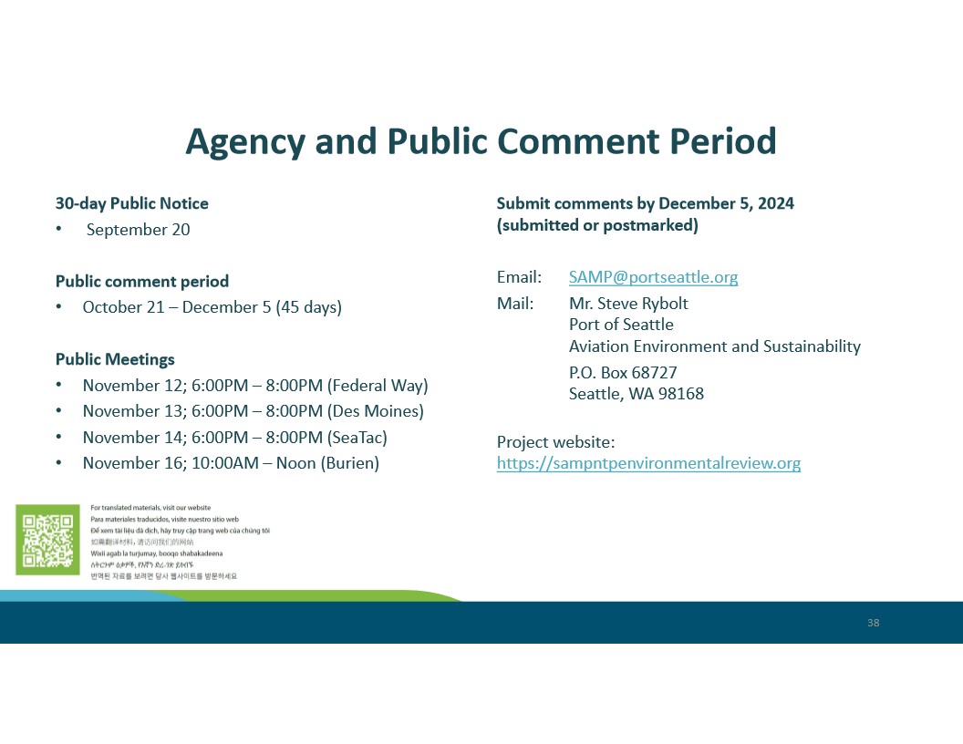
Slide 38 from a Port of Seattle presentation announcing the 30-day public notice (September 20) and 45-day public comment period (October 21 – December 5, 2024) for the Seattle-Tacoma International Airport Sustainable Airport Master Plan (SAMP) environmental review. Public meetings are listed for Federal Way, Des Moines, SeaTac, and Burien in November 2024, with comments directed to Mr. Steve Rybolt at SAMP@portseattle.org or via the project website sampntpenvironmentalreview.org. -
2024_10_22_SM_Packet_Supplemental (11a SAMP EA Presentation)_40
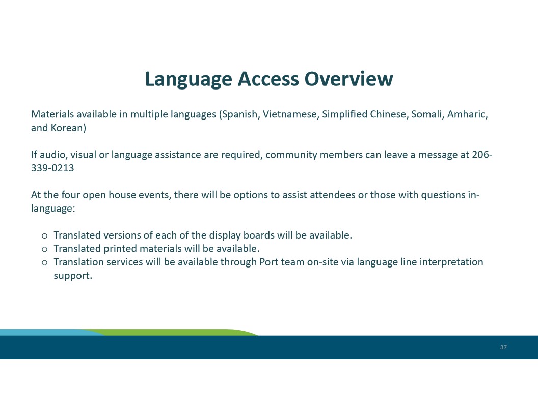
Slide 37 from a Port of Seattle presentation outlines language access provisions for Sea-Tac Airport community open house events, noting materials available in Spanish, Vietnamese, Simplified Chinese, Somali, Amharic, and Korean. Community members requiring audio, visual, or language assistance could call 206-339-0213, and on-site language line interpretation support was offered at four open house events. -
2024_10_22_SM_Packet_Supplemental (11a SAMP EA Presentation)_39
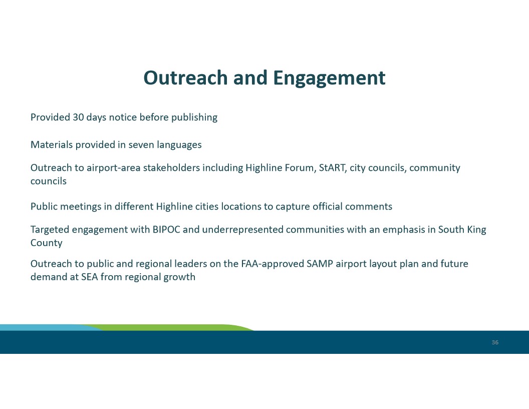
Slide 36 from a Sea-Tac Airport (SEA) presentation summarizing public outreach and engagement efforts related to the FAA-approved SAMP (Sustainable Airport Master Plan) airport layout plan. Activities included 30-day advance notice, materials in seven languages, stakeholder outreach to the Highline Forum and StART, public meetings in Highline cities, targeted engagement with BIPOC and underrepresented communities in South King County, and outreach to regional leaders on future airport demand.