TagNEPA(390)
-
2024_10_22_SM_Packet_Supplemental (11a SAMP EA Presentation)_11
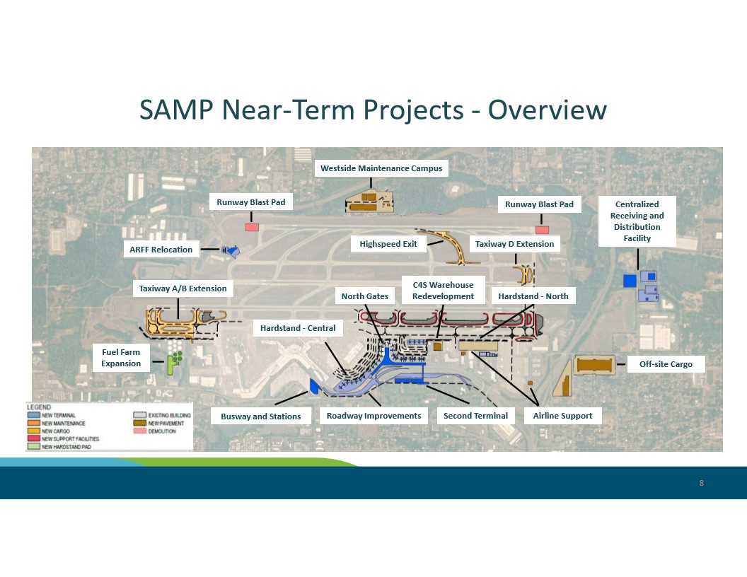
Slide 8 from a Seattle-Tacoma International Airport Strategic Airport Master Plan (SAMP) presentation, showing an aerial map of near-term capital projects including a Second Terminal, North Gates, Taxiway A/B and D extensions, Runway Blast Pads, Busway and Stations, Roadway Improvements, Fuel Farm Expansion, ARFF Relocation, Westside Maintenance Campus, and Off-site Cargo facilities. The legend distinguishes new terminal, maintenance, cargo, support facilities, hardstand pad, existing buildings, new pavement, and demolition areas. -
2024_10_22_SM_Packet_Supplemental (11a SAMP EA Presentation)_10
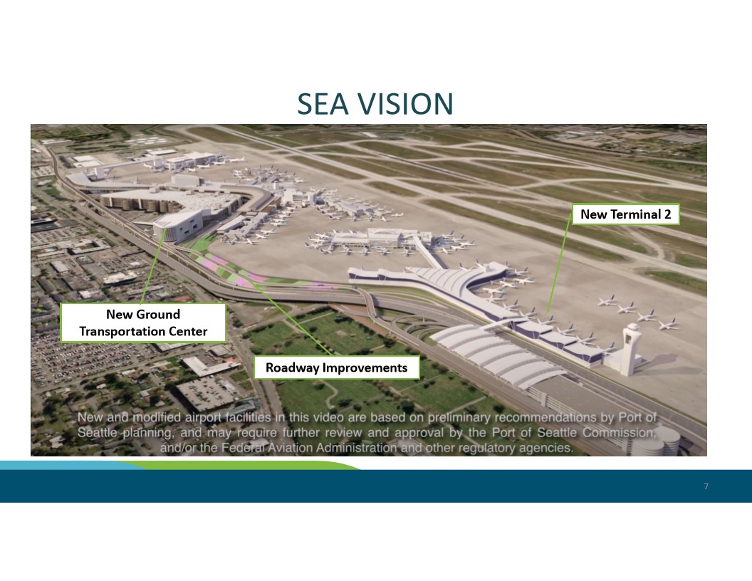
A Port of Seattle presentation slide titled 'SEA VISION' (slide 7) showing an aerial rendering of proposed future development at Seattle-Tacoma International Airport, including a New Terminal 2, a New Ground Transportation Center, and Roadway Improvements. A disclaimer notes that the facilities are based on preliminary recommendations by Port of Seattle planning and may require further review by the Port of Seattle Commission, the FAA, and other regulatory agencies. -
2024_10_22_SM_Packet_Supplemental (11a SAMP EA Presentation)_9
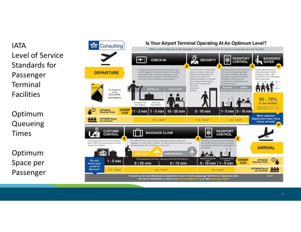
An IATA Consulting infographic titled 'Is Your Airport Terminal Operating At An Optimum Level?' outlining the IATA Level of Service (LoS) concept for passenger terminal facilities, including optimum queueing times and space-per-passenger standards for departure and arrival processes such as check-in, security, passport control, baggage claim, and customs. The slide references IATA's Airport Development Reference Manual (ADRM) at iata.org/adrm. -
2024_10_22_SM_Packet_Supplemental (11a SAMP EA Presentation)_8
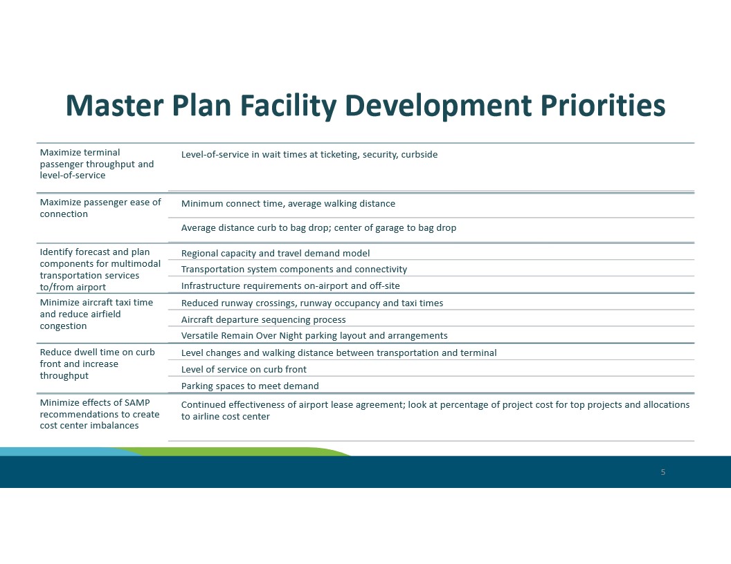
A presentation slide titled 'Master Plan Facility Development Priorities' outlining airport planning objectives including maximizing terminal passenger throughput, ease of connection, multimodal transportation, minimizing aircraft taxi time, reducing curb front dwell time, and minimizing cost center imbalances from SAMP recommendations. No specific airport name, date, or organization logo is visible in the image. -
2024_10_22_SM_Packet_Supplemental (11a SAMP EA Presentation)_7
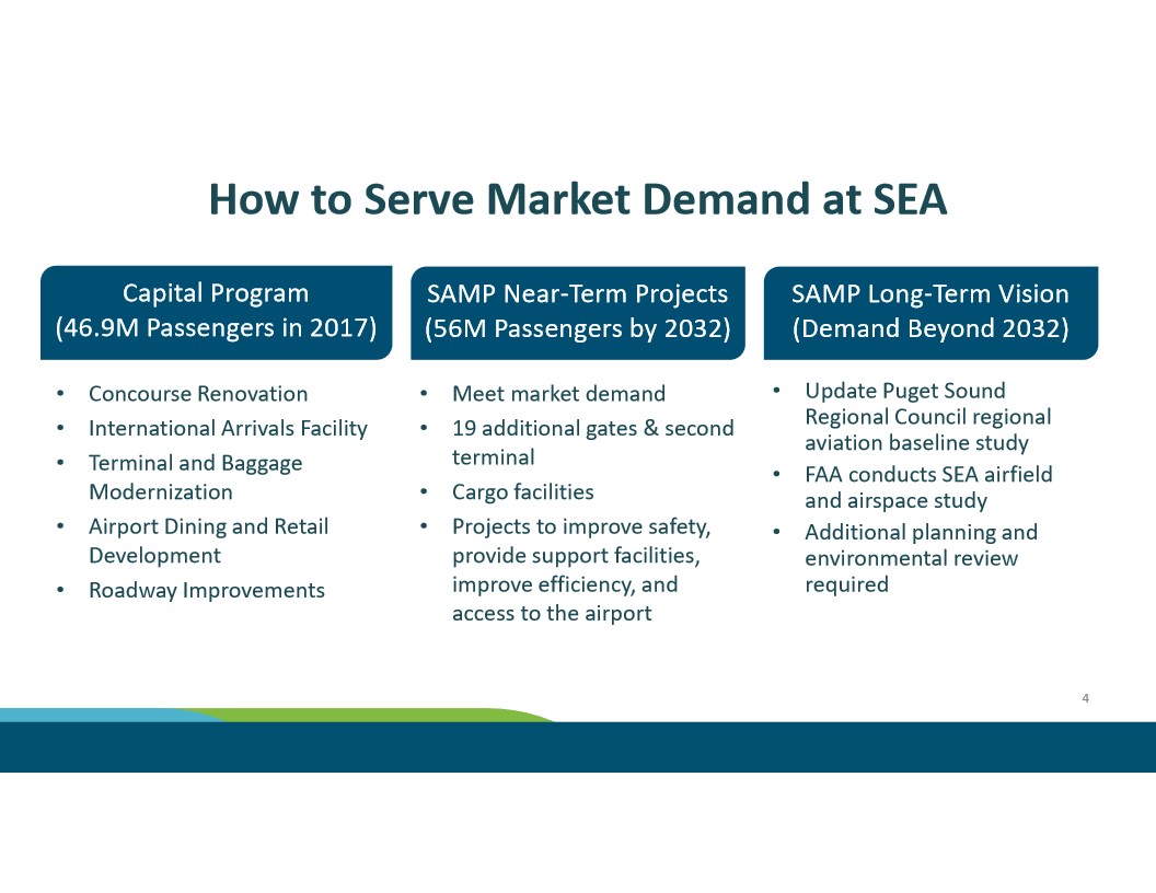
A presentation slide titled 'How to Serve Market Demand at SEA' outlining Seattle-Tacoma International Airport's three-phase capacity strategy: the Capital Program serving 46.9M passengers in 2017, SAMP Near-Term Projects targeting 56M passengers by 2032 (including 19 additional gates and a second terminal), and a SAMP Long-Term Vision for demand beyond 2032 involving FAA airfield studies and environmental review. -
2024_10_22_SM_Packet_Supplemental (11a SAMP EA Presentation)_6
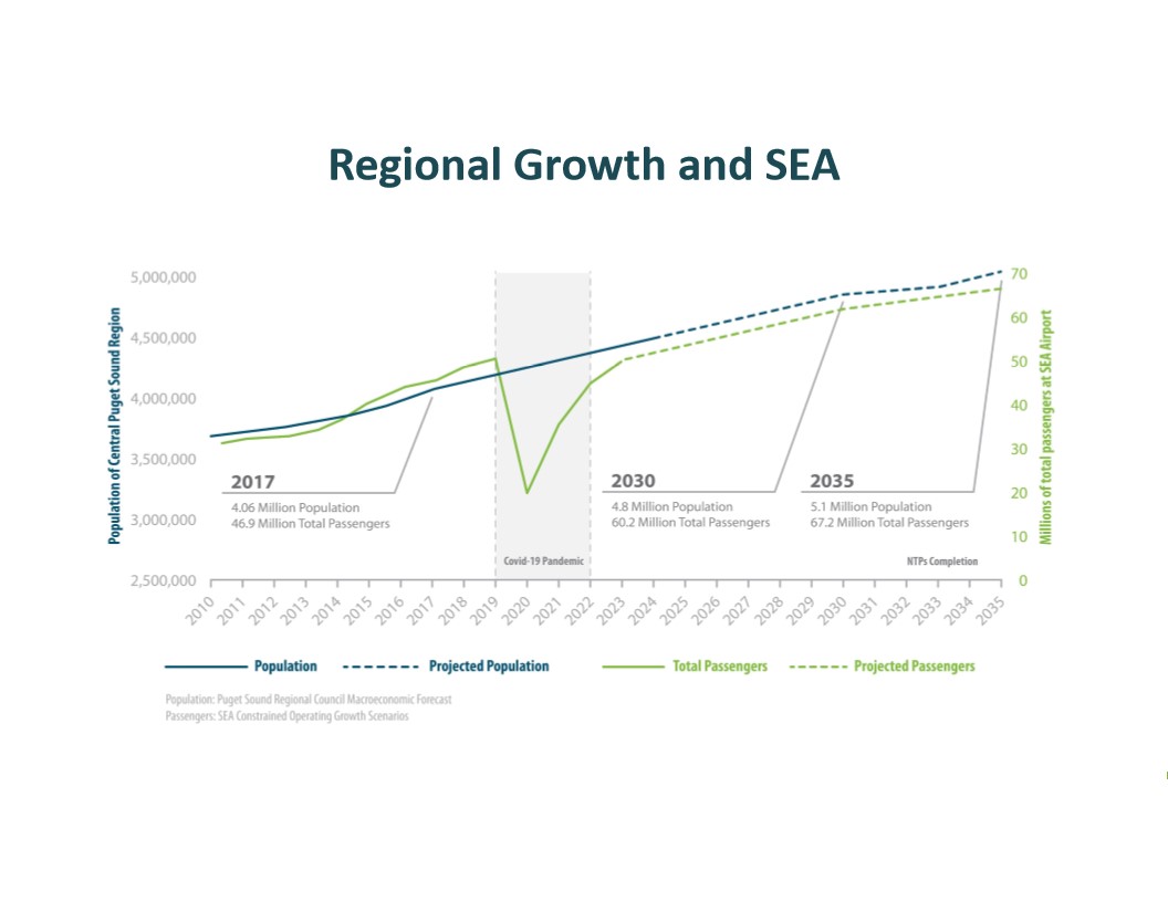
This chart from a Sea-Tac Airport (SEA) planning document shows the correlation between Central Puget Sound regional population growth and total passenger volumes from 2010 through 2035, including the COVID-19 pandemic dip. Key data points include 46.9 million passengers and 4.06 million population in 2017, with projections of 60.2 million passengers and 4.8 million population by 2030, and 67.2 million passengers and 5.1 million population by 2035 following NTPs Completion. -
2024_10_22_SM_Packet_Supplemental (11a SAMP EA Presentation)_5
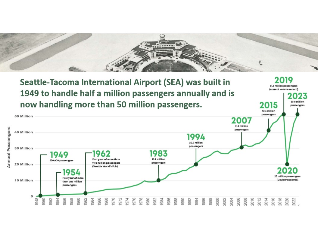
An infographic chronicling annual passenger volume at Seattle-Tacoma International Airport (SEA) from its 1949 opening (130,600 passengers) through 2023 (50.8 million passengers), highlighting milestones such as the 1962 Seattle World's Fair surge, the 2019 record of 51.8 million passengers, and the COVID-19 pandemic drop to 20 million in 2020. A historic aerial photograph of the original terminal building appears at the top. -
2024_10_22_SM_Packet_Supplemental (11a SAMP EA Presentation)_4
Title slide for a Port of Seattle commission presentation dated October 22, 2024, agenda Item No. 11a supp, covering Sustainable Airport Master Plan Near-Term Projects at Seattle-Tacoma International Airport. -
2024_10_22_SM_Packet_Supplemental (11a SAMP EA Presentation)_3
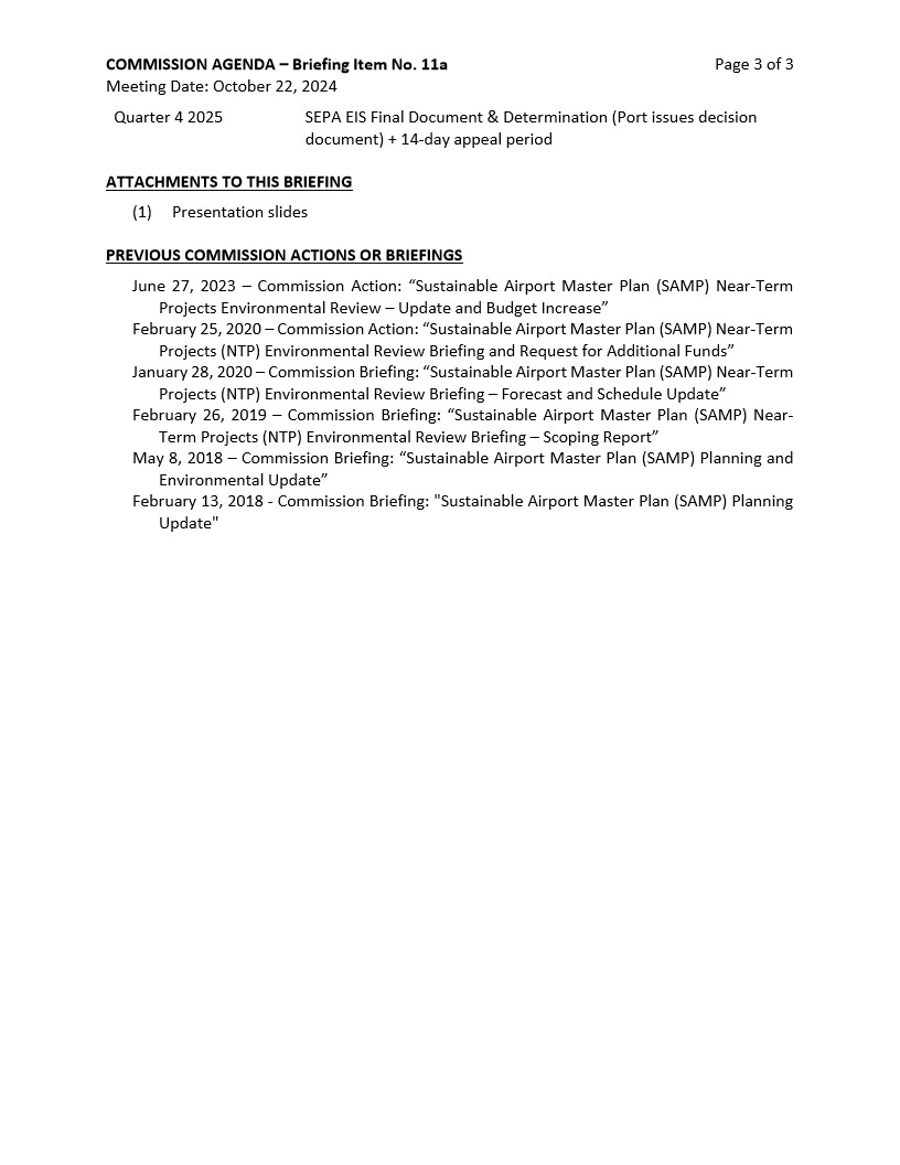
This is page 3 of 3 of a Port of Seattle Commission Agenda briefing document dated October 22, 2024, covering the Sustainable Airport Master Plan (SAMP) Near-Term Projects Environmental Review. It lists a Quarter 4 2025 milestone for the SEPA EIS Final Document and Decision, one attachment (presentation slides), and six previous Commission actions or briefings on SAMP dating from February 2018 through June 2023. -
2024_10_22_SM_Packet_Supplemental (11a SAMP EA Presentation)_2
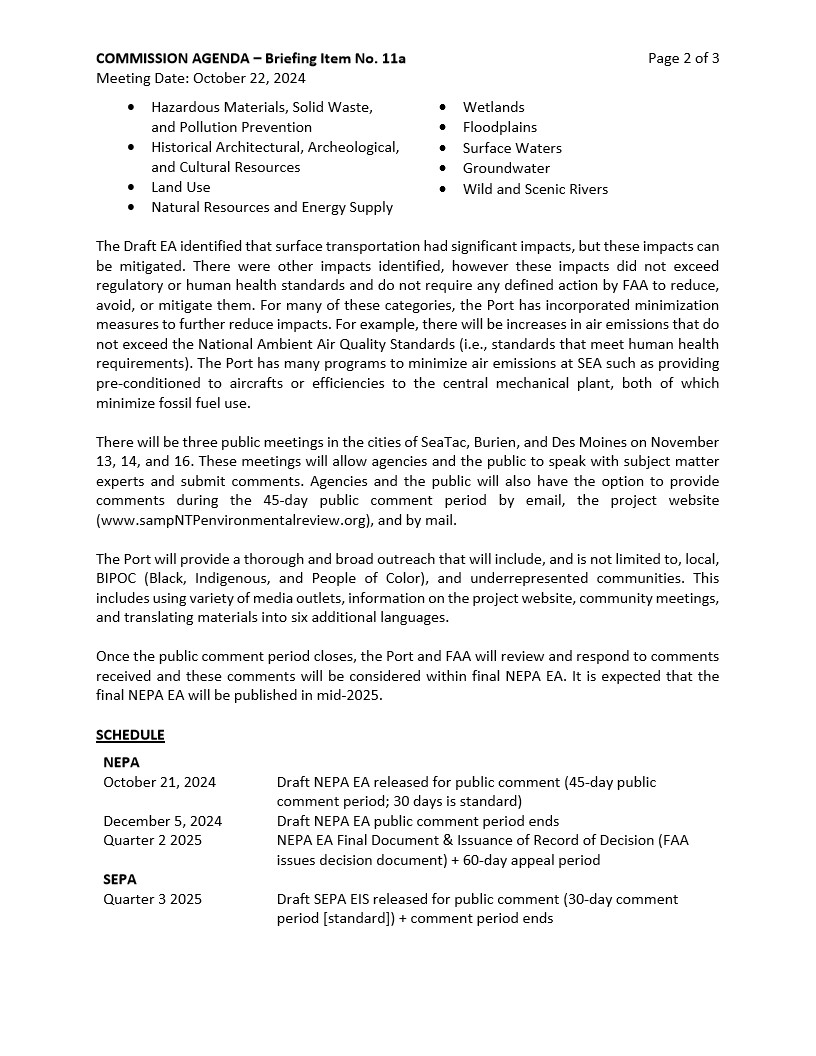
Page 2 of 3 from Commission Agenda Briefing Item No. 11a, dated October 22, 2024, summarizing the Draft Environmental Assessment for Sea-Tac Airport (SEA) surface transportation impacts and outlining the public comment schedule, including the Draft NEPA EA released October 21, 2024 with a 45-day comment period closing December 5, 2024, and public meetings in SeaTac, Burien, and Des Moines on November 13, 14, and 16.