TagNEPA(390)
-
Chapter 3 Affected Environment_45
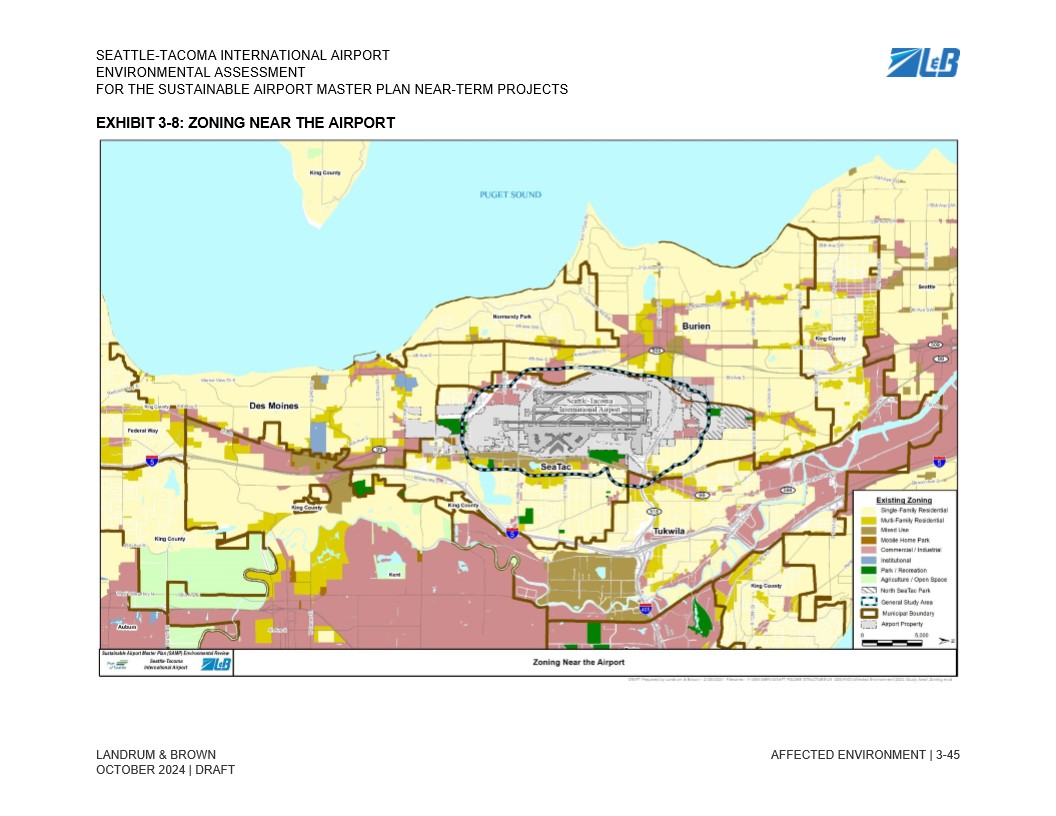
Exhibit 3-8 from the Seattle-Tacoma International Airport Environmental Assessment for the Sustainable Airport Master Plan Near-Term Projects, prepared by Landrum & Brown (October 2024 Draft). The map displays existing zoning categories near Sea-Tac Airport, including surrounding municipalities such as Burien, SeaTac, Des Moines, Tukwila, and King County, with a legend distinguishing residential, commercial/industrial, institutional, park/recreation, and agriculture/open space zones, as well as the North SeaTac Park boundary, General Study Area, and Airport Property. -
Chapter 3 Affected Environment_43
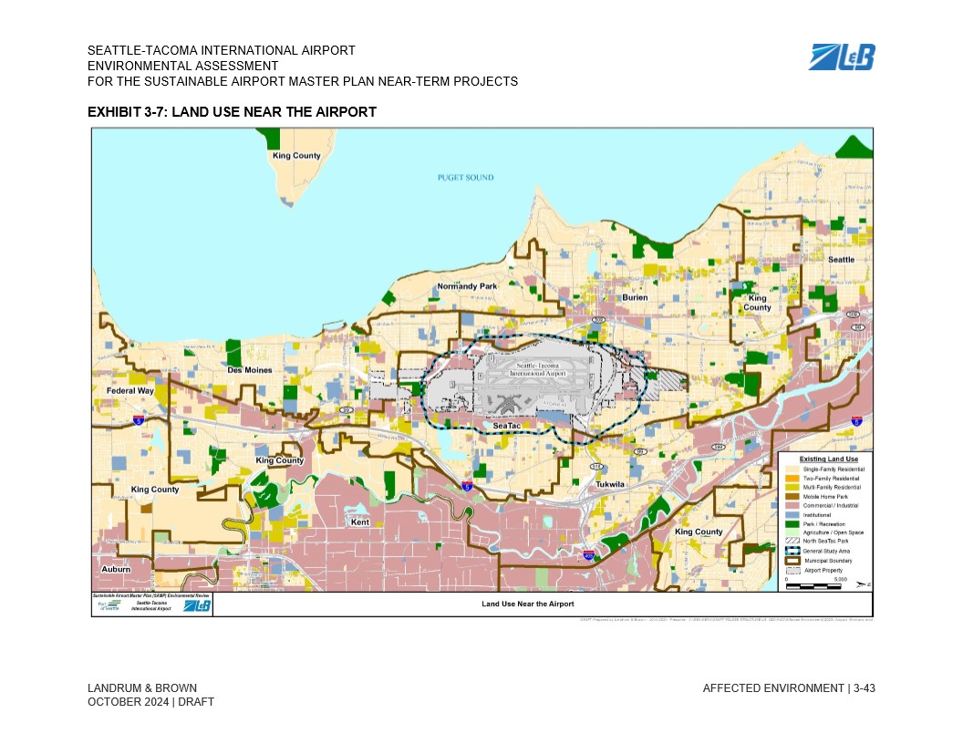
This map, from the Seattle-Tacoma International Airport Sustainable Airport Master Plan (SAMP) Environmental Assessment prepared by Landrum & Brown (draft, October 2024), depicts existing land uses in the vicinity of Sea-Tac Airport, including surrounding municipalities such as SeaTac, Burien, Des Moines, Tukwila, and Kent, with a legend distinguishing residential, commercial/industrial, institutional, park, and agricultural zones along with the airport property boundary and North SeaTac Park. -
Chapter 3 Affected Environment_39
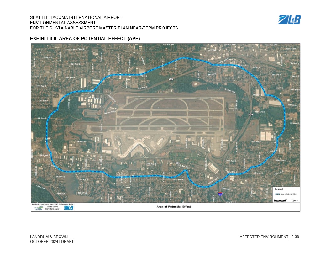
This exhibit from the Seattle-Tacoma International Airport Sustainable Airport Master Plan Near-Term Projects Environmental Assessment (Draft, October 2024, prepared by Landrum & Brown) shows an aerial map with a blue dashed boundary delineating the Area of Potential Effect (APE) surrounding the airport and adjacent neighborhoods. -
Chapter-3-Affected-Environment_25 – Copy
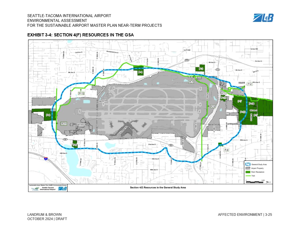
Draft Environmental Assessment exhibit (October 2024, Landrum & Brown) for the Seattle-Tacoma International Airport Sustainable Airport Master Plan Near-Term Projects, mapping Section 4(f) protected resources—parks/recreation areas (labeled P-1 through P-15) and trails—within the General Study Area surrounding Sea-Tac Airport property. -
Chapter-3-Affected-Environment_5 – Copy
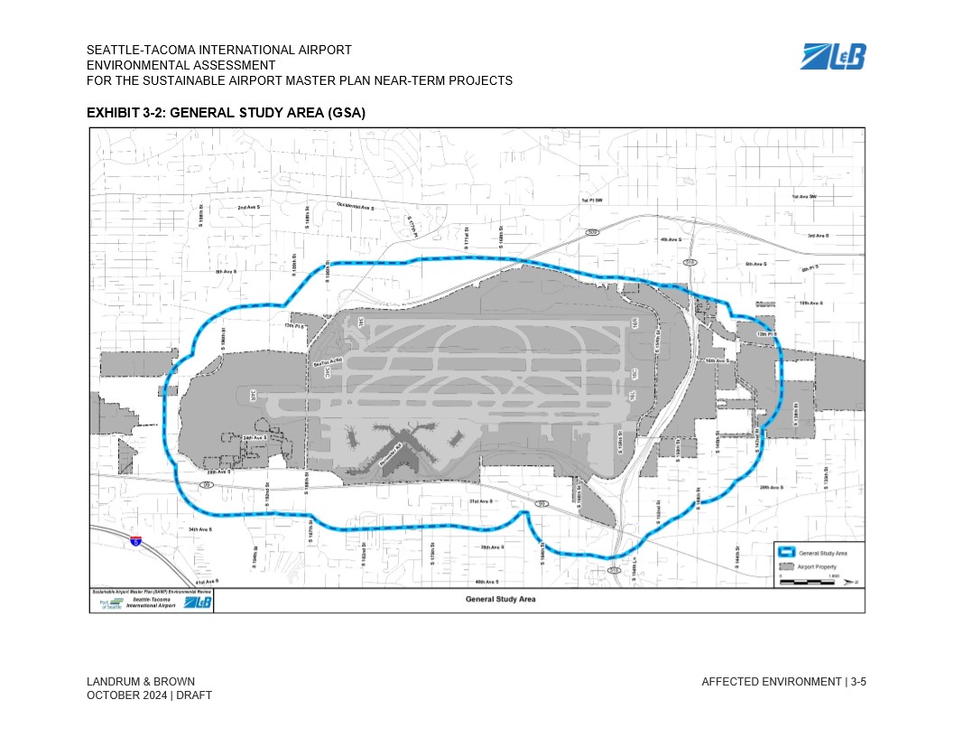
Exhibit 3-2 from the Seattle-Tacoma International Airport Environmental Assessment for the Sustainable Airport Master Plan Near-Term Projects, prepared by Landrum & Brown, dated October 2024 (Draft). The map depicts the General Study Area boundary (shown in blue) encompassing the airport property (shown in gray) and surrounding neighborhoods, oriented within the street grid of the SeaTac/Des Moines area. -
Chapter-3-Affected-Environment_3 – Copy
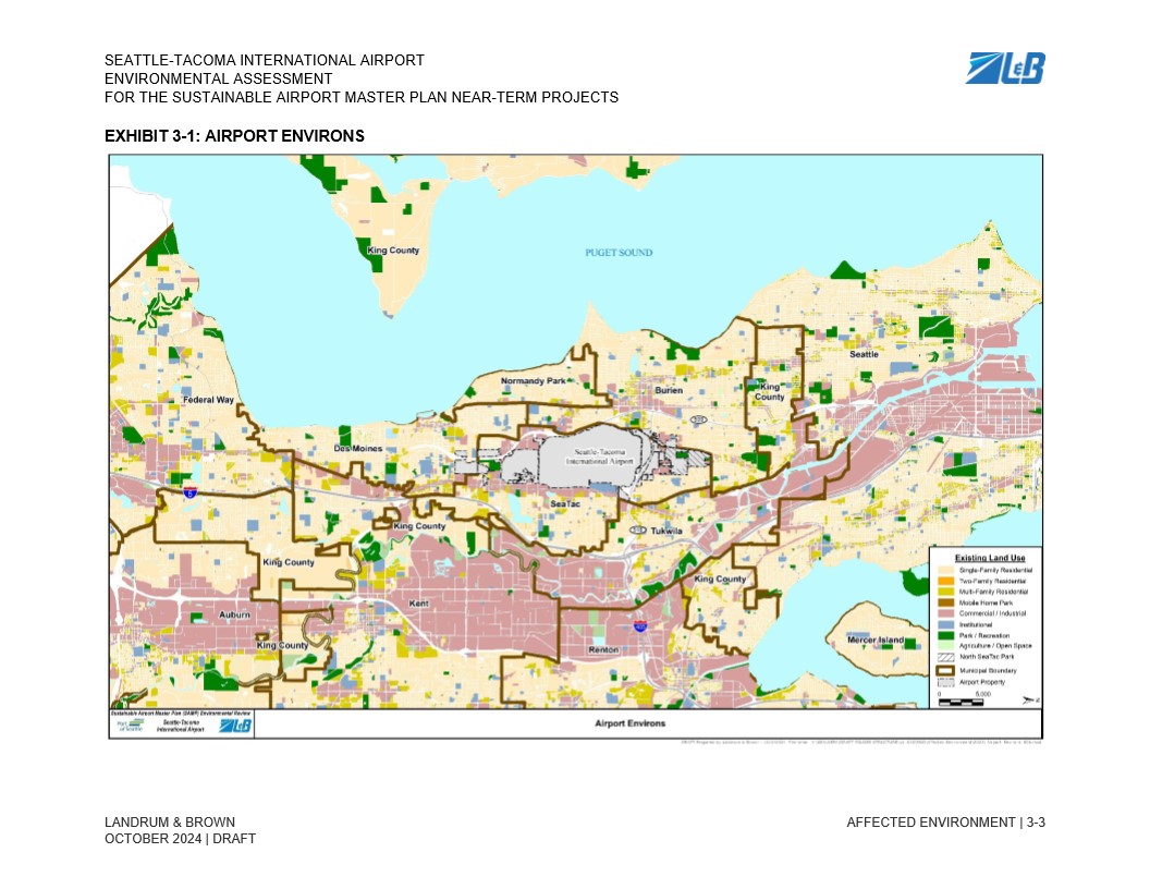
Exhibit 3-1 from the Seattle-Tacoma International Airport Environmental Assessment for the Sustainable Airport Master Plan Near-Term Projects, prepared by Landrum & Brown, dated October 2024 (Draft). The map depicts existing land use classifications across the airport environs, including surrounding municipalities such as SeaTac, Burien, Des Moines, Tukwila, Renton, Kent, Auburn, and Federal Way, with the airport property boundary delineated. -
Chapter 3 Affected Environment_111
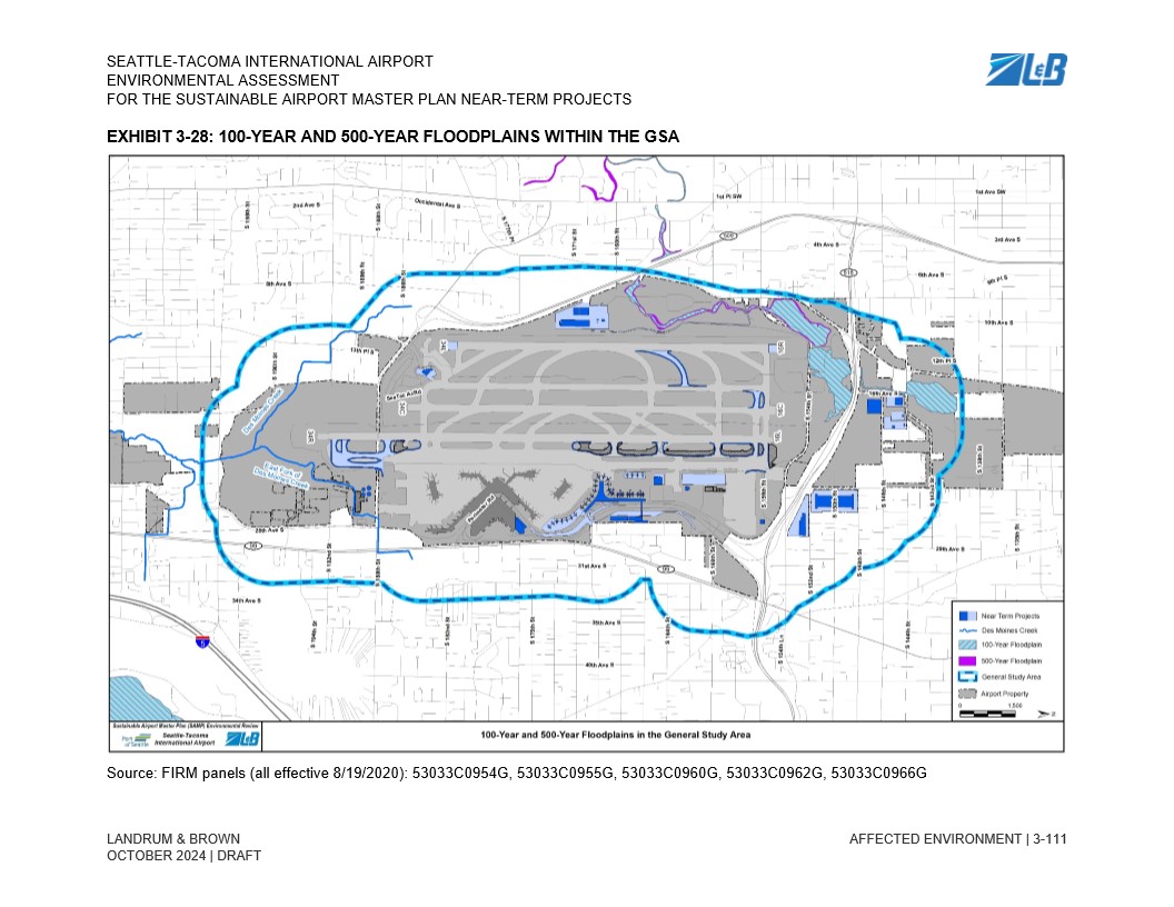
Exhibit 3-28 from the Seattle-Tacoma International Airport Environmental Assessment for the Sustainable Airport Master Plan Near-Term Projects, prepared by Landrum & Brown (October 2024 Draft), depicting 100-year and 500-year floodplains within the General Study Area. The map references FIRM panels effective 8/19/2020 and shows Des Moines Creek, near-term project locations, and airport property boundaries. -
Chapter 3 Affected Environment_107
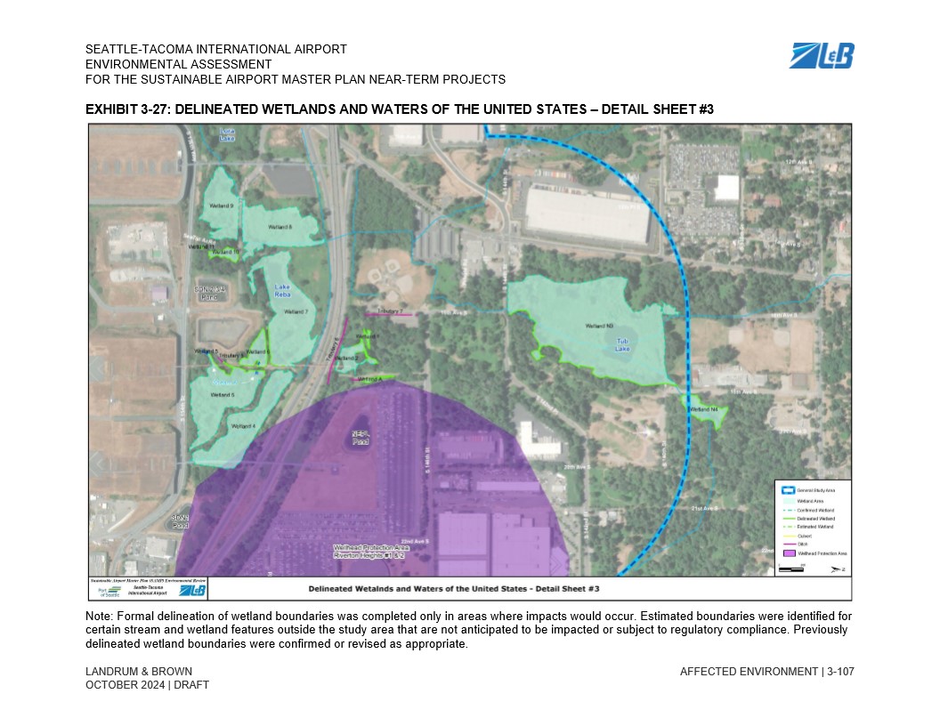
Exhibit 3-27 from the Seattle-Tacoma International Airport Environmental Assessment for the Sustainable Airport Master Plan Near-Term Projects (Draft, October 2024), prepared by Landrum & Brown. The map shows delineated and confirmed wetlands, streams, ditches, and a Wellhead Protection Area near the airport, including named features such as Lake Keba, Tub Lake, Iota Lake, and Stout Pond, overlaid on an aerial photograph of the study area. -
Chapter 3 Affected Environment_105
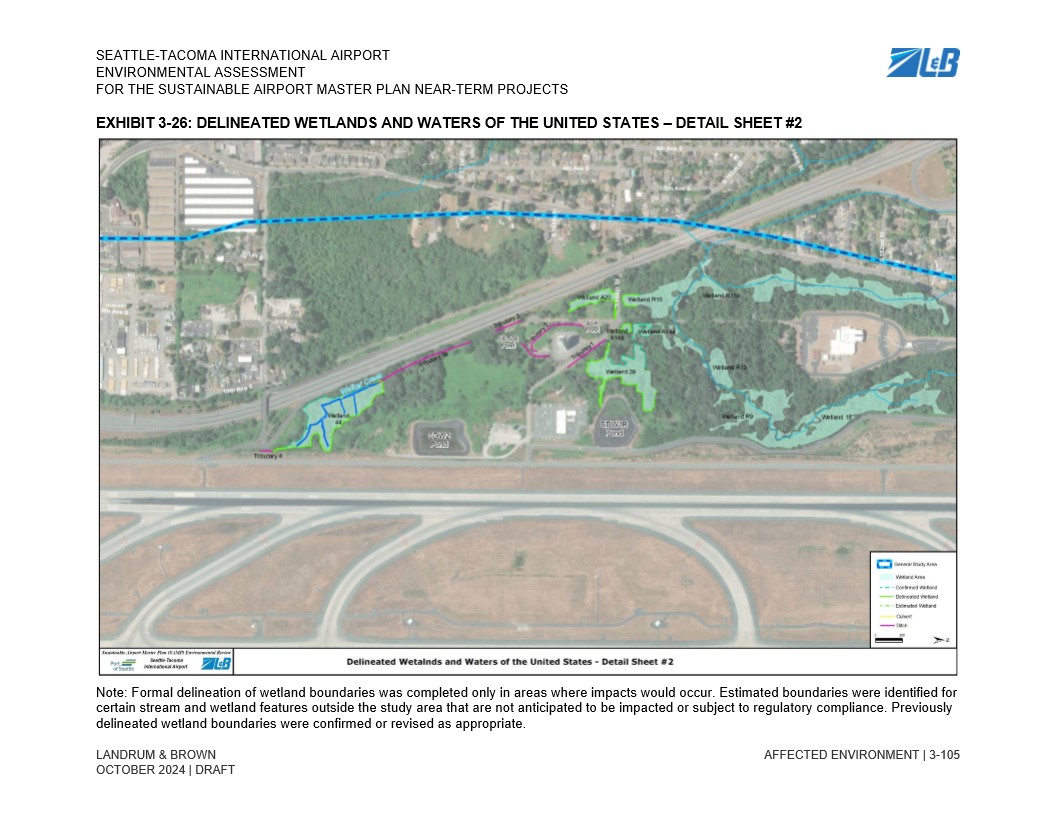
A draft October 2024 exhibit from the Seattle-Tacoma International Airport Environmental Assessment for the Sustainable Airport Master Plan (SAMP) Near-Term Projects, prepared by Landrum & Brown. The aerial map (Exhibit 3-26, Detail Sheet #2) shows delineated and confirmed wetland boundaries, estimated wetlands, tributaries, and other Waters of the United States in the area south of the airport's runway environment, with a note that formal delineation was completed only in areas where impacts would occur. -
Chapter 3 Affected Environment_103
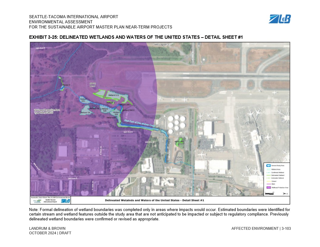
Exhibit 3-25 from the Seattle-Tacoma International Airport Environmental Assessment for the Sustainable Airport Master Plan Near-Term Projects, prepared by Landrum & Brown, dated October 2024 (Draft). The aerial map identifies delineated, confirmed, and estimated wetland boundaries, streams, ditches, and Wellhead Protection Areas in the vicinity of Sea-Tac Airport, including named wetlands (e.g., Wetland G12, Wetland DMC2) and the West Fork of Des Moines Creek.