TagNEPA(390)
-
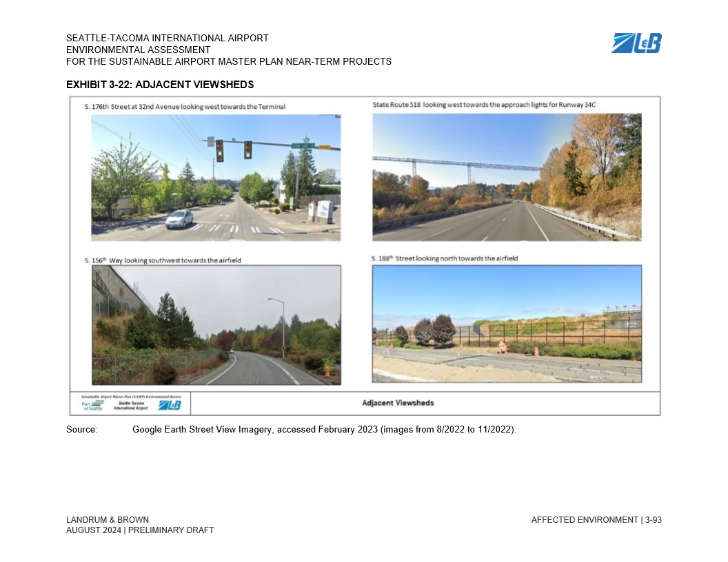
Chapter 3 Affected Environment_93
Page 3-93 from the Seattle-Tacoma International Airport Environmental Assessment for the Sustainable Airport Master Plan Near-Term Projects (Landrum & Brown, August 2024 Preliminary Draft), showing four Google Earth Street View images of adjacent viewsheds: S. 176th Street at 32nd Avenue looking west toward the Terminal, State Route 518 looking west toward Runway 34C approach lights, S. 156th Way looking southwest toward the airfield, and S. 188th Street looking north toward the airfield. Source imagery was accessed February 2023 (August–November 2022). -
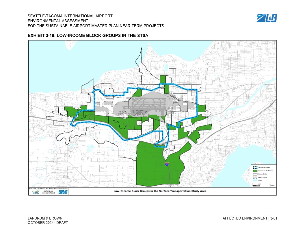
Chapter 3 Affected Environment_81
Draft exhibit from the Seattle-Tacoma International Airport Environmental Assessment for the Sustainable Airport Master Plan Near-Term Projects, prepared by Landrum & Brown, dated October 2024. The map (Exhibit 3-19) identifies low-income block groups within the Surface Transportation Study Area (STSA) surrounding Sea-Tac Airport, with green shading indicating low-income block groups and a blue dashed line denoting the general study area boundary. -
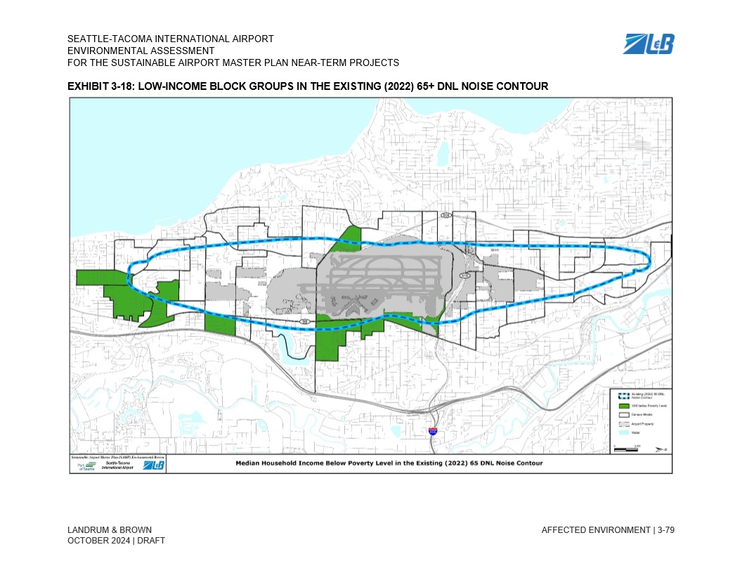
Chapter 3 Affected Environment_79
Exhibit 3-18 from the Seattle-Tacoma International Airport Environmental Assessment for the Sustainable Airport Master Plan Near-Term Projects (Draft, October 2024), prepared by Landrum & Brown. The map shows census block groups with median household income below poverty level (highlighted in green) that fall within the existing 2022 65+ DNL noise contour (shown as a blue dashed ellipse) surrounding Sea-Tac Airport. -
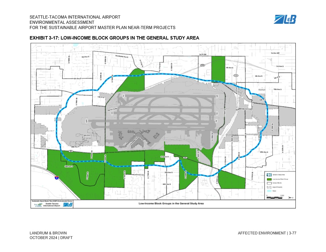
Chapter 3 Affected Environment_77
Draft Environmental Assessment exhibit from the Seattle-Tacoma International Airport Sustainable Airport Master Plan (SAMP) Near-Term Projects, prepared by Landrum & Brown, dated October 2024. The map identifies low-income census block groups (shown in green) within the General Study Area (outlined in blue dashes) surrounding Sea-Tac Airport, as part of the environmental justice analysis. -
Chapter 3 Affected Environment_75
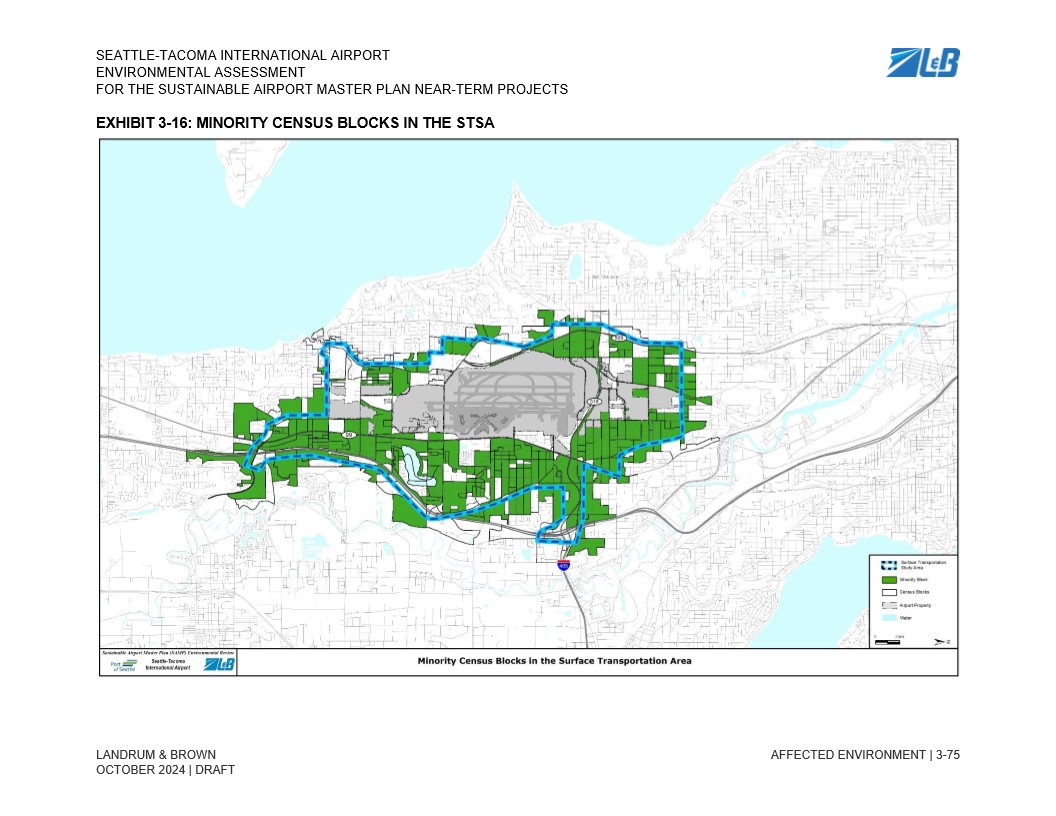
This map, from the Seattle-Tacoma International Airport Sustainable Airport Master Plan Near-Term Projects Environmental Assessment (Draft, October 2024, prepared by Landrum & Brown), depicts minority census blocks within the Surface Transportation Study Area (STSA) surrounding Sea-Tac Airport. Green shading identifies minority census blocks, the blue dashed boundary delineates the Surface Transportation Study Area, and gray shading marks airport property. -
Chapter 3 Affected Environment_73
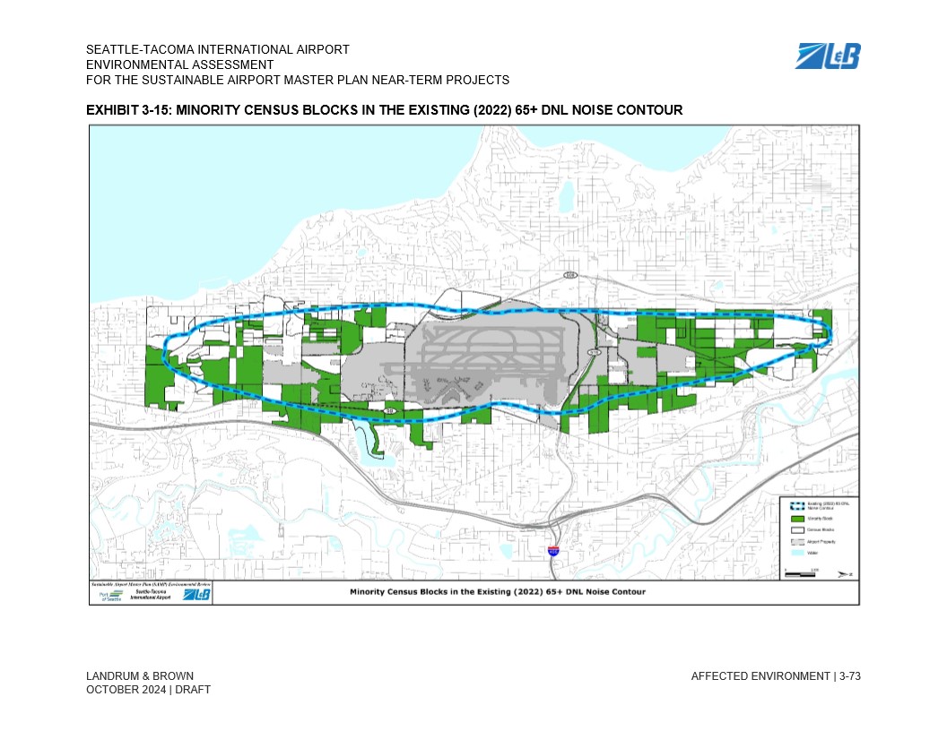
Exhibit 3-15 from the Seattle-Tacoma International Airport Environmental Assessment for the Sustainable Airport Master Plan Near-Term Projects, prepared by Landrum & Brown, October 2024 Draft. The map displays minority census blocks (shown in green) falling within the existing 2022 65+ DNL noise contour (blue dashed line) surrounding Sea-Tac Airport property (gray). -
Chapter 3 Affected Environment_71
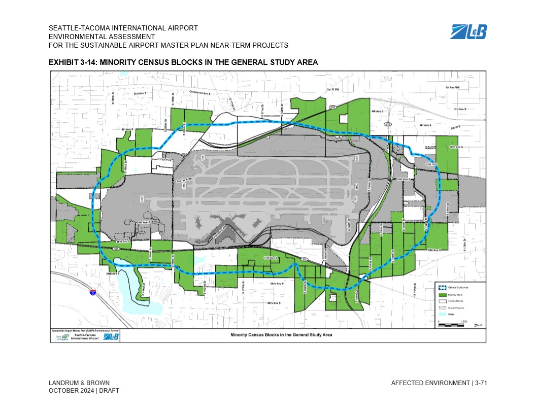
This map, labeled Exhibit 3-14, is from the Seattle-Tacoma International Airport Environmental Assessment for the Sustainable Airport Master Plan Near-Term Projects, drafted by Landrum & Brown in October 2024. It depicts minority census blocks (shown in green) within the General Study Area (outlined in blue) surrounding Sea-Tac Airport, as part of an environmental justice analysis. -
Chapter 3 Affected Environment_65
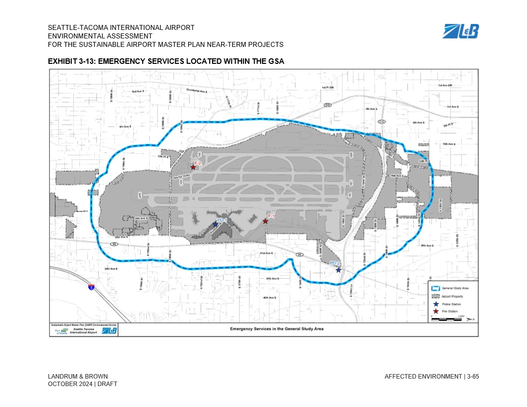
This exhibit from the Seattle-Tacoma International Airport Sustainable Airport Master Plan (SAMP) Environmental Assessment, prepared by Landrum & Brown (draft, October 2024), maps emergency services within the General Study Area (GSA). It identifies two fire stations (F-1 and F-2, marked with red stars) and two police stations (PD-1 and PD-2, marked with blue stars) relative to airport property. -
Chapter 3 Affected Environment_63
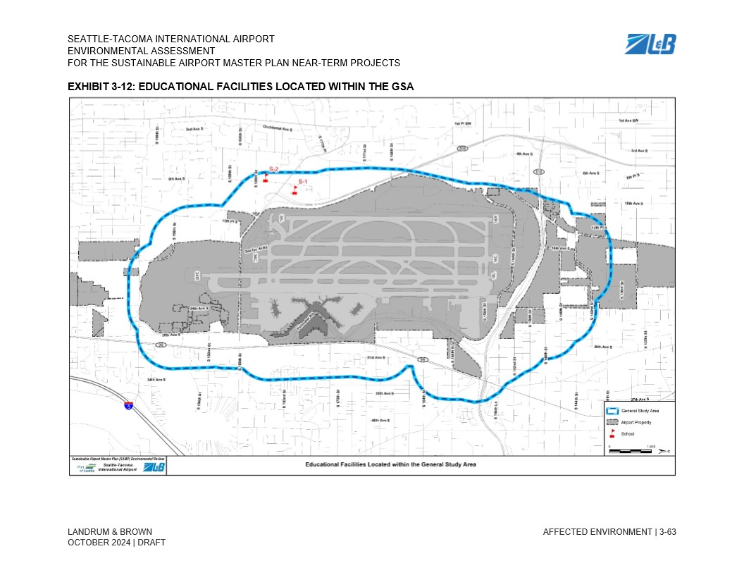
This map, from the Seattle-Tacoma International Airport Sustainable Airport Master Plan (SAMP) Environmental Assessment (Draft, October 2024, prepared by Landrum & Brown), shows educational facilities located within the General Study Area (GSA). Two schools, labeled S-1 and S-2, are marked with red icons northwest of the airport property boundary, which is outlined in blue. -
Chapter 3 Affected Environment_51
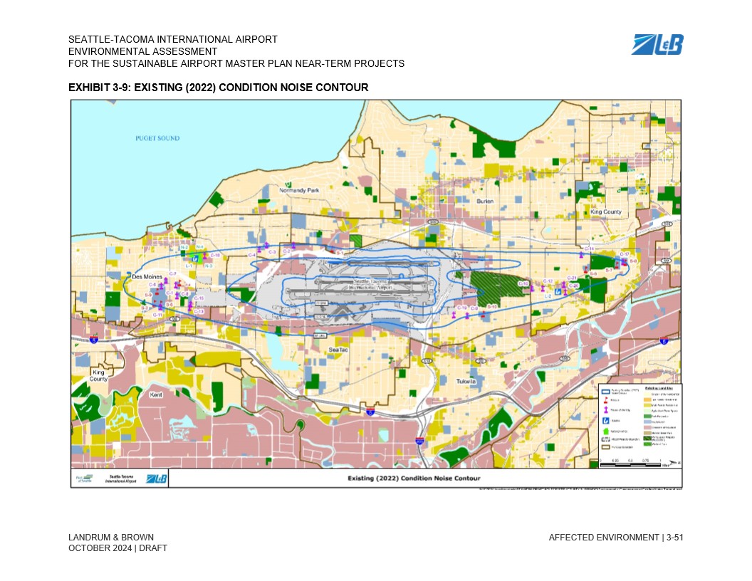
Exhibit 3-9 from the Seattle-Tacoma International Airport Environmental Assessment for the Sustainable Airport Master Plan Near-Term Projects, prepared by Landrum & Brown, dated October 2024 (Draft). The map displays the 2022 existing noise contour lines around Sea-Tac Airport overlaid on surrounding communities including Burien, Des Moines, SeaTac, Tukwila, Normandy Park, and portions of King County, with land use classifications shown in the legend.