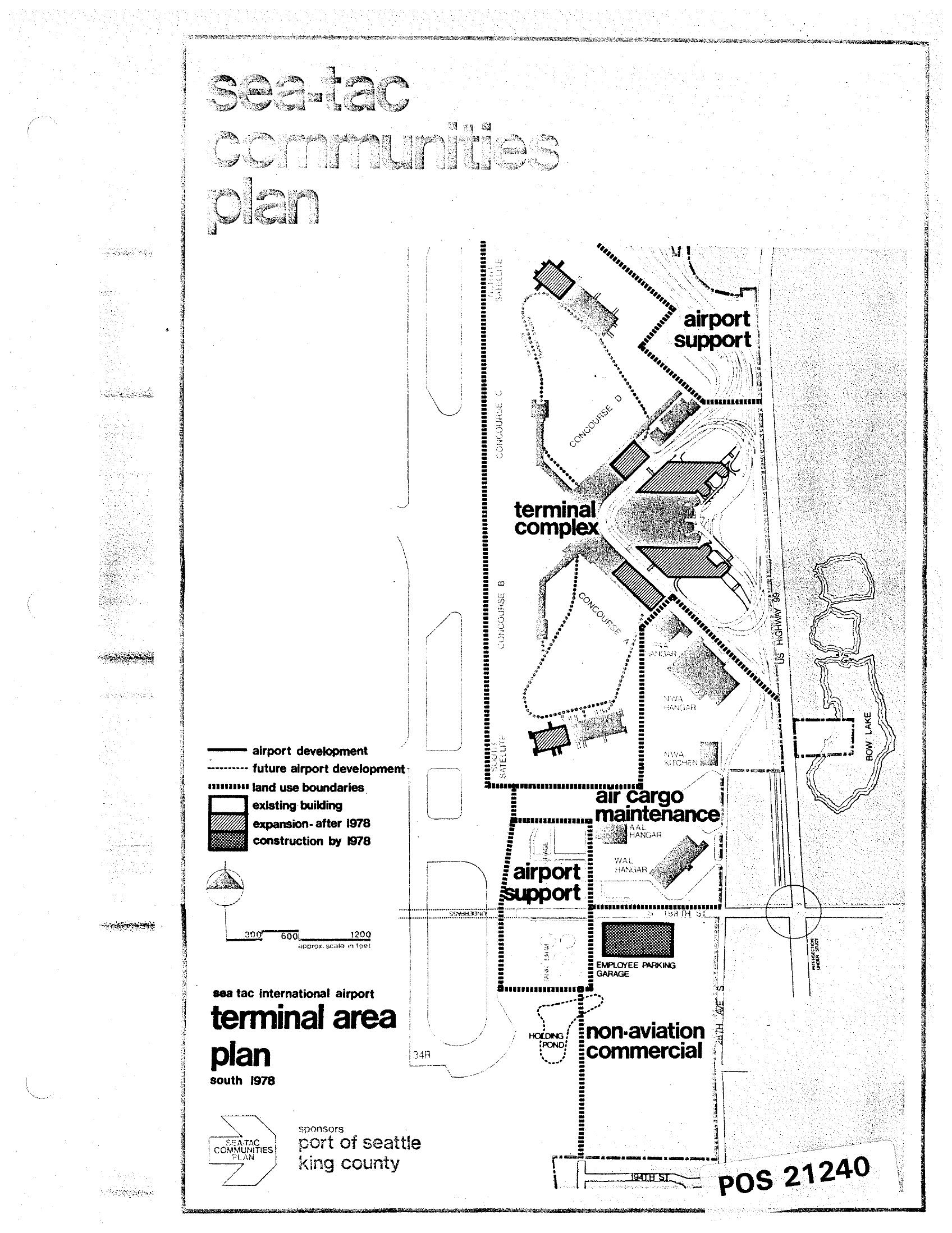
A land-use map from the Sea-Tac Communities Plan showing the Sea-Tac International Airport terminal area as of south 1978, sponsored by the Port of Seattle and King County. The map identifies zones including the terminal complex, airport support, air cargo maintenance, and non-aviation commercial areas, with a legend distinguishing existing buildings, expansions after 1978, and construction by 1978. Document reference number POS 21240.Open full document
Notes
A land-use map from the Sea-Tac Communities Plan showing the Sea-Tac International Airport terminal area as of south 1978, sponsored by the Port of Seattle and King County. The map identifies zones including the terminal complex, airport support, air cargo maintenance, and non-aviation commercial areas, with a legend distinguishing existing buildings, expansions after 1978, and construction by 1978. Document reference number POS 21240.