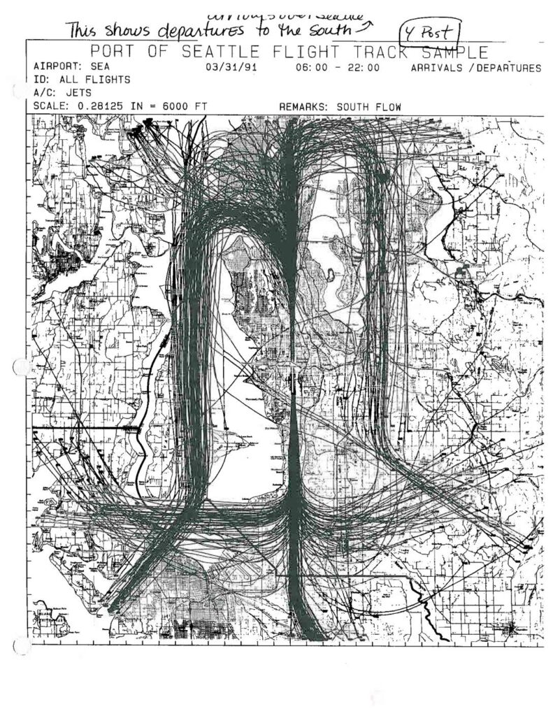
Port Of Seattle Flight Track Sample: South Flow Arrivals/Departures — Pre- and Post-Four Post Plan Comparison Maps

These two Port of Seattle Flight Track Sample maps compare jet aircraft arrival and departure patterns at Seattle-Tacoma International Airport (SEA) under south flow conditions, one from March 22, 1989 (pre-4 Post) and one from March 31, 1991 (4 Post). Both charts plot all jet flight tracks between approximately 4:30–24:00 and 6:00–22:00 respectively, showing how flight paths over the Seattle region shifted between the two periods. The maps are annotated to highlight southbound departures and arrivals over Seattle, serving as visual evidence for noise impact analysis related to airport runway and procedure policy changes.

Notes

Two Port Of Seattle flight track sample maps showing jet arrivals and departures at Seattle-Tacoma International Airport (SEA) under south flow conditions. Page 1 dated 03/31/91 (06:00–22:00), labeled ‘4 Post’ — showing departures to the south with flight tracks visible over Seattle and surrounding areas. Page 2 dated 03/22/89 (04:30–24:00), labeled ‘Pre-4 Post’ — showing departures to the south and arrivals over Seattle before the Four Post Plan was implemented. Scale: 0.28125 IN = 6000 FT. Both maps track all jet flights (A/C: Jets) and are annotated by hand to indicate before-and-after comparison of flight track dispersal patterns related to the Four Post Plan procedure change.

V V