I understand that you will never share my information with anyone, you will only use it to keep me updated on relevant events and that I may unsubscribe at any time.
Since 2016, working to obtain justice for everyone living under the flight path.
Less Noise. Cleaner Air. Better Public Health. Compensation.
Everything you think you know about the airport is wrong.
Last Updated: September 22nd, 2024
City Council to decide on Des Moines Creek West purchase from Port
Small parcel big step to enable controversial expansion of business park
[09/19/2024]The City Council has added this item to their September 26 Agenda (6:00pm).
[09/12/2024]At their September 12 meeting, the City Council held over this decision until October. We will provide notice as soon as it is scheduled. Please note that this sale is not the same land parcel being decided by the City’s SEPA hearing examiner on October 18.
In July, the Port of Seattle approved purchase of an area of land in Des Moines to begin work on Des Moines Creek Business Park Phase V (ie. ‘Des Moines Creek West’)
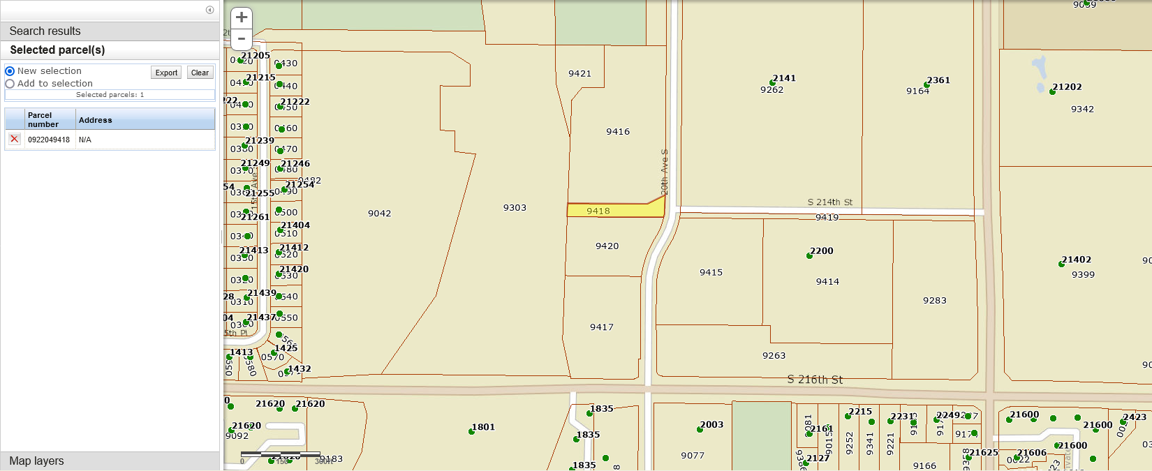
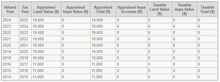
At their September 12, 2024 meeting, the Des Moines City Council will also vote to complete the sale, accepting $690,000 to surplus Tract C. Tract C is a narrow strip of land, with an assessed value of less than $20,000. It is to be used as a connecting road between the existing complex and the expansion. Those wishing to provide public comment can do so here or by emailing the City Council: citycouncil@desmoineswa.gov
This is not the WSDOT surplus parcel being appealed by a local group, which we covered here. One almost needs a score card (or a land use attorney) to keep track of the development of the DMCBP. The reason there are so many small parcels has to do with the fact that the area was originally a residential neighborhood. Over time, there were a series of property buyouts and land swaps. WSDOT three decades ago when an alternate route for SR-509 was considered. Then the Port of Seattle as the FAA deemed the area too noisy.
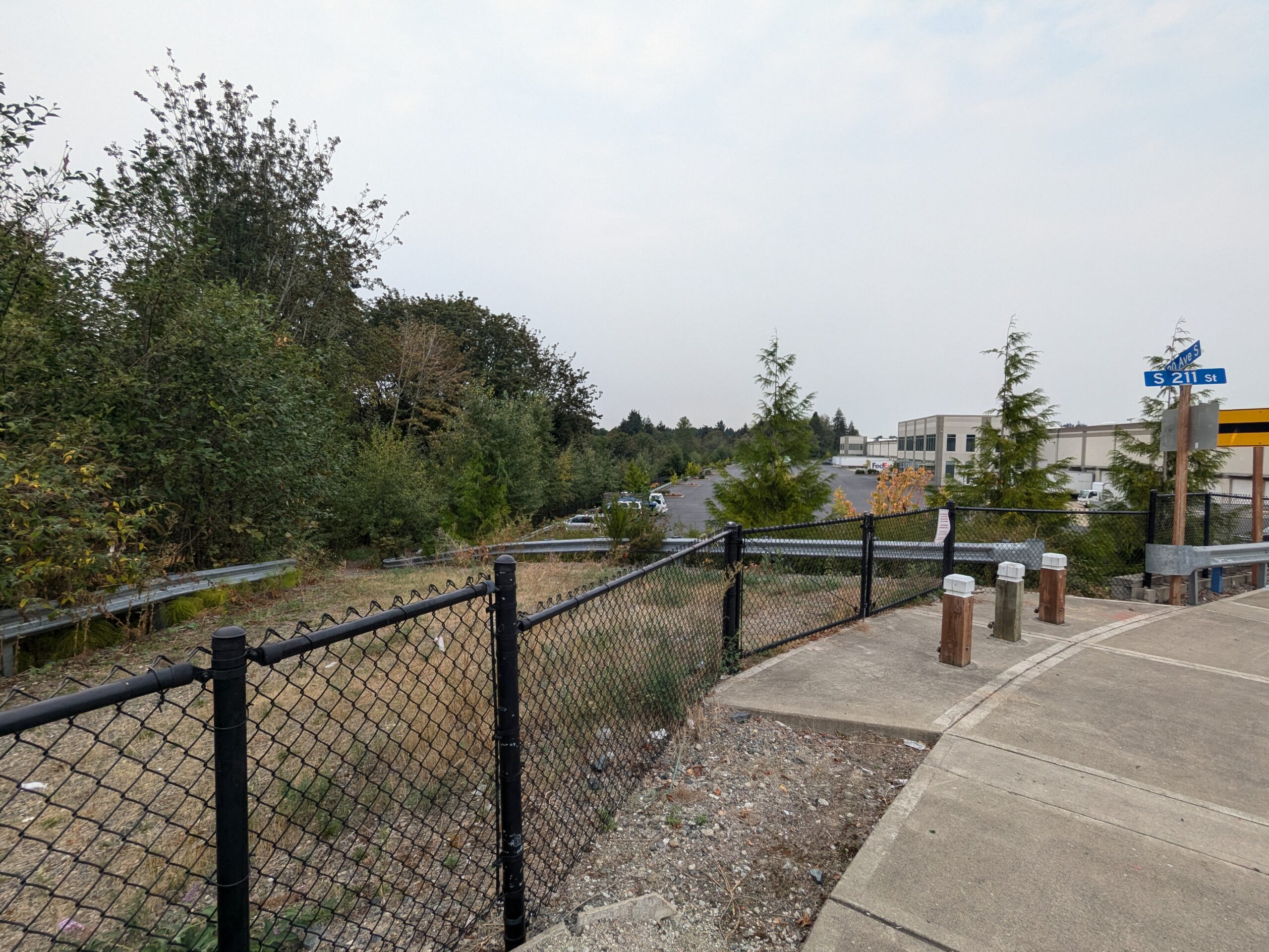
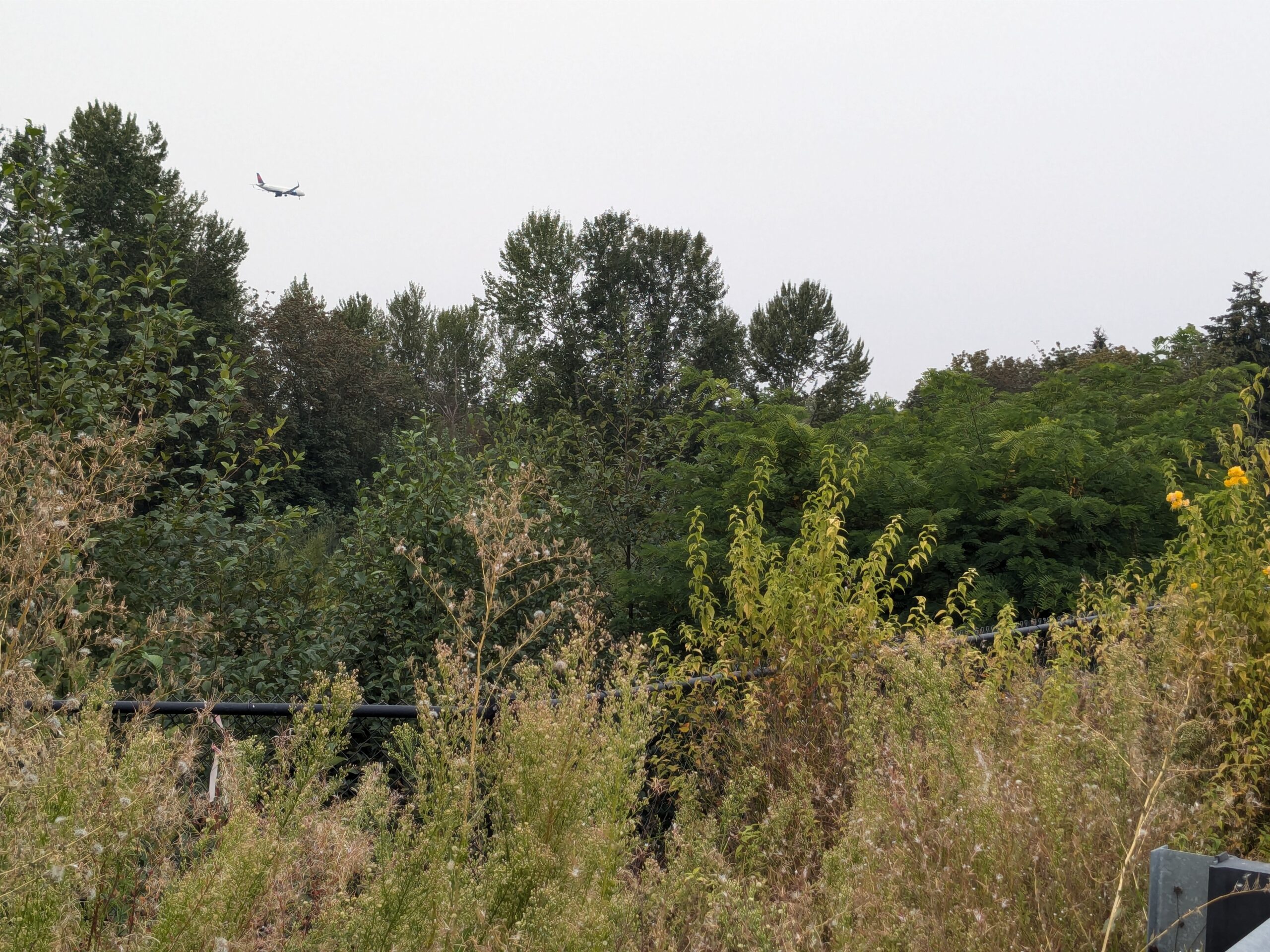
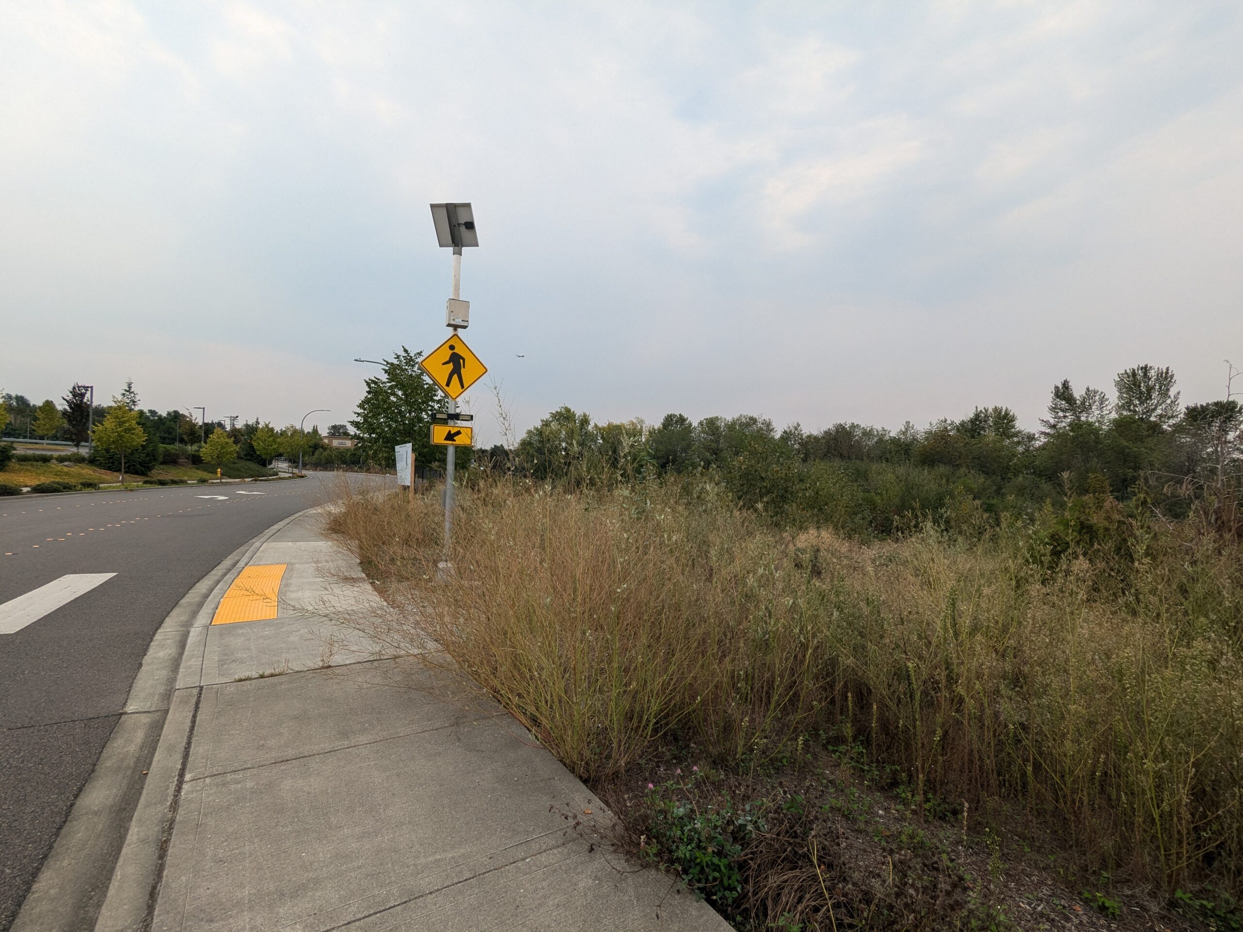
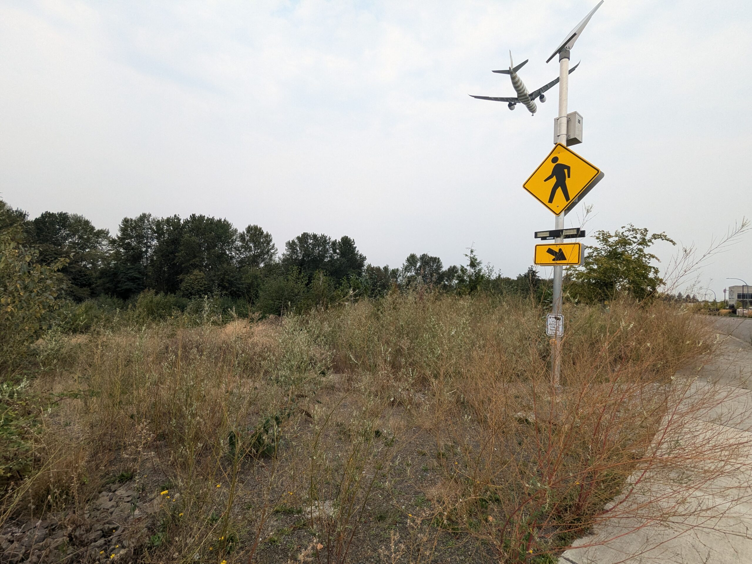
The Property
A public notice sign posted by the City of Des Moines, WA Planning Department (21630 11th Avenue South, Suite D, Des Moines, WA 98198) announcing a proposed land use action: construction of a 402,380 square-foot industrial building and related civil improvements on 21 acres of a 30-acre site, accessed from S. 216th St. and 20th Ave. S., including filling 11,938 square feet of wetlands, rerouting a Type NS stream, and constructing a new trail connection. Contact phone listed as (206) 870-7576.
View from a pedestrian path at the intersection of S 211th Street and an avenue (partially visible street sign), showing a chain-link fence, undeveloped vegetated land, and a commercial/industrial building with a FedEx vehicle visible in the background. The area is consistent with the industrial zone near Seattle-Tacoma International Airport.
A commercial passenger aircraft, appearing to display red livery consistent with an Alaska Airlines or Delta Air Lines livery, is captured on final approach descent above a dense tree line and overgrown vegetation. A guardrail is visible in the foreground, suggesting the photo was taken from a roadside or elevated embankment in the airport vicinity.
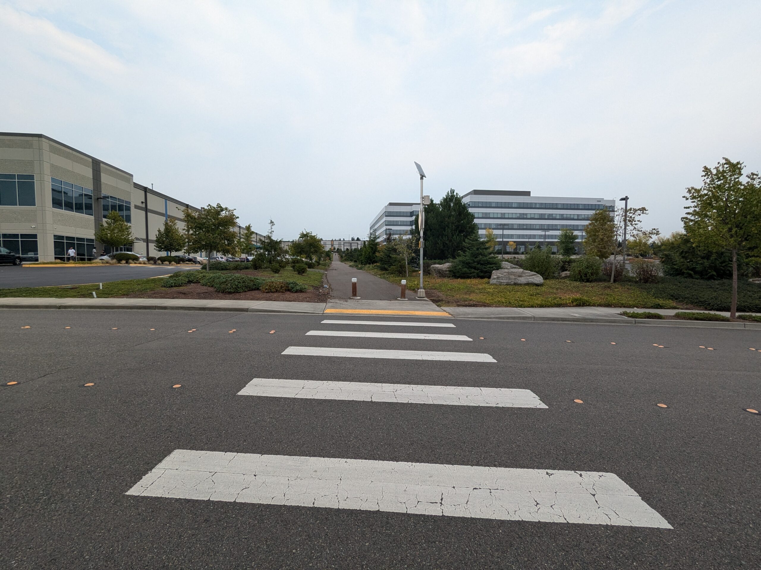
A solar-powered pedestrian crossing warning sign (MUTCD W11-2 standard yellow diamond) with a flashing beacon is mounted at a sidewalk curb cut featuring a yellow tactile warning pad. The surrounding area shows an unmaintained overgrown field with dry grasses alongside a curved roadway, consistent with undeveloped land near a major transportation corridor.
A commercial jet aircraft is visible on low final approach over an undeveloped, overgrown lot adjacent to a road. A yellow pedestrian crossing warning sign and a secondary yellow caution sign are mounted on a pole in the foreground, consistent with infrastructure near a major airport flight path.
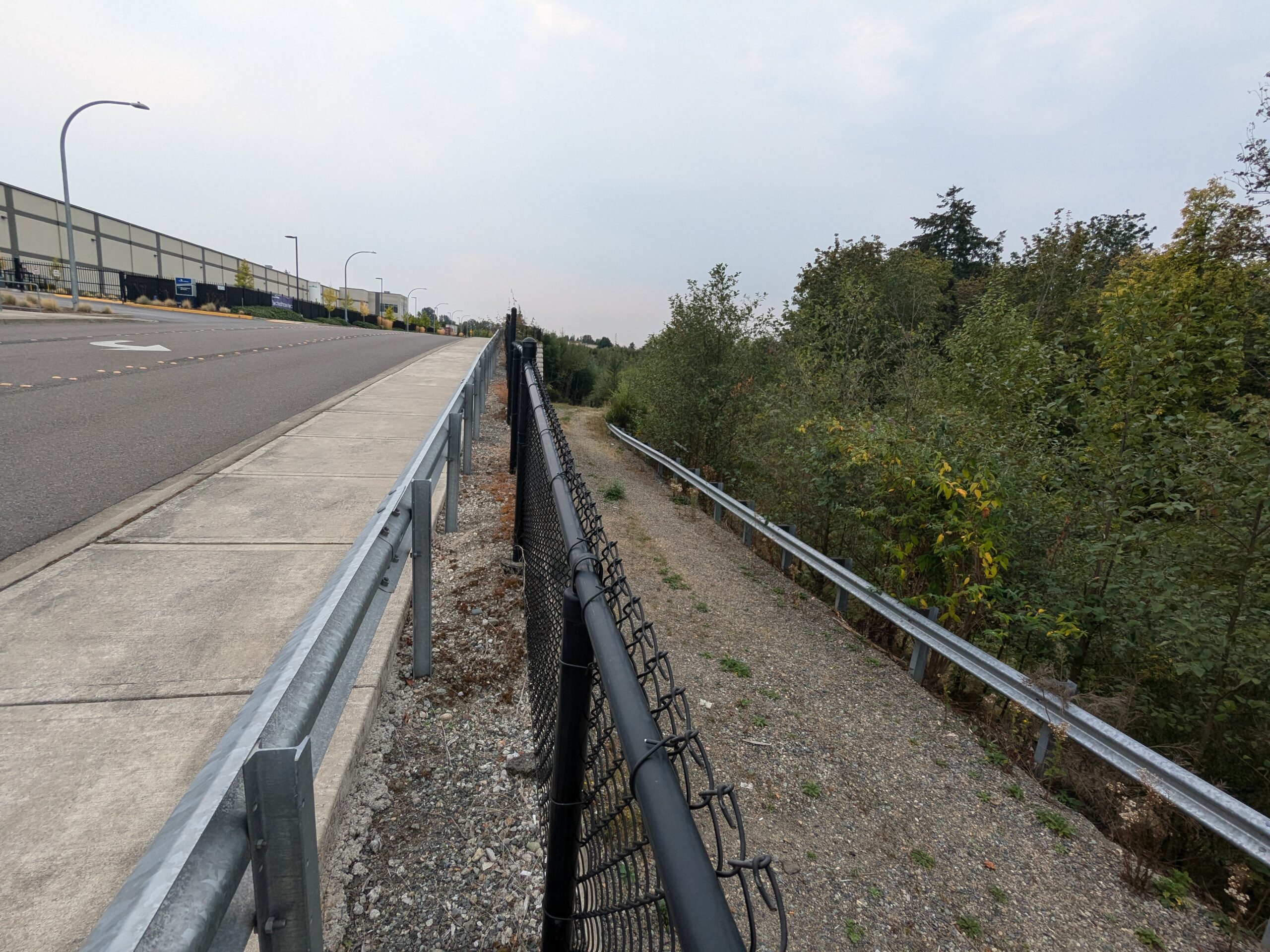
The image shows a paved road with a concrete sidewalk on the left, separated by a metal guardrail and damaged black chain-link fence from a gravel service path on the right, which is bordered by a second guardrail and dense native vegetation. A large industrial or warehouse building is visible in the background on the left side, consistent with airport-adjacent industrial development.
Background
There have been three major attempts by the Port to partner with the City of Des Moines to develop the property. The current plan goes back to the 2014 Des Moines Creek Business Park Amended Second Agreement. Although the various land transactions had not occurred, that agreement makes clear the City’s current intentions–including Des Moines Creek West.
It is perhaps no coincidence that Des Moines is the only city in the area that has no public planning commission.
Development of the entire area has had devastating negative impacts for the City of Des Moines. It is our poster child for the pitfalls of entering into one-time-money development agreements as a substitute for airport mitigation.
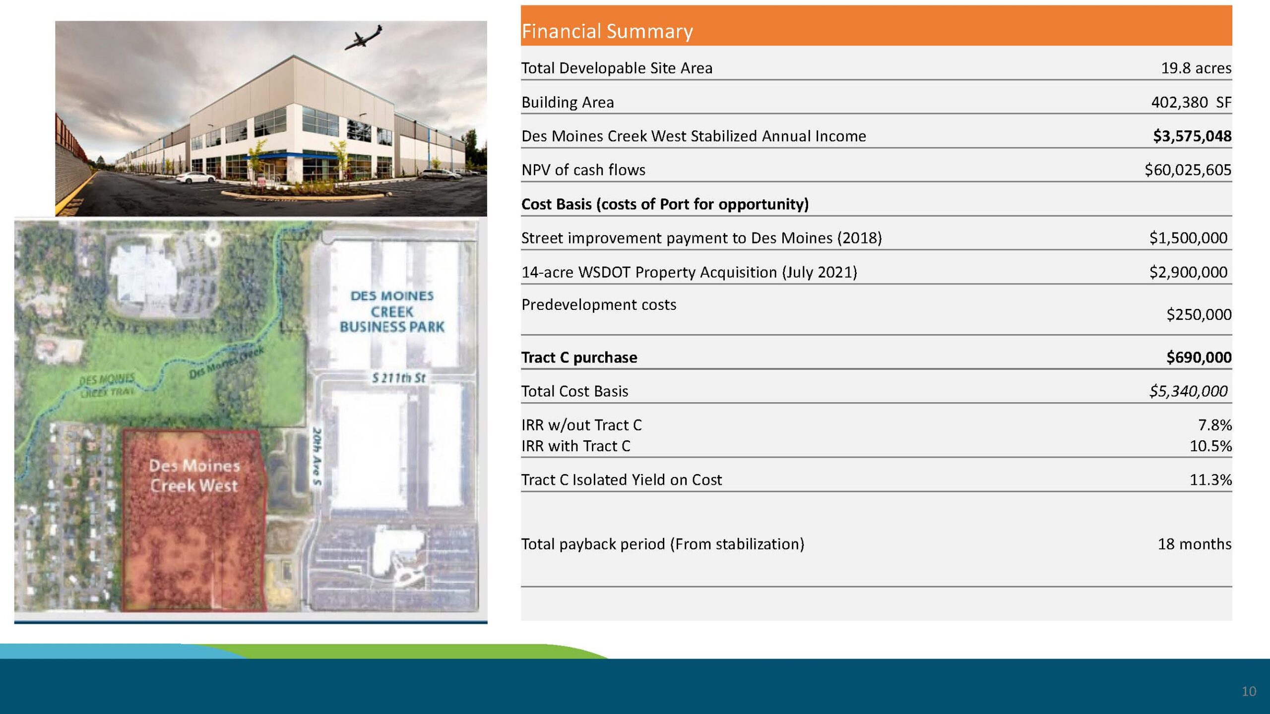
In this latest case, the City will get a one-time payment of $690,000, while the Port will be able to rent the property to the developer and recoup their costs in as little as eighteen months. Since the entire property will remain tax-exempt, regardless of how many workers are employed on site, there will be very little ongoing revenue.
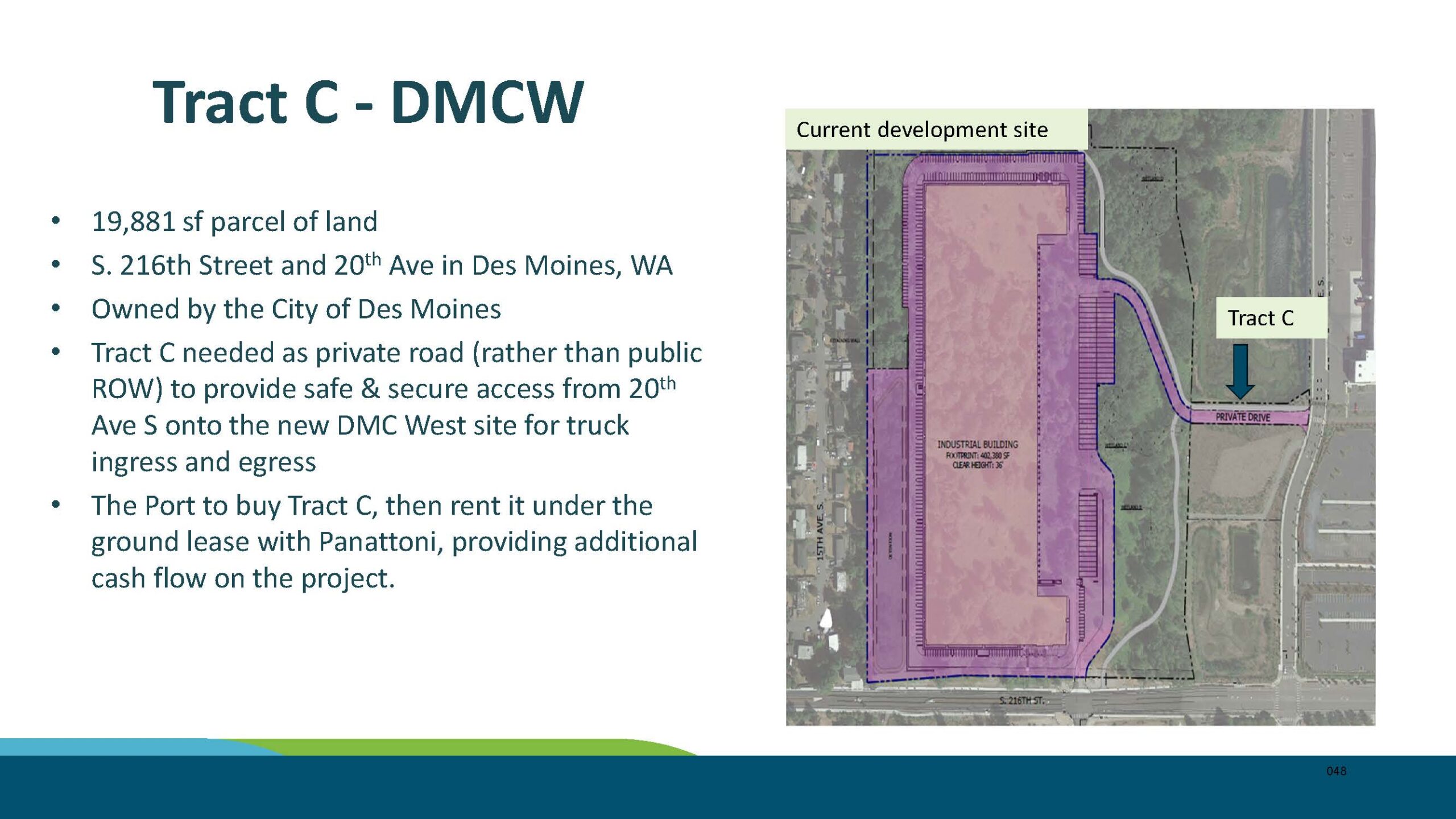
Slide labeled ‘Tract C – DMCW’ (Des Moines Creek West) describes a 19,881 sq ft parcel at S. 216th Street and 20th Ave S in Des Moines, WA, owned by the City of Des Moines. The Port plans to purchase Tract C to serve as a private road for truck ingress/egress to the new DMC West industrial site developed with Panattoni, with the parcel then rented under a ground lease to generate additional cash flow.
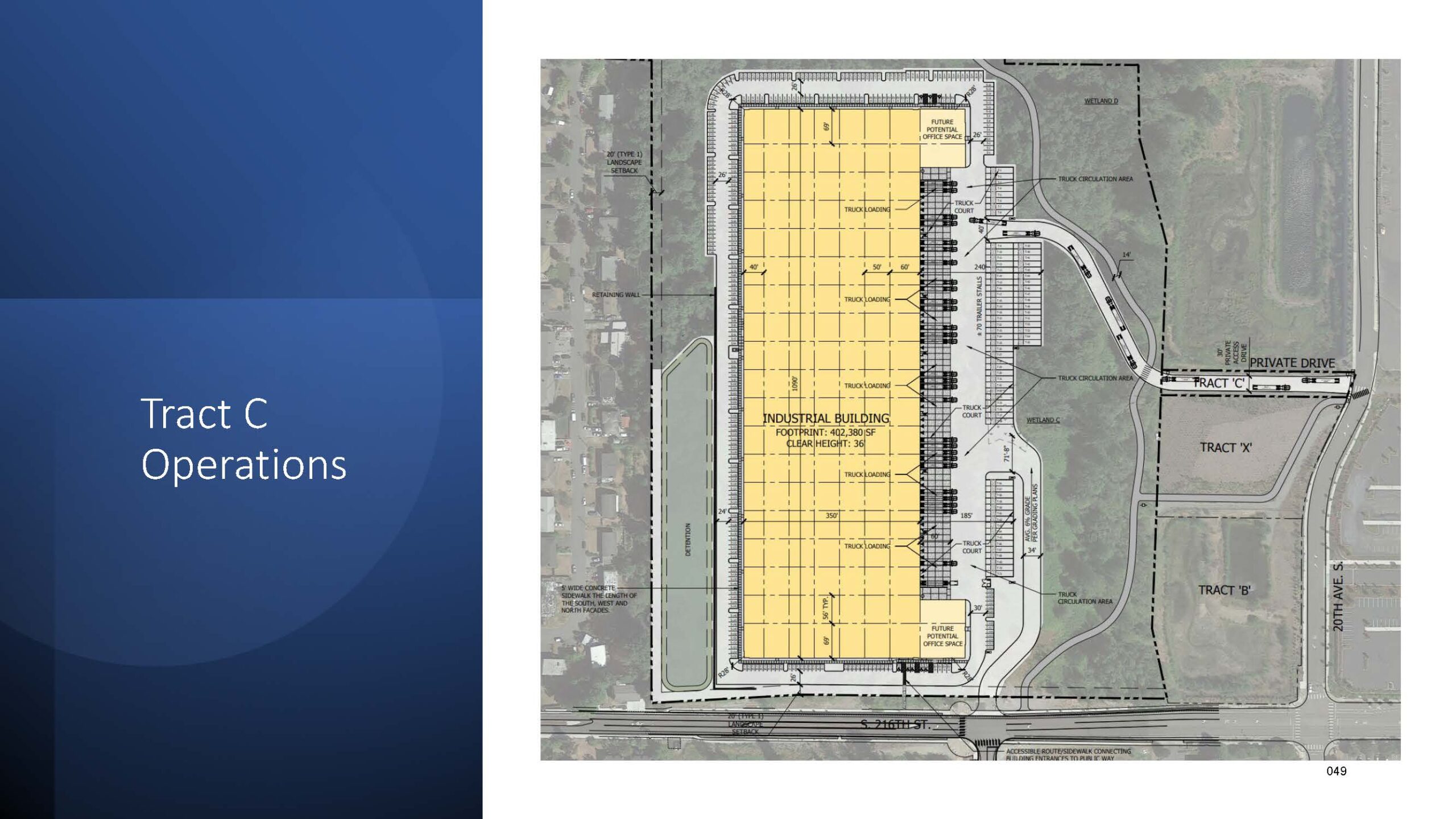
Architectural site plan for an industrial building on Tract C, showing a footprint of 402,380 square feet with a clear height of 36 feet, located along S. 216th Street. The plan details truck loading areas, truck courts, truck circulation areas, trailer stalls, detention pond, landscape setbacks, a retaining wall, future potential office spaces, and adjacent Tracts B, X, and C with access via a private drive, consistent with a large warehouse/distribution facility development presentation slide 049.
A Port of Seattle development presentation slide summarizing the financial metrics for the Des Moines Creek West project, showing 19.8 developable acres, 402,380 SF of building area, a stabilized annual income of $3,575,048, NPV of $60,025,605, total cost basis of $5,340,000 (including a $690,000 Tract C purchase and a $2,900,000 WSDOT property acquisition in July 2021), IRR with Tract C of 10.5%, and an 18-month payback period from stabilization. The slide includes an aerial map identifying the Des Moines Creek Business Park and Des Moines Creek West parcels near S 211th St and 20th Ave S, adjacent to Sea-Tac Airport.
A King County GIS parcel map search result showing selected parcel number 0922049418 (listed as N/A address), highlighted in yellow near the intersection of S 214th Street and 20th Avenue S, in an area consistent with the Sea-Tac Airport vicinity. Surrounding parcel numbers and street labels are visible, indicating this is a King County iMap or similar county parcel viewer screenshot.
A tabular record showing appraised land values, improvement values, and taxable totals for a property across valued years 2014–2024 (tax years 2015–2025). The appraised land value increased from $11,800 to $19,600 between 2016 and 2018, with improvements and taxable values consistently recorded as zero throughout the entire period.
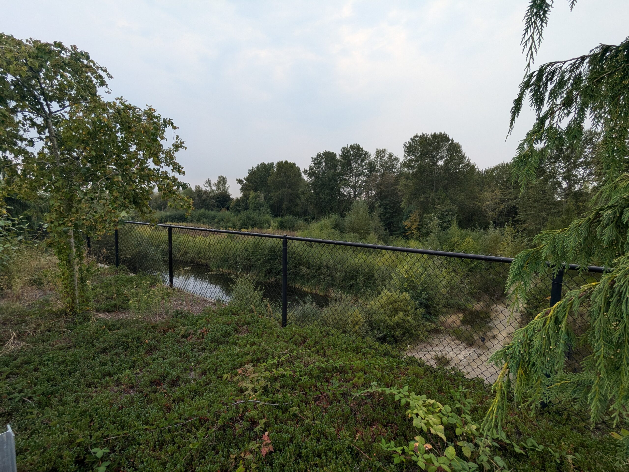
According to the real estate assessment, no tree replacement will be necessary since there are currently no trees on the parcel. This points out another flaw in this development approach. By looking at each parcel individually rather than cumulatively, it further reduces opportunities for meaningful environmental mitigation. The on-paper environmental assessment of the entire Des Moines Creek West project bears little resemblance to what is easily seen by the naked eye–a great potential forest and wetlands.
As we’ve said many times, community benefit was the original language of all the FAA property buyouts. The same money that paid for the Des Moines Creek Business Park also bought North Sea-Tac Park. The WSDOT surplus program allows cities first right of refusal for similar reasons.
Community benefit can mean different things for each community, but the benefit of surplus lands should ultimately redound to the community.
It is unfortunate, but at least understandable why the Port of Seattle would have taken advantage of this system. Revenues they obtain from these projects at least provide genuine economic benefit somewhere in King County. But the fact that the City of Des Moines has been on board with this approach for so long, despite no ongoing benefits to their city is highly questionable.
1 Reply to “City Council to decide on Des Moines Creek West purchase from Port”
We can only sell this land once, if there’s no long term revenue in the contract, forget it! Bad choice. Please sell more responsibly thinking of our wetlands environment as well asfuture generations needing forever revenue.
We use cookies to provide basic functionality. We also provide access to search engines in order to provide site analytics. We do not sell or share your data.
 At their September 12, 2024 meeting, the Des Moines City Council will also vote to complete the sale, accepting $690,000 to surplus Tract C. Tract C is a narrow strip of land, with an assessed value of less than $20,000. It is to be used as a connecting road between the existing complex and the expansion. Those wishing to provide public comment can do so here or by emailing the City Council: citycouncil@desmoineswa.gov
 This is not the WSDOT surplus parcel being appealed by a local group, which we covered here. One almost needs a score card (or a land use attorney) to keep track of the development of the DMCBP. The reason there are so many small parcels has to do with the fact that the area was originally a residential neighborhood. Over time, there were a series of property buyouts and land swaps. WSDOT three decades ago when an alternate route for SR-509 was considered. Then the Port of Seattle as the FAA deemed the area too noisy.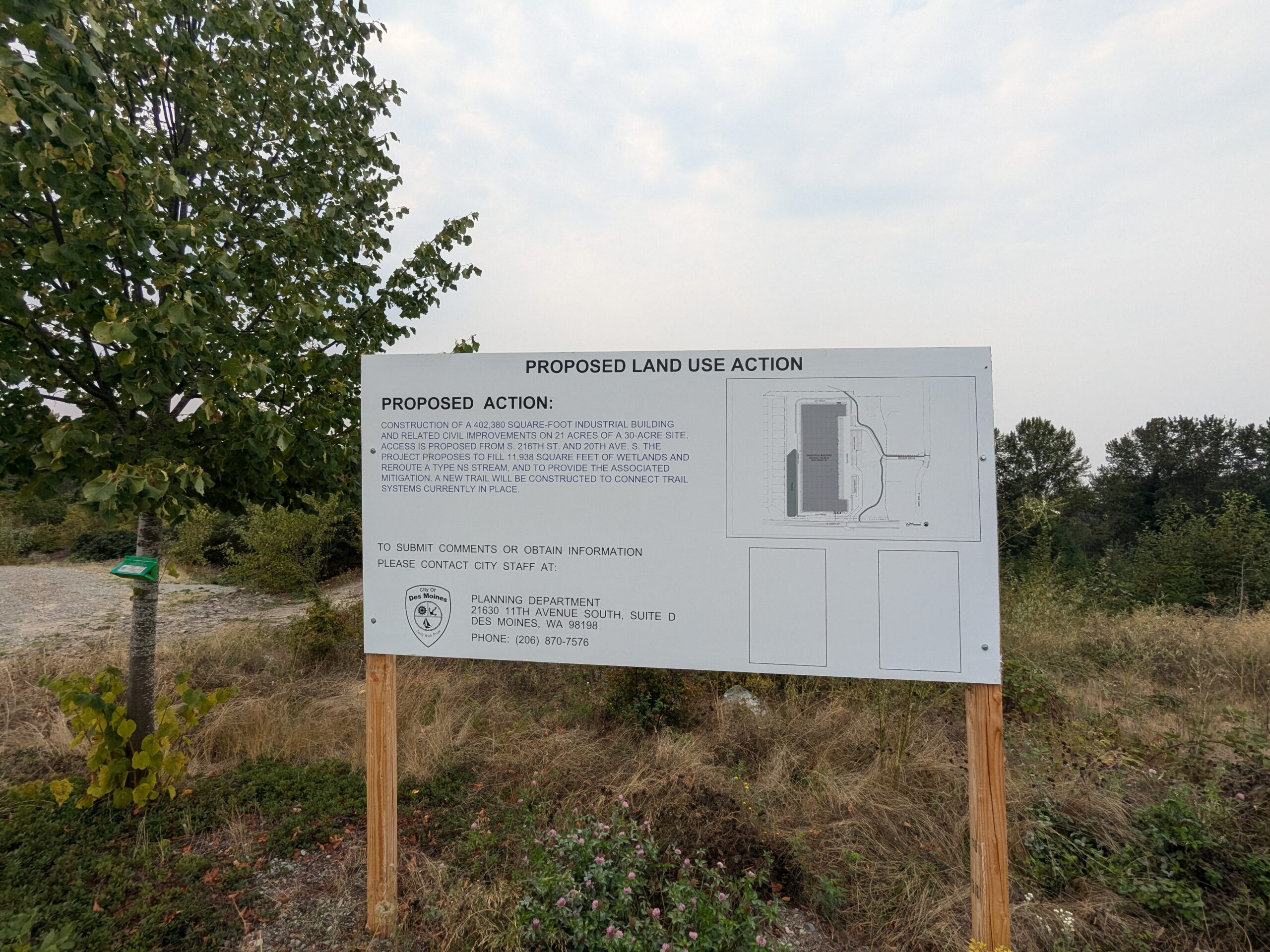
We can only sell this land once, if there’s no long term revenue in the contract, forget it! Bad choice. Please sell more responsibly thinking of our wetlands environment as well asfuture generations needing forever revenue.