Notes
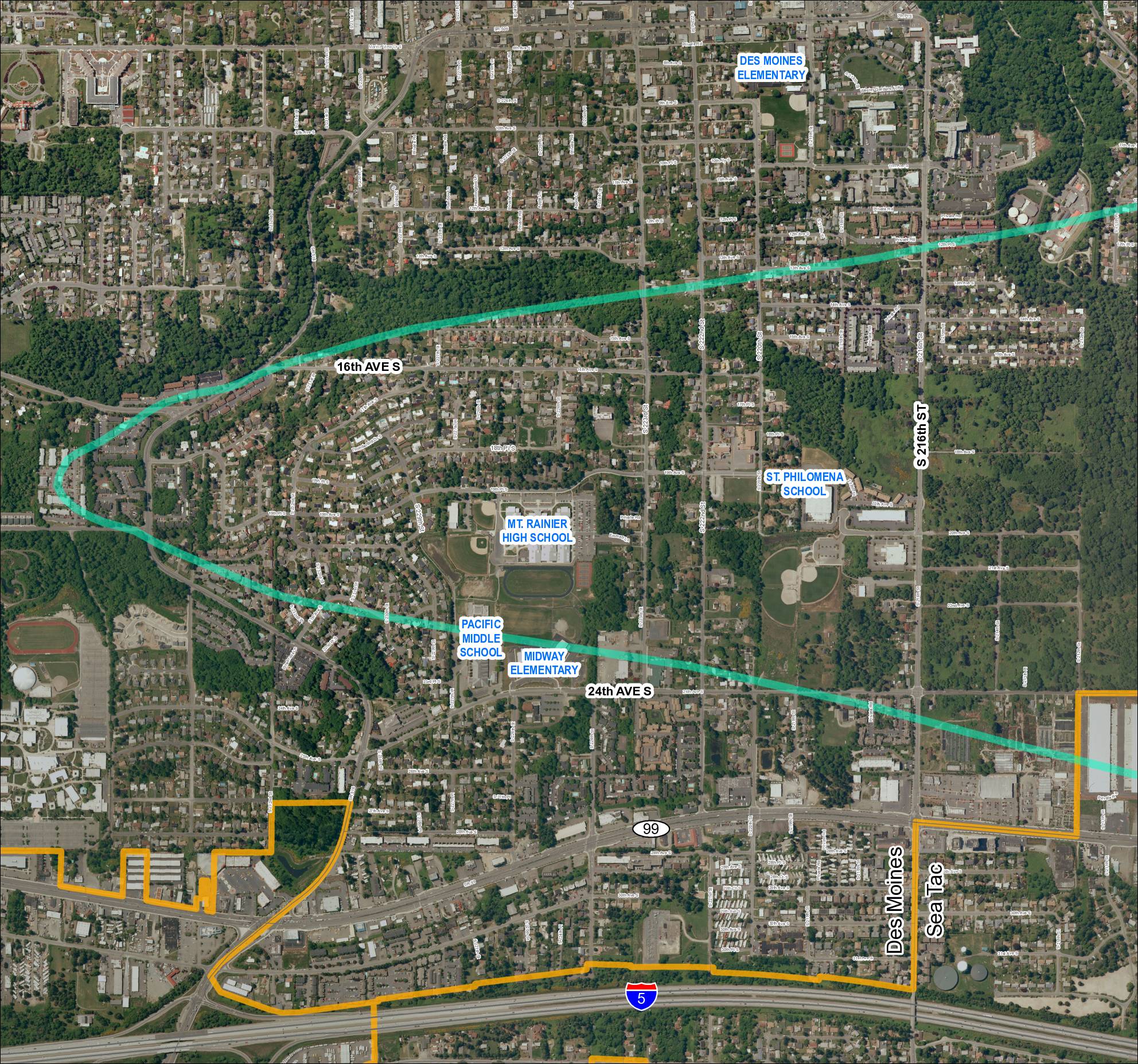
Aerial map (Grid 1, 2018) showing the Des Moines and Sea Tac area with a flight corridor overlay (teal/cyan corridor line) passing through residential neighborhoods. Map identifies schools including Des Moines Elementary, Mt. Rainier High School, Pacific Middle School, Midway Elementary, and St. Philomena School. Key streets labeled include S 216th St, 24th Ave S, 16th Ave S, and SR 99. Orange boundary lines delineate a southern zone near I-5 and SR 509. The map appears to be part of the Sea-Tac Communities Plan (STCP) mapping series.