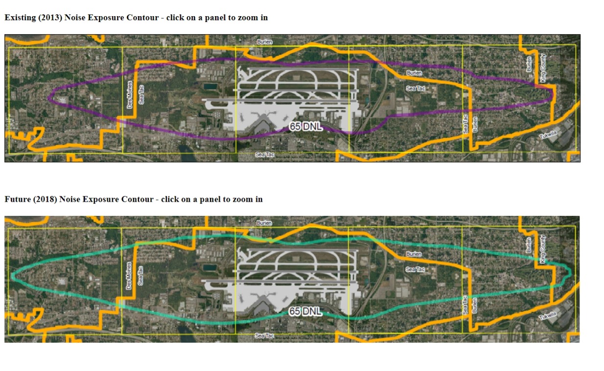
Two aerial noise exposure contour maps for Seattle-Tacoma International Airport showing the 65 DNL boundary for 2013 (existing, in purple) and 2018 (future, in teal/green), with an outer study area boundary in orange. The contours extend over surrounding communities including Burien, SeaTac, Des Moines, Tukwila, and unincorporated King County.Open full document
Notes
Two aerial noise exposure contour maps for Seattle-Tacoma International Airport showing the 65 DNL boundary for 2013 (existing, in purple) and 2018 (future, in teal/green), with an outer study area boundary in orange. The contours extend over surrounding communities including Burien, SeaTac, Des Moines, Tukwila, and unincorporated King County.