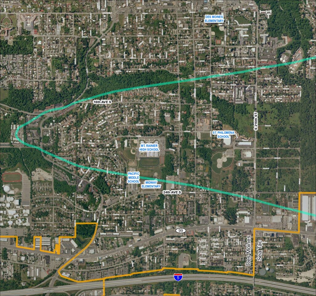
This map shows the Des Moines and SeaTac area of Washington State, highlighting a noise impact corridor (shown in teal) that sweeps across the region near Sea-Tac Airport. The corridor passes over several schools including Mt. Rainier High School, Pacific Middle School, Midway Elementary, St. Philomena School, and Des Moines Elementary, indicating these institutions fall within the airport's noise-affected zone. A separate boundary (shown in orange) outlines what appears to be an airport-related land use or acquisition area in the southern portion of the map near Interstate 5.Open full document
Notes
Aerial map (Grid 1, 2018) showing the Des Moines and Sea Tac area with a flight corridor overlay (teal/cyan corridor line) passing through residential neighborhoods. Map identifies schools including Des Moines Elementary, Mt. Rainier High School, Pacific Middle School, Midway Elementary, and St. Philomena School. Key streets labeled include S 216th St, 24th Ave S, 16th Ave S, and SR 99. Orange boundary lines delineate a southern zone near I-5 and SR 509. The map appears to be part of the Sea-Tac Communities Plan (STCP) mapping series.