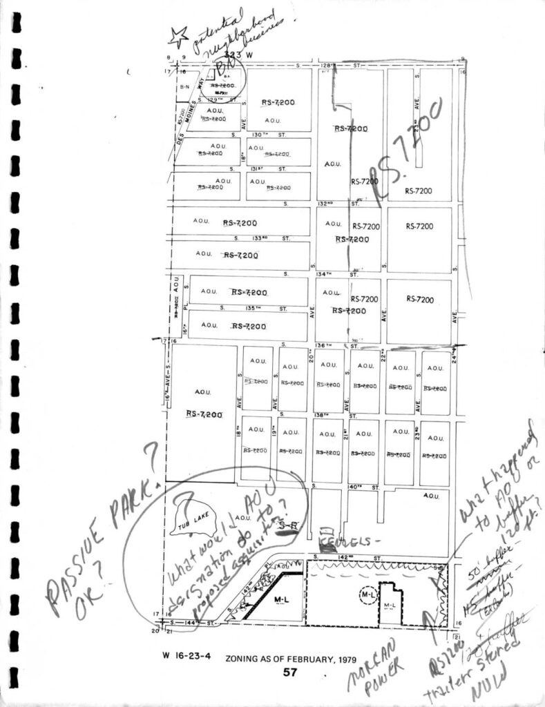
Zoning Map: North Sea-Tac Park Area, February 1979

This is a zoning map dated February 1979 for section W 16-23-4, showing land use designations—primarily RS-7200 (single-family residential) and A.O.U. (Airport Operations Use) zones—in the area south of S. 128th Street near Seattle-Tacoma Airport. Handwritten annotations raise questions about passive park designations, proposed AOC/AOU classifications near Tub Lake, buffer distances (50-foot and 45-foot buffers are noted), and the status of an RS-7200 trailer storage site. The notes suggest an active policy review regarding how airport-related zoning categories and noise buffers should be applied to residential and transitional parcels in this neighborhood.

Notes

Zoning map for section W 16-23-4 as of February 1979, covering the North Sea-Tac Park (NSTP) area including streets from approximately S. 128th St. to S. 144th St. Zoning designations shown include RS-7200, A.O.U. (Airport Operations Use), M-L, S-R, and B-N. Notable features include Tub Lake and Des Moines Ave. Handwritten annotations ask questions about A.O.U. designations, passive park use, neighborhood business potential near 123rd W, buffer distances (50-foot, 45-foot), RS-7200 trailer storage, and proposed designation changes. Notes reference ‘Morgan Power’ and ‘what happened to A.O.U. buffer 120 ft?’ Context suggests use in Highline Community Plan or NSTP planning discussions.

V V