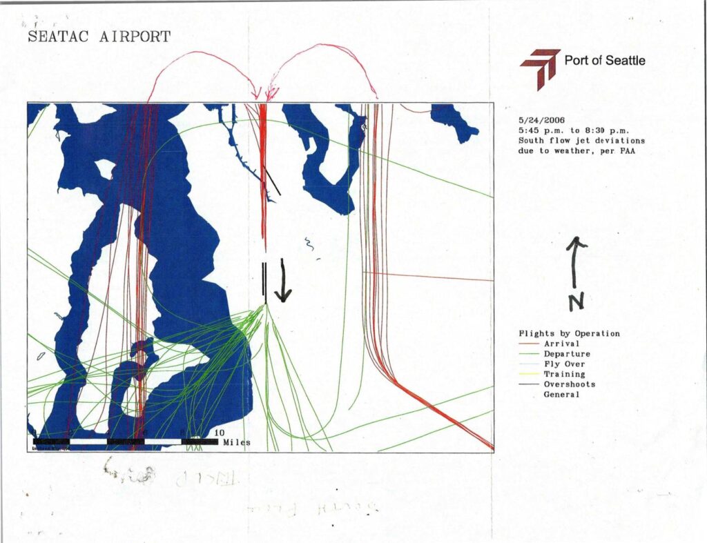
This Port of Seattle document shows a flight-track map of Seattle-Tacoma (Sea-Tac) Airport activity on May 24, 2006, between 5:45 p.m. and 8:30 p.m. During this period, south-flow jet aircraft deviated from their standard routes due to weather conditions, as confirmed by the FAA. The map distinguishes arrivals, departures, fly-overs, training flights, and overshoots by color, illustrating how unusual flight paths spread noise impacts across a wider area of the surrounding region.Open full document
Notes
Port Of Seattle flight track map for Sea-Tac Airport showing south flow jet deviations due to weather per FAA, covering 5:45 p.m. to 8:30 p.m. on May 24, 2006. Color-coded flight tracks by operation type: arrivals (red), departures (green), fly overs, training, overshoots, and general. Map covers the Puget Sound region with a 10-mile scale bar, depicting how weather-related FAA directives caused jet flight path deviations from standard south flow patterns.