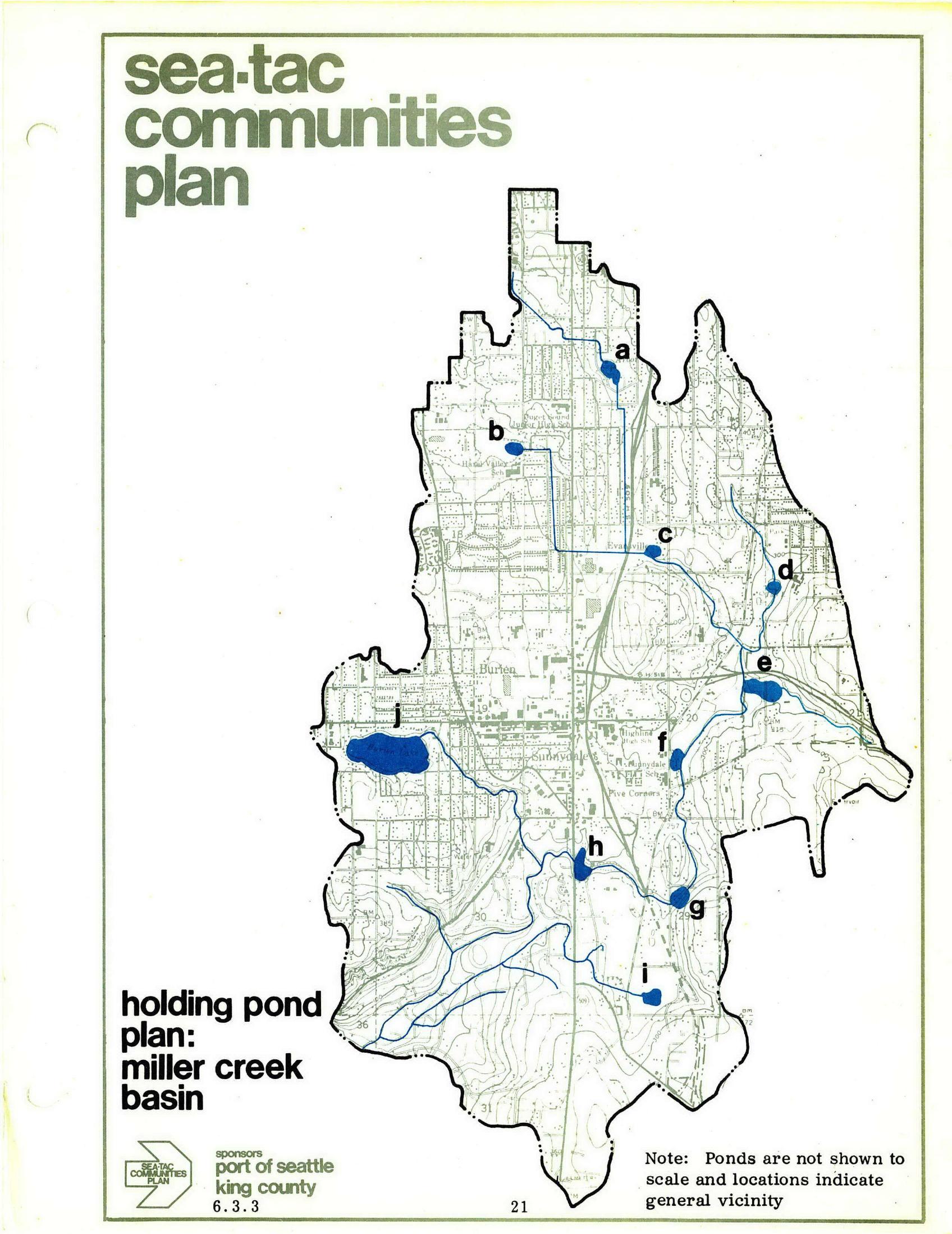
Page 21 of the Sea-Tac Communities Plan, sponsored by the Port of Seattle and King County, showing a holding pond plan map for the Miller Creek Basin. Ten proposed holding pond locations (labeled a through j) are marked in blue within the plan boundary, with a note that pond sizes are not to scale and locations indicate general vicinity only.Open full document
Notes
Page 21 of the Sea-Tac Communities Plan, sponsored by the Port of Seattle and King County, showing a holding pond plan map for the Miller Creek Basin. Ten proposed holding pond locations (labeled a through j) are marked in blue within the plan boundary, with a note that pond sizes are not to scale and locations indicate general vicinity only.