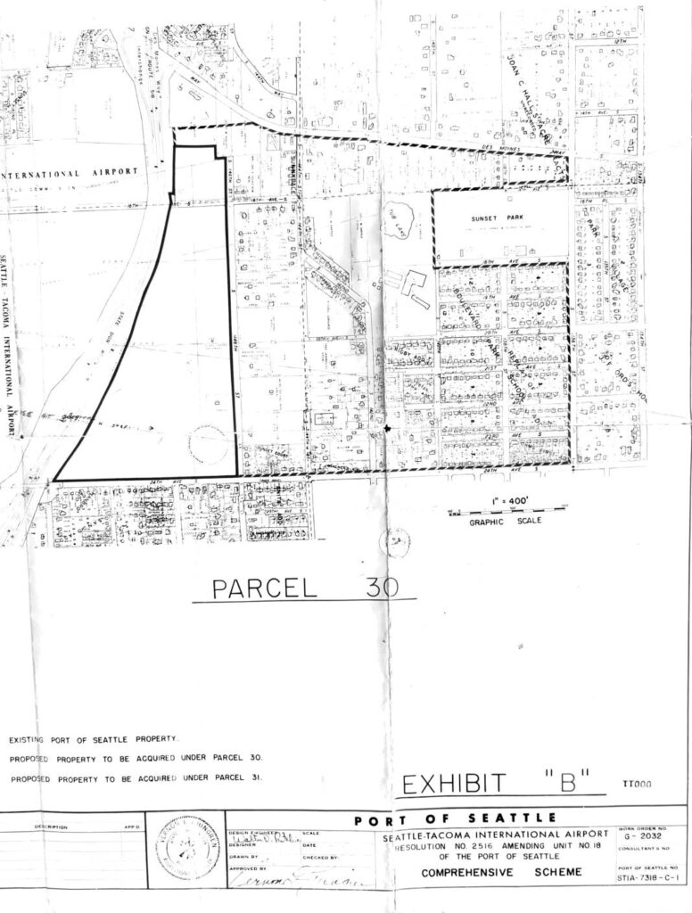
This document is Exhibit 'B' to Port of Seattle Resolution No. 2516, which amends Unit No. 18 of the Port of Seattle's Comprehensive Scheme for Seattle-Tacoma International Airport. It contains maps (Work Order No. G-2032, drawing STIA-7318-C-1) identifying Parcel 30 and Parcel 31 — areas of land proposed for acquisition by the Port of Seattle adjacent to the existing airport property, including neighborhoods near Sunset Park and Des Moines. The maps delineate existing Port-owned land from the proposed acquisition parcels, indicating planned airport expansion or noise-buffer land purchases in the surrounding residential area.Open full document
Notes
This document is a set of engineering maps (Exhibit B) associated with Port of Seattle Resolution No. 2516, which amends Unit No. 18 of the Port of Seattle’s Comprehensive Scheme. The maps show Parcel 30 in the vicinity of Seattle-Tacoma International Airport, depicting existing Port of Seattle property and proposed property to be acquired under Parcels 30 and 31. The area shown includes Sunset Park and surrounding residential neighborhoods near the airport.