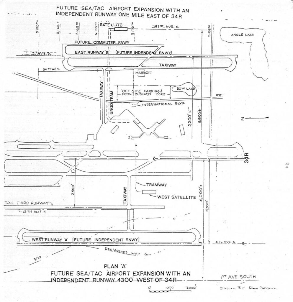
This document presents two conceptual expansion plans for Seattle-Tacoma (Sea-Tac) Airport, showing proposed future runway configurations including an independent runway located one mile east of runway 34R (Plan A shows an alternative 4,300 feet west of 34R). The drawings detail proposed taxiways, satellite terminals, a future commuter runway, an underground tram system, and associated ground infrastructure such as off-site parking and hotel/business core areas. These plans were likely developed as part of noise and capacity planning studies to evaluate how additional independent runways could affect surrounding communities, including areas near Angle Lake, Bow Lake, and along key corridors such as International Boulevard and Des Moines Way South.Open full document
Notes
A detailed airport planning map showing two proposed expansion scenarios for Sea-Tac Airport: one with an independent runway one mile east of 34R, and Plan A with an independent runway 4300 feet west of 34R. The diagram identifies key features including future commuter and independent runways, taxiways, satellite terminals, tramway, off-site parking, hotel and business core areas, and surrounding roadways such as International Boulevard, Des Moines Way S., and 1st Ave. South. Landmarks including Bow Lake, Angle Lake, and the Marriott hotel are also depicted.