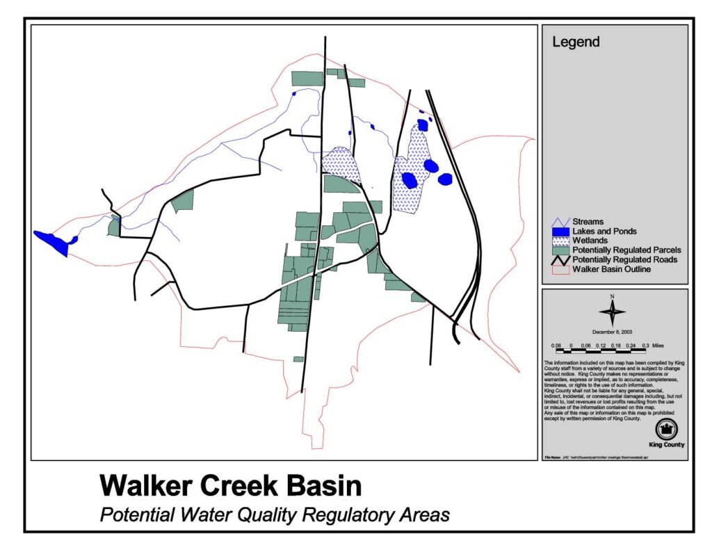
This King County map, dated December 8, 2003, identifies Potential Water Quality Regulatory Areas within the Walker Creek Basin, highlighting features such as streams, lakes and ponds, wetlands, potentially regulated parcels, and potentially regulated roads. The map was compiled by King County staff to support water quality planning and regulation in the basin. Note that while this document relates to King County environmental planning, it does not directly address Sea-Tac Airport noise policy.Open full document
Notes
A map produced by King County depicting the Walker Creek Basin and its potential water quality regulatory areas. The map identifies streams, lakes and ponds, wetlands, potentially regulated parcels, potentially regulated roads, and the Walker Basin outline. It was created on December 8, 2003.