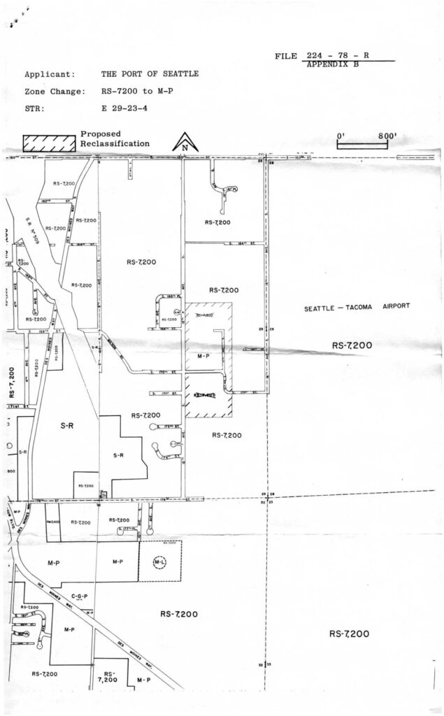
This 1978 King County Building & Land Development document relates to a zoning reclassification application (File 224-78-R) filed by the Port of Seattle, proposing to change land near Seattle-Tacoma Airport from residential (RS-7,200) to manufacturing-park (M-P) zoning. The accompanying map shows the affected parcels in section E 29-23-4, located adjacent to Sea-Tac Airport, where multiple residential zones were targeted for conversion. A notice was mailed to area resident Virginia Dana at 2648 South 142nd Street, Seattle, in March 1978.Open full document
Notes
File 224-78-R, Appendix B: Zoning reclassification map submitted by Port Of Seattle proposing zone change from RS-7200 to M-P for parcel STR E 29-23-4 near Seattle-Tacoma Airport. Hatched areas indicate proposed reclassification. Surrounding zones include S-R, M-P, C-G-P, M-L, and RS-7200. Adjacent to Seattle-Tacoma Airport boundary. Mailed March 15, 1978 by King County Building & Land Development, Room 450, King County Administration Building, to Ms. Virginia Dana, 2648 South 142nd Street, Seattle, WA 98168.