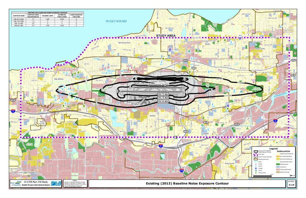
This exhibit from the Seattle-Tacoma International Airport 14 CFR Part 150 Study maps the existing 2013 baseline noise exposure contours around Sea-Tac Airport, showing DNL 65, 70, and 75 dBA noise zones across surrounding communities including SeaTac, Burien, Des Moines, and Tukwila. The DNL 65 dBA or greater contour covers approximately 5.9 square miles, encompassing an estimated 1,887 housing units and roughly 4,879 residents, along with 9 noise-sensitive facilities such as schools, churches, and hospitals. Notably, no housing units fall within the higher-impact DNL 70 dBA or above zones, though significant residential and commercial land uses exist within the broader 65 dBA contour area.Open full document
Notes
A 14 CFR Part 150 study map showing the existing 2013 baseline noise exposure contours (DNL 65, 70, and 75 dBA) for Seattle-Tacoma International Airport and surrounding communities. The map displays existing land use, noise-sensitive facilities including schools, churches, hospitals, nursing homes, and libraries within the study area. A summary table indicates that the DNL 65+ dBA contour covers 5.9 square miles containing 1,887 housing units and an estimated population of 4,879.