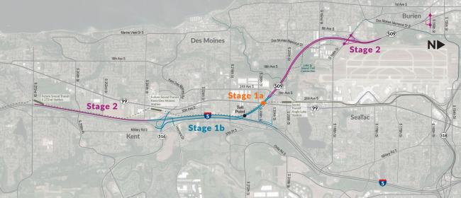
A project staging map shows the SR 509 extension and I-5 connector route divided into Stage 1a (toll point near Des Moines Memorial Drive), Stage 1b (along Military Road S toward Kent), and Stage 2 (extending northwest toward Burien and southeast toward Kent via SR 99). The map covers the Des Moines, SeaTac, Burien, and Kent areas of Washington State, with route numbers 99, 509, 316, and 5 visible.Open full document
Notes
A project staging map shows the SR 509 extension and I-5 connector route divided into Stage 1a (toll point near Des Moines Memorial Drive), Stage 1b (along Military Road S toward Kent), and Stage 2 (extending northwest toward Burien and southeast toward Kent via SR 99). The map covers the Des Moines, SeaTac, Burien, and Kent areas of Washington State, with route numbers 99, 509, 316, and 5 visible.