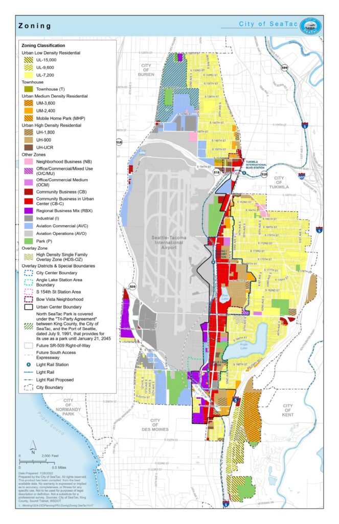
This zoning map from the City of SeaTac (prepared July 28, 2022) shows land-use classifications throughout the city, which borders Seattle-Tacoma International Airport. The map identifies a range of residential, commercial, industrial, and aviation-related zones — including Aviation Commercial (AVC) and Aviation Operations (AVO) designations — that reflect the airport's significant influence on surrounding land use and development policy. Special overlay districts, light rail corridors, and station area boundaries are also depicted, highlighting the city's efforts to manage growth and compatibility with airport noise and operations.Open full document
Notes
Official zoning map of the City of SeaTac, Washington, prepared by the City of SeaTac on July 28, 2022. The map displays zoning classifications including residential, commercial, industrial, aviation, and park zones, along with overlay districts, special boundaries, and transportation infrastructure such as light rail stations. It also shows the Seattle-Tacoma International Airport and surrounding municipal boundaries.