Tagproperty(41)
-
 2026-02-24 00:00
PACCAR Lease Termination
Port of Seattle Commission agenda item requesting authorization for the Executive Director to execute a lease termination agreement with PACCAR at SEA Airport. The termination will facilitate PACCAR’s transition to Boeing Field and support SEA’s airport capital development program and operations. -
-
 2023-04-24 15:13
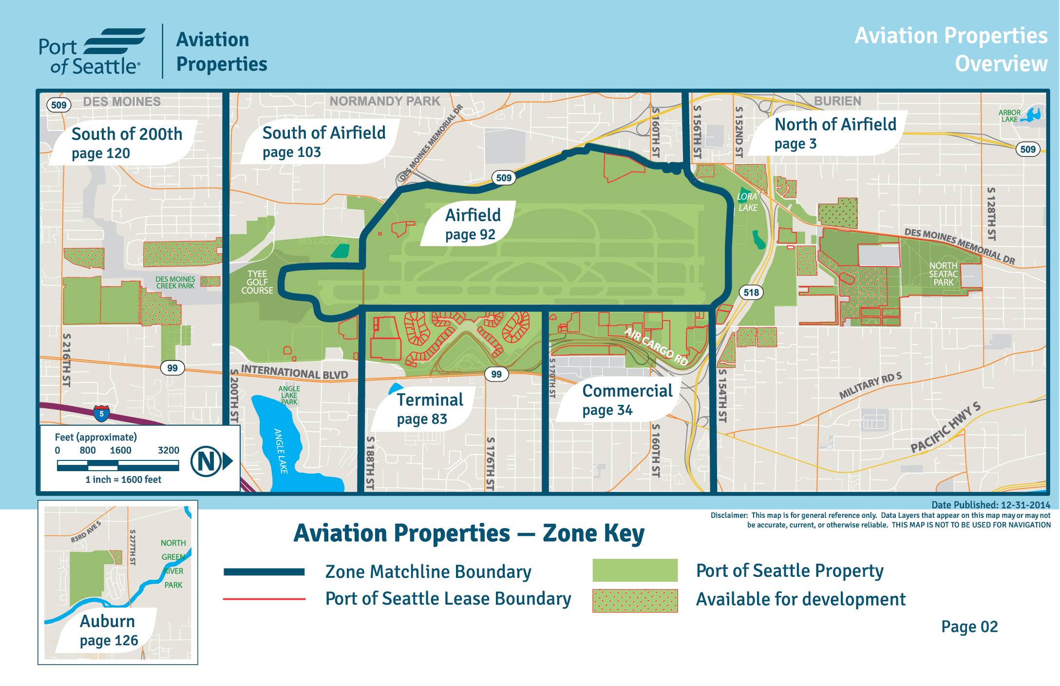
Port of Seattle – Airport Property Overview
-
 2023-04-24 15:12
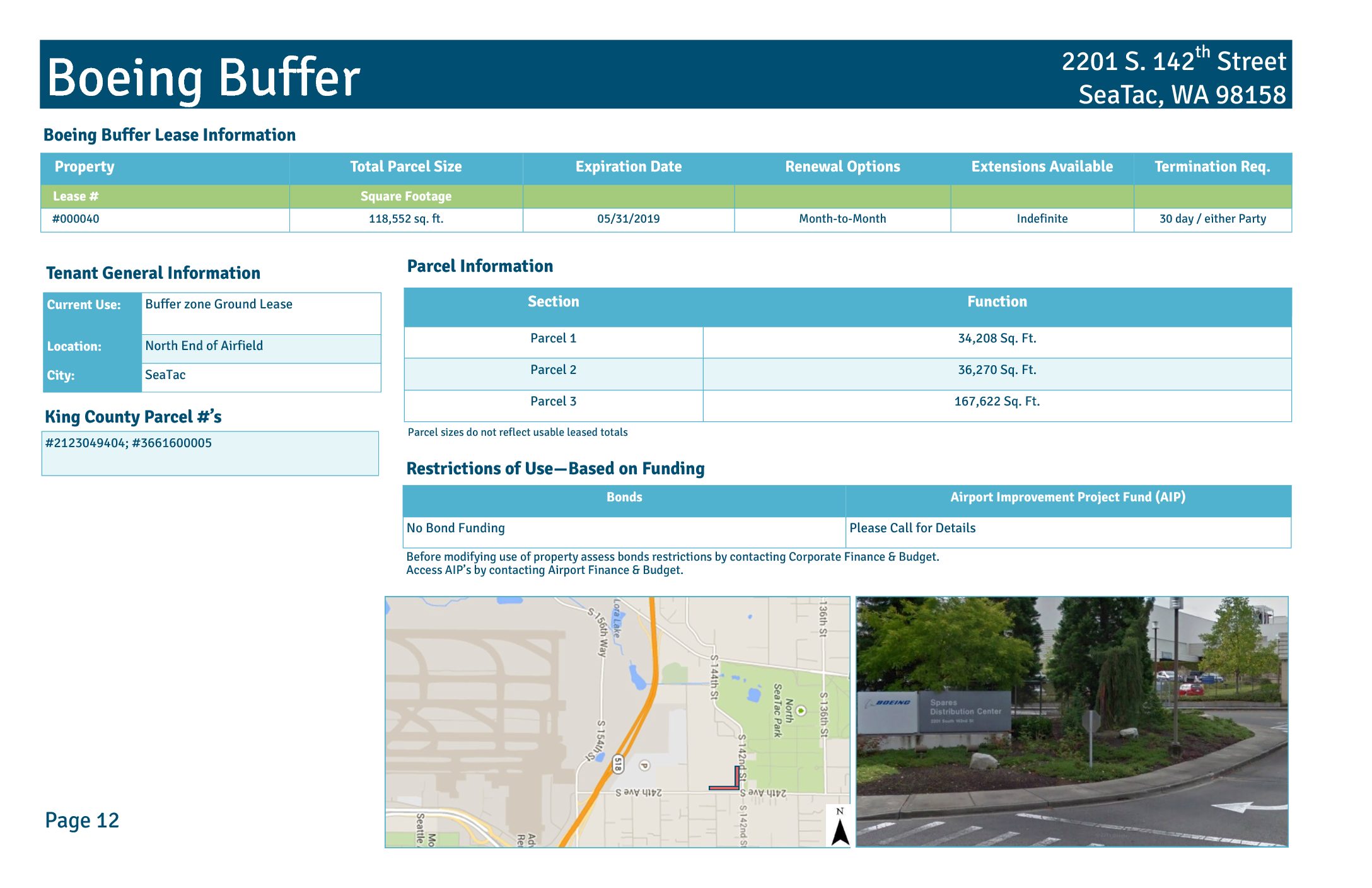
Boeing Buffer
Property Total Parcel Size Expiration Date Renewal Options Extensions Available Termination Req. Lease # Square Footage #000040 118,552 sq. ft. 05/31/2019 Month-to-Month Indefinite 30 day / either Party Boeing Buffer Section Function Parcel 1 34,208 Sq. Ft. Parcel 2 36,270 Sq. Ft. Parcel 3 167,622 Sq. Ft. Boeing Buffer Lease Information Parcel Information 2201 S. 142th Street SeaTac, WA 98158 Restrictions of Use—Based on Funding Bonds Airport Improvement Project Fund (AIP) No Bond Funding Please Call for Details Tenant General Information Current Use: Buffer zone Ground Lease Location: North End of Airfield City: SeaTac Page 12 Parcel sizes do not reflect usable leased totals King County Parcel #’s #2123049404; #3661600005 Before modifying use of property assess bonds restrictions by contacting Corporate Finance & Budget. Access AIP’s by contacting Airport Finance & Budget. 24th Ave S S 1 th St S 1 nd St 21st Ave S Boeing Buffer Lease #000040 21st Ave S Boeing Company SeaTac Community Center S 1 th St 20th Ave S North Employee Parking Lot Riverton Heights Reservoir Parcel 1 Parcel 2 Parcel 3 Boeing Buffer Aerial Photo Taken Spring 2012 200 400100 Feet inch = 200 feet Port of Seattle Lease Boundary Page 13 N or th f A ir fi el d Date Published: 12-31-2014 Disclaimer: This map is for general reference only. Data Layers that appear on this map may or may not be accurate, current, or otherwise reliable. THIS MAP IS NOT TO BE USED FOR NAVIGATION. -
 2023-01-14 23:37
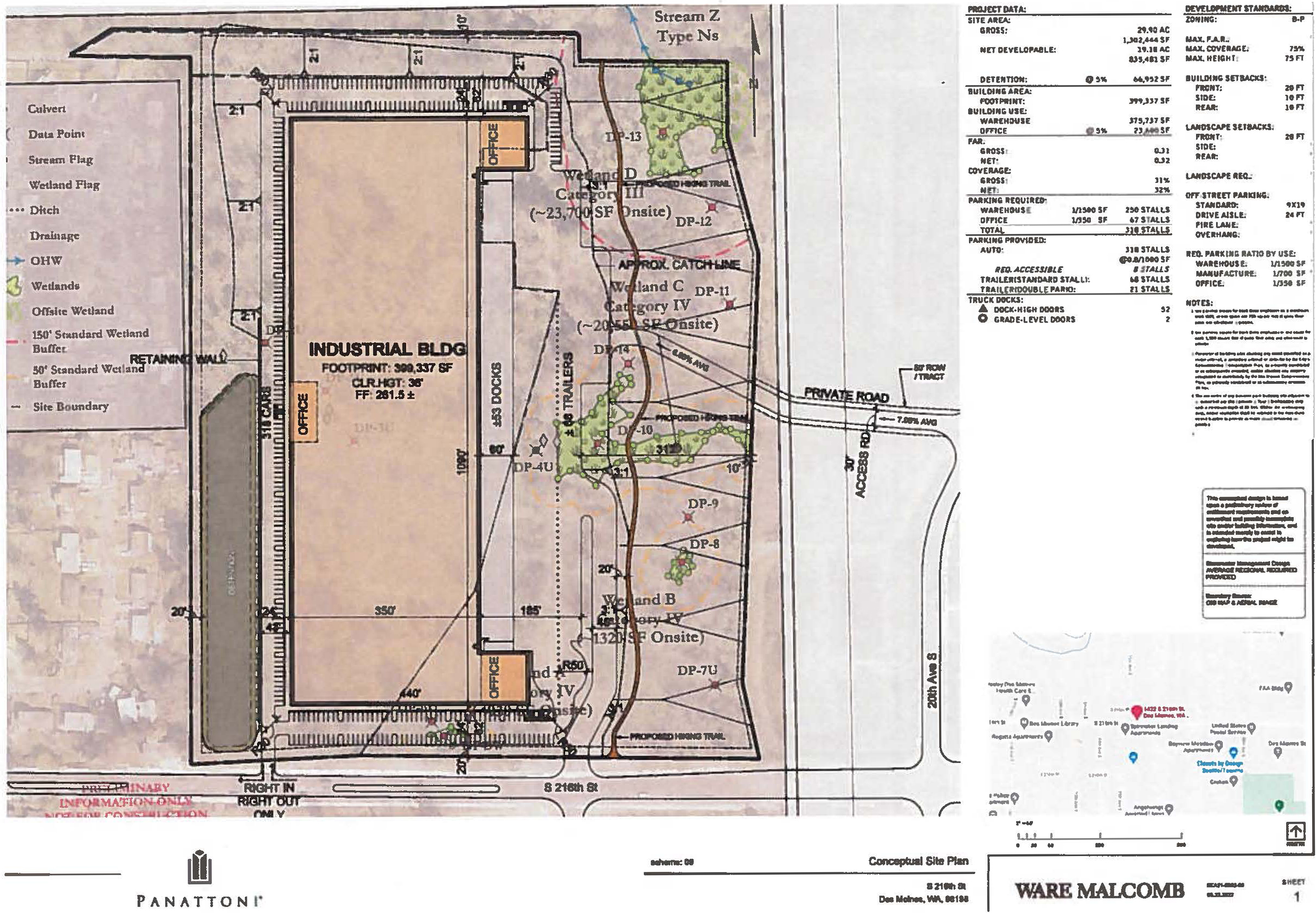
Des Moines Creek Business Park Warehouse (Panattoni)
-
 2022-09-23 00:23
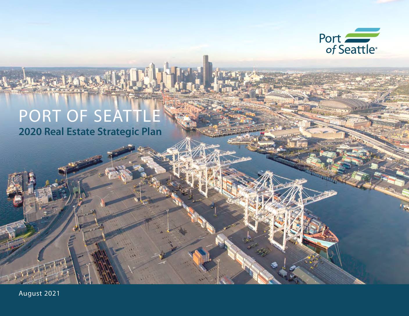
Port of Seattle – Real Estate Strategic Plan, 2020
2020 REAL ESTATE STRATEGIC PLAN | August 2021 Introduction ..........................................................1 Market Context ....................................................2 Real Estate Principles .........................................7 Property Profiles and Strategies ...................17 Fishermen’s Terminal .................................. 18 Salmon Bay Marina ..................................... 21 Terminal 91, Pier 90 & Pier 91 .................... 23 Terminal 91- Uplands ................................. 24 Pier 90 & Pier 91 ............................................ 27 Harbor Marine Corporate Center ............. 29 Pier 69 ............................................................. 31 World Trade Center West ............................ 33 Portfolio Growth - Implementation ............35 APPENDIX .............................................................45 ACKNOWLEDGMENTS Port Commissioners Port Leadership Port Real Estate Team Advisory Committee Members Introduction 2020 REAL ESTATE STRATEGIC PLAN | August 2021 PROJECT BACKGROUND & PURPOSE Heartland has been tasked with developing a Real Estate Strategic Plan (RESP) for the Port of Seattle (POS) with a focus on select properties from the Port’s portfolio of industrial and office assets. The analysis and strategy serve an update to the 2016 POS Real Estate Strategic Plan, which resulted in a series of property specific recommendations that the Port has been leveraging since that time. The updated RESP is designed to provide the POS with a strategy to effectively evaluate and manage its existing portfolio of real estate assets while also providing a framework for evaluating future real estate investments and acquisitions. APPROACH & METHODOLOGY Underwriting of and Evaluation of Assets Heartland initiated the effort with a thorough review of Port selected assets within the portfolio. This included development of comprehensive tenant and occupancy profiles and development of a portfolio level model to evaluate future lease turnover and overall… -
 2022-08-31 00:00
Des Moines Creek West – Executed Ground Lease, August 31, 2022
-
 2019-03-30 21:05
Flying Food Fare
Property Total Parcel Size Expiration Date Renewal Options Extensions Available Extensions Length Lease # Square Footage #000086 90,114 sq. ft. 03/31/2018 Until 2028 2 5 years Flying Food Fare Building ID Code/ Common Name Function Building Owned By Approximate Total Foot Print Office Whse. Sq. ft. Sq. ft. Sq. ft. Flying Food Fare Building Flight Kitchen and Office Tenant 34,199 1,312 32,887 Flying Food Fare Lease Information Flying Food Fare Building Information 2300 S. 154th Street SeaTac, WA 98158 Restrictions of Use—Based on Funding Bonds Airport Improvement Project Fund (AIP) Please Call for Details Please Call for Details Tenant General Information Current Use: Non-Aeronautical Ground Lease Location: North End of Airfield City: SeaTac Page 16 King County Parcel #’s #2823049016 Before modifying use of property assess bonds restrictions by contacting Corporate Finance & Budget. Access AIP’s by contacting Airport Finance & Budget. Flying Food Fare Lease #000086 Cargo 1 SDN1 Pond North Employee Parking Lot Transiplex SR5 S 1 th St Hardstand 1 Sky Chefs, Inc. Perim eter R oad Commercial Airf ield Airfield Flying Food Fare Nort h of Airf ield North of 156th Port of Seattle Lease Boundary Zone Matchline Boundary Aerial Photo Taken Spring 2012 100 20050 Feet inch = 100 feet Page 17 N or th f A ir fi el d Date Published: 12-31-2014 Disclaimer: This map is for general reference only. Data Layers that appear on this map may or may not be accurate, current, or otherwise reliable. THIS MAP IS NOT TO BE… -
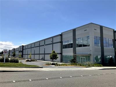
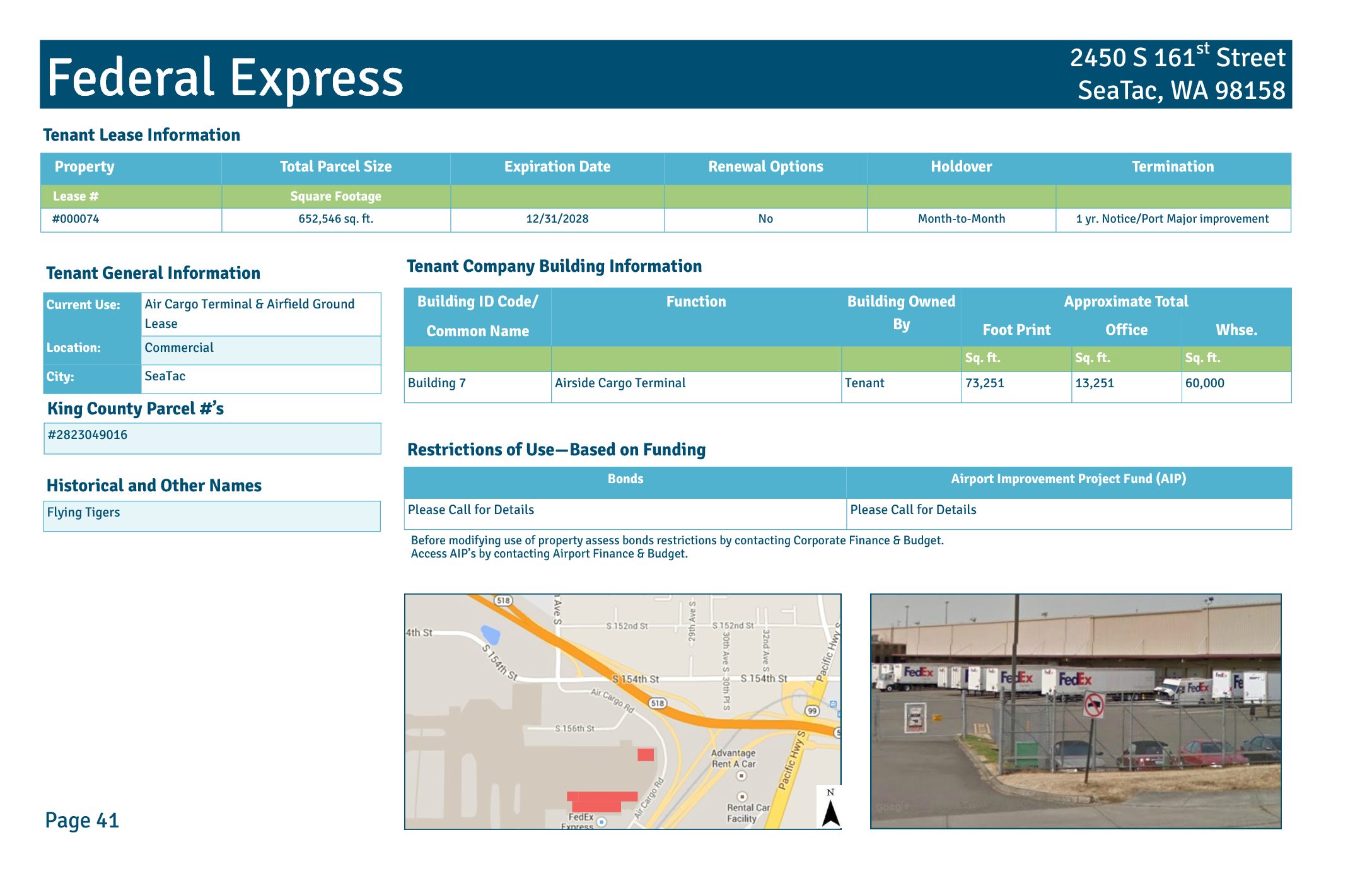 2019-03-30 21:05
Federal Express
Property Total Parcel Size Expiration Date Renewal Options Holdover Termination Lease # Square Footage #000074 652,546 sq. ft. 12/31/2028 No Month-to-Month 1 yr. Notice/Port Major improvement Federal Express Building ID Code/ Common Name Function Building Owned By Approximate Total Foot Print Office Whse. Sq. ft. Sq. ft. Sq. ft. Building 7 Airside Cargo Terminal Tenant 73,251 13,251 60,000 Tenant Lease Information Tenant Company Building Information 2450 S 161st Street SeaTac, WA 98158 Restrictions of Use—Based on Funding Bonds Airport Improvement Project Fund (AIP) Please Call for Details Please Call for Details Tenant General Information Current Use: Air Cargo Terminal & Airfield Ground Lease Location: Commercial City: SeaTac Page 41 King County Parcel #’s #2823049016 Before modifying use of property assess bonds restrictions by contacting Corporate Finance & Budget. Access AIP’s by contacting Airport Finance & Budget. Historical and Other Names Flying Tigers Federal Express Lease #000074 Co mm erc ial Gate Gourmet Cargo 1 SR5 S 1 th St Air Ca rgo Rd S 16 0th St Hardstand 3 Hardstand 1 Air Cargo Rd Alaska Cargo Hardstand 4 Cargo 4E Cargo 4N BT Property, LLC United Maintenance Facility Bolanos Properties, LLC Air Cargo Rd Water Tower Field Office Federal Express Federal Express No rth of Ai rfie ld Hardstand 2 Transiplex C om m er ci al Aerial Photo Taken Spring 2012 200 400100 Feet inch = 200 feet Page 42 Port of Seattle Lease Boundary Zone Matchline Boundary Date Published: 12-31-2014 Disclaimer: This map is for general reference only.… -
 2019-03-30 21:05
FAA Tower
Property Total Parcel Size Expiration Date Renewal Options Extensions Available Extensions Length Holdover Lease # Square Footage #000224 99,626 sq. ft. 09/30/2019 Until 2079 3 20 yrs No FAA Tower Building ID Code/ Common Name Function Building Owned By Approximate Total Foot Print Office Whse. Sq. ft. Sq. ft. Sq. ft. Building 17 FAA Air Traffic Control Tower Tenant 10,291 11,291 FAA Tower Lease Information Tenant Company Building Information 2580 S 166th Street SeaTac, WA 98158 Tenant General Information Current Use: FAA Facilities Lease Location: Commercial City: SeaTac Page 59 King County Parcel #’s #2823049016 Restrictions of Use—Based on Funding Bonds Airport Improvement Project Fund (AIP) Please Call for Details Please Call for Details Before modifying use of property assess bonds restrictions by contacting Corporate Finance & Budget. Access AIP’s by contacting Airport Finance & Budget. FAA Tower Lease #000224 Air Cargo Rd Hardstand 4 Alaska Cargo Hardstand 5 Cargo 4S FAA Tower C om m er ci al Aerial Photo Taken Spring 2012 100 20050 Feet inch = 100 feet Page 60 Port of Seattle Lease Boundary Date Published: 12-31-2014 Disclaimer: This map is for general reference only. Data Layers that appear on this map may or may not be accurate, current, or otherwise reliable. THIS MAP IS NOT TO BE USED FOR NAVIGATION.