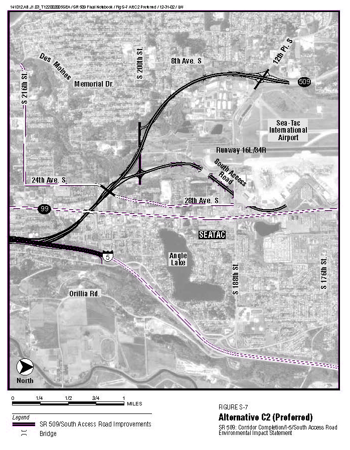
This is Figure S-7 from the SR 509 Corridor Completion/I-5/South Access Road Environmental Impact Statement, showing the preferred Alternative C2 alignment. The aerial map depicts proposed SR 509 and South Access Road improvements near Sea-Tac International Airport, connecting to I-5 via Orillia Road, with key landmarks including Angle Lake, Runway 16L/34R, and surrounding streets in SeaTac, Washington, dated December 31, 2002.Open full document
Notes
This is Figure S-7 from the SR 509 Corridor Completion/I-5/South Access Road Environmental Impact Statement, showing the preferred Alternative C2 alignment. The aerial map depicts proposed SR 509 and South Access Road improvements near Sea-Tac International Airport, connecting to I-5 via Orillia Road, with key landmarks including Angle Lake, Runway 16L/34R, and surrounding streets in SeaTac, Washington, dated December 31, 2002.