Notes
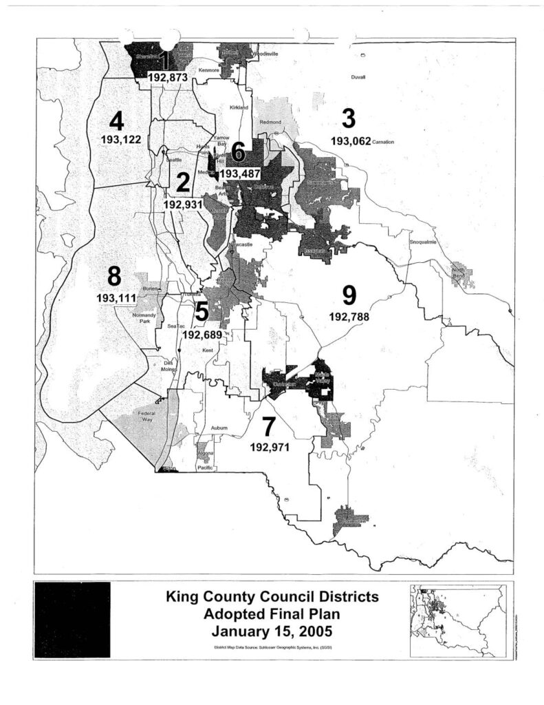
King County Council Districts Adopted Final Plan map dated January 15, 2005, produced by Schlosser Geographic Systems, Inc. (SGSI). Shows all nine King County Council district boundaries with population figures: District 1 (192,873), District 2 (192,931), District 3 (193,062), District 4 (193,122), District 5 (192,689), District 6 (193,487), District 7 (192,971), District 8 (193,111), District 9 (192,788). Geographic coverage includes Seattle, Kenmore, Kirkland, Redmond, Bellevue, Issaquah, Carnation, Snoqualmie, North Bend, Newcastle, Renton, Tukwila, Burien, Normandy Park, SeaTac, Des Moines, Federal Way, Kent, Auburn, Algona, Pacific, Black Diamond, and Enumclaw areas.