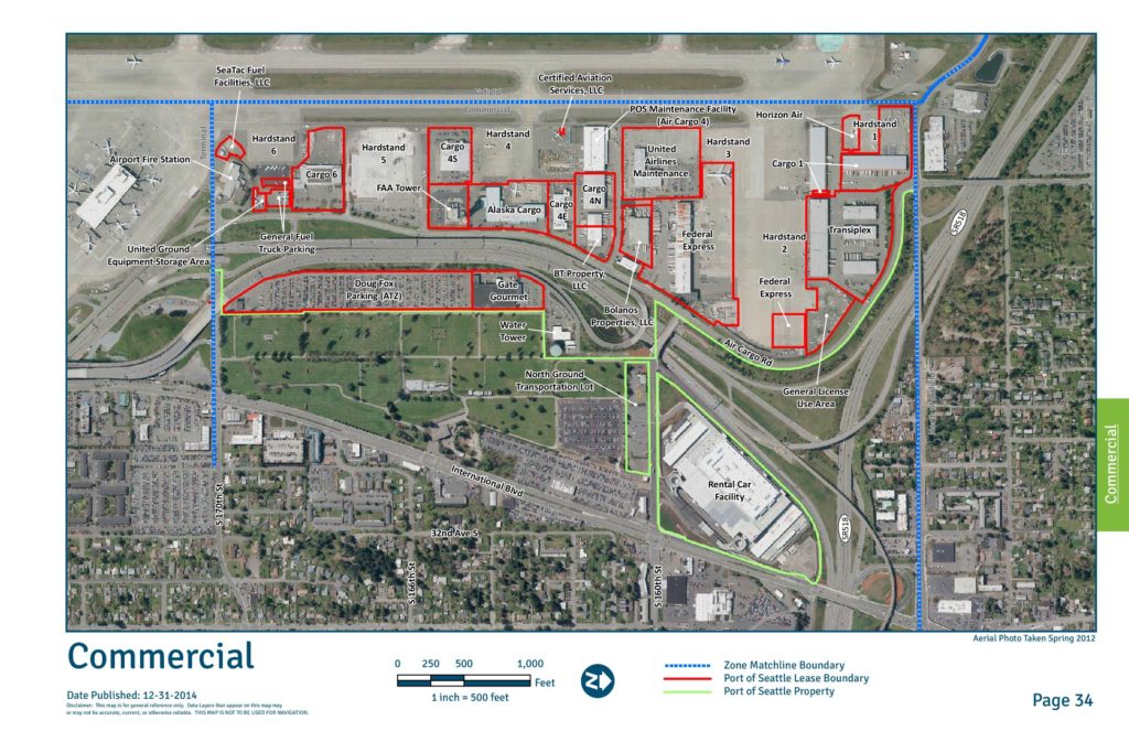
This map provides a general reference overview of the commercial zone at Seattle-Tacoma International Airport (Sea-Tac), showing Port of Seattle lease boundaries and property lines as of December 2014. It identifies key facilities including cargo buildings, hardstands, fuel facilities, airline maintenance areas, a rental car facility, and ground transportation lots. The aerial photo, taken in Spring 2012, covers the area bounded by SR-518, International Boulevard, and surrounding streets south of the airfield.Open full document
Notes
An aerial map of the commercial zone at Sea-Tac Airport showing Port of Seattle lease boundaries, property designations, and tenant locations including cargo facilities, fuel facilities, hardstands, and ground transportation areas. The map identifies named tenants such as FedEx, Alaska Cargo, Horizon Air, SeaTac Fuel Facilities LLC, Certified Aviation Services LLC, and others. The aerial photo was taken in spring 2012 and published December 31, 2014.