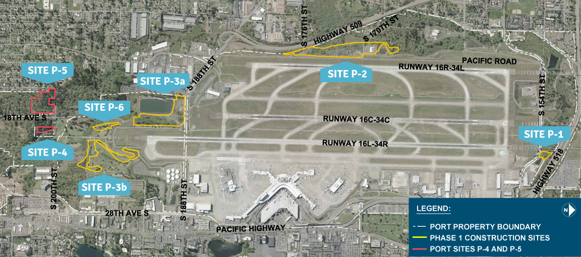
Aerial map of Seattle-Tacoma International Airport identifying labeled construction and port sites (P-1 through P-6, including P-3a and P-3b) with Phase 1 Construction Sites outlined in yellow and Port Sites P-4 and P-5 outlined in red. The map shows three parallel runways (16R-34L, 16C-34C, 16L-34R), surrounding roads including Highway 509, Highway 518, and Pacific Highway, and the Port Property Boundary marked with a dashed white line.Open full document
Notes
Aerial map of Seattle-Tacoma International Airport identifying labeled construction and port sites (P-1 through P-6, including P-3a and P-3b) with Phase 1 Construction Sites outlined in yellow and Port Sites P-4 and P-5 outlined in red. The map shows three parallel runways (16R-34L, 16C-34C, 16L-34R), surrounding roads including Highway 509, Highway 518, and Pacific Highway, and the Port Property Boundary marked with a dashed white line.