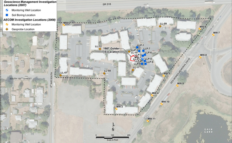
Aerial site map showing environmental investigation locations near South 150th Street and Des Moines Memorial Drive, referencing a 1987 Golder Excavation site. The map identifies monitoring wells, soil borings, and geoprobe locations from two investigation phases: Geoscience Management (2007) and AECOM (2008), with labeled points including LLP, LL, and MW series markers consistent with a contamination investigation near Sea-Tac Airport.Open full document
Notes
Aerial site map showing environmental investigation locations near South 150th Street and Des Moines Memorial Drive, referencing a 1987 Golder Excavation site. The map identifies monitoring wells, soil borings, and geoprobe locations from two investigation phases: Geoscience Management (2007) and AECOM (2008), with labeled points including LLP, LL, and MW series markers consistent with a contamination investigation near Sea-Tac Airport.