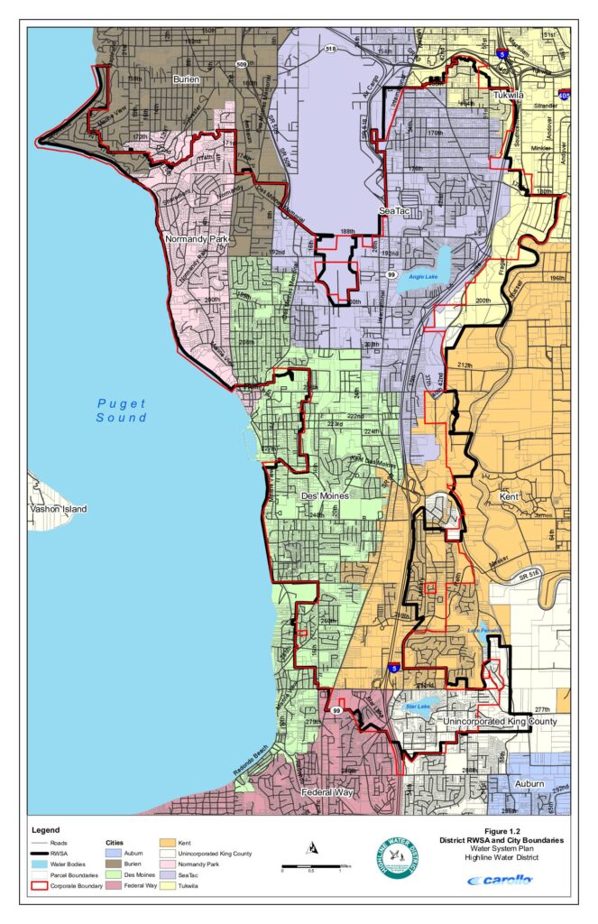
This map from Highline Water District's Water System Plan shows the district's Regional Water Service Area (RWSA) and surrounding city boundaries in the communities near Sea-Tac Airport, including Burien, Normandy Park, Des Moines, SeaTac, Tukwila, Kent, Federal Way, and unincorporated King County. The document depicts roads, water bodies such as Angle Lake, Lake Fenwick, and Star Lake, and parcel boundaries across the service area along the eastern shore of Puget Sound. While primarily a water infrastructure planning document, it provides detailed geographic context for the municipalities and neighborhoods in the Sea-Tac Airport vicinity.Open full document
Notes
A detailed map showing the Retail Water Service Area (RWSA) and corporate boundaries of Highline Water District in relation to surrounding cities and unincorporated King County. The map covers the area between Puget Sound and Interstate 5, spanning from Tukwila and Burien in the north to Federal Way and Auburn in the south. It includes roads, water bodies, parcel boundaries, and city limits for municipalities including Des Moines, SeaTac, Normandy Park, Kent, and others.