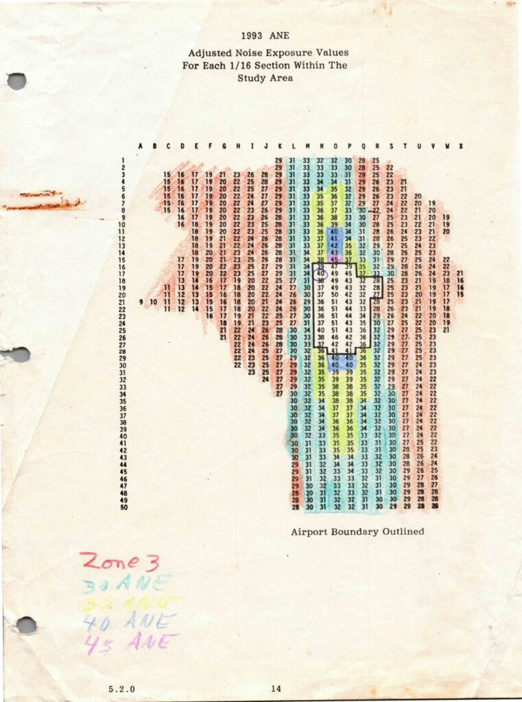
This 1993 document presents Adjusted Noise Exposure (ANE) values for each 1/16 section within the Sea-Tac Airport study area, displayed as a grid referenced by row numbers (1–50) and column letters (A–X). The values represent measured noise levels across the surrounding region, with higher readings concentrated near the airport boundary and lower values toward the outer edges of the study area. Handwritten annotations indicate noise zone classifications at 30, 33, 40, and 45 ANE thresholds, which were used to define noise impact zones for land use planning purposes.Open full document
Notes
1993 Adjusted Noise Exposure (ANE) values tabulated for each 1/16 section within the Sea-Tac Airport study area, with airport boundary outlined. Grid coordinates A through X (columns) and rows 1 through 50 present ANE values ranging from approximately 9 to 51. Handwritten annotations identify Zone 3 noise contour thresholds at 30 ANE, 33 ANE, 40 ANE, and 45 ANE. Document is section 5.2.0, page 14, produced in context of Port of Seattle noise exposure mapping.