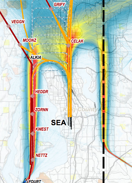
A noise exposure or flight track density map centered on Seattle-Tacoma International Airport (labeled 'SEA'), showing instrument fixes/waypoints including GRIFY, VEGGN, MOONZ, CELAK, ALKIA, HEDDR, ZORNN, KWEST, NETTZ, and FOURT over King County, Washington. Heat-map coloring (red/orange/yellow/blue) indicates noise or traffic concentration levels along approach and departure corridors.Open full document
Notes
A noise exposure or flight track density map centered on Seattle-Tacoma International Airport (labeled ‘SEA’), showing instrument fixes/waypoints including GRIFY, VEGGN, MOONZ, CELAK, ALKIA, HEDDR, ZORNN, KWEST, NETTZ, and FOURT over King County, Washington. Heat-map coloring (red/orange/yellow/blue) indicates noise or traffic concentration levels along approach and departure corridors.