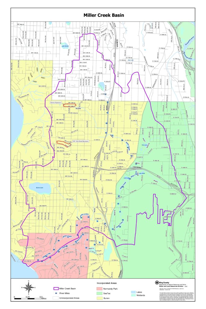
This King County map document depicts the Miller Creek Basin, covering portions of the incorporated cities of Burien, Normandy Park, and SeaTac, as well as surrounding unincorporated areas. It highlights key waterways including Miller Creek, Walker Creek, and the Duwamish River, along with lakes, wetlands, and notable drainage features such as the Hermes Depression and SW 142nd Street Depression. The map was produced by the King County Water and Land Resources Division and includes river mile markers and jurisdictional boundaries relevant to watershed and land-use planning in the vicinity of Seattle-Tacoma International Airport.Open full document
Notes
A detailed map of the Miller Creek Basin produced by King County Water and Land Resources Division. The map shows the basin boundaries, waterways including Miller Creek, Walker Creek, and the Duwamish River, wetlands, lakes, and incorporated areas including Burien, Normandy Park, and SeaTac. It also identifies features such as the Hermes Depression and SW 142nd Street Depression.