Notes
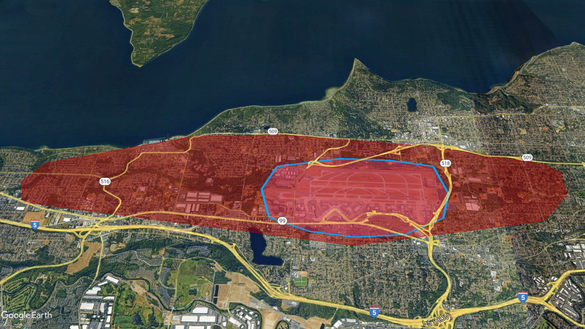
The outlined area in blue is the Area of Potential Effect (APE)–the boundary of consideration for most aspects of the SAMP NEPA review process. The red is the 2024 DNL65 boundary.
I understand that you will never share my information with anyone, you will only use it to keep me updated on relevant events and that I may unsubscribe at any time.
The outlined area in blue is the Area of Potential Effect (APE)–the boundary of consideration for most aspects of the SAMP NEPA review process. The red is the 2024 DNL65 boundary.