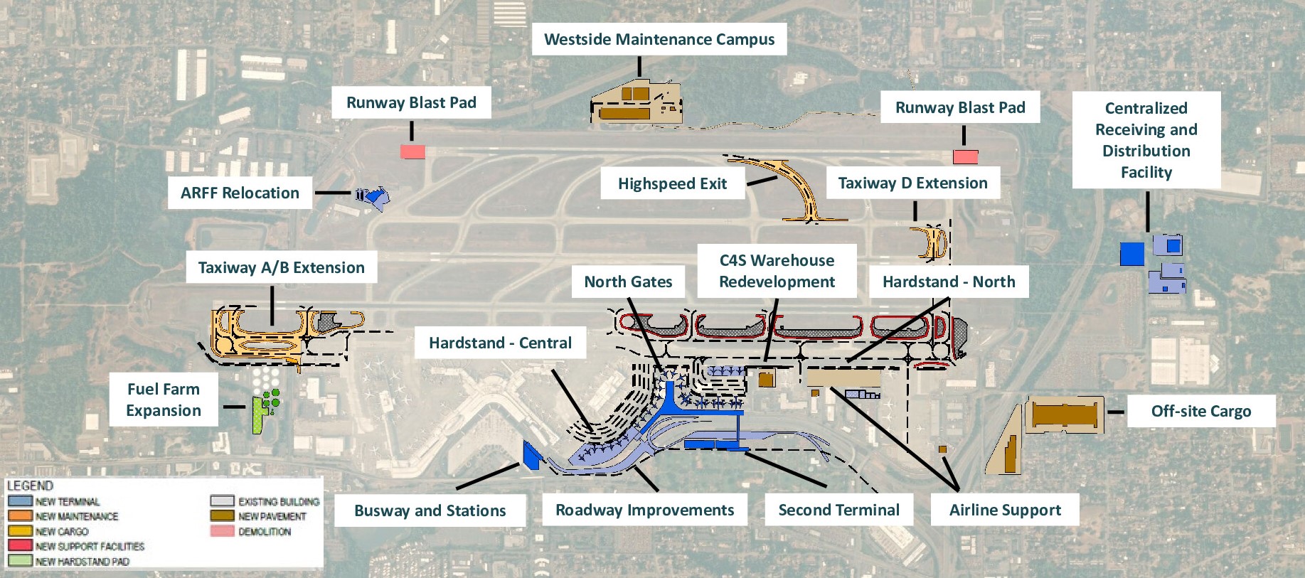
Aerial planning map of Seattle-Tacoma International Airport (Sea-Tac) showing proposed and existing infrastructure projects, including a Second Terminal, North Gates, Taxiway A/B and D Extensions, Runway Blast Pads, Highspeed Exit, ARFF Relocation, Fuel Farm Expansion, Westside Maintenance Campus, Busway and Stations, Roadway Improvements, Hardstand areas (Central and North), C4S Warehouse Redevelopment, Airline Support facilities, Off-site Cargo, and a Centralized Receiving and Distribution Facility. A color-coded legend distinguishes new terminals, maintenance, cargo, support facilities, hardstand pads, existing buildings, new pavement, and demolition areas.Open full document
Notes
Aerial planning map of Seattle-Tacoma International Airport (Sea-Tac) showing proposed and existing infrastructure projects, including a Second Terminal, North Gates, Taxiway A/B and D Extensions, Runway Blast Pads, Highspeed Exit, ARFF Relocation, Fuel Farm Expansion, Westside Maintenance Campus, Busway and Stations, Roadway Improvements, Hardstand areas (Central and North), C4S Warehouse Redevelopment, Airline Support facilities, Off-site Cargo, and a Centralized Receiving and Distribution Facility. A color-coded legend distinguishes new terminals, maintenance, cargo, support facilities, hardstand pads, existing buildings, new pavement, and demolition areas.