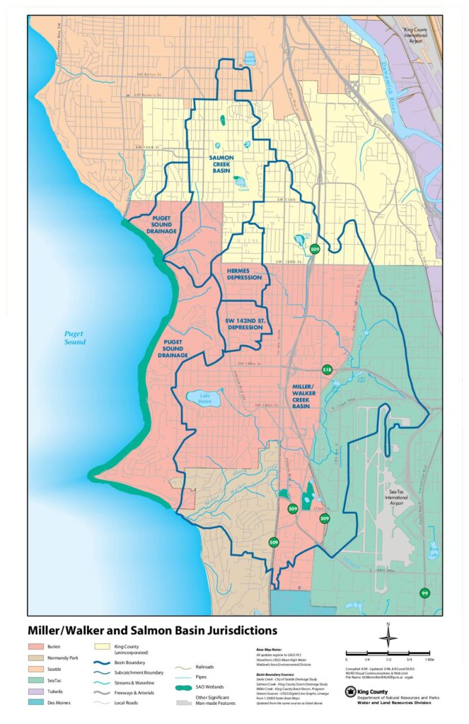
This map from King County's Department of Natural Resources and Parks illustrates the jurisdictional boundaries of the Miller/Walker Creek and Salmon Creek drainage basins in the area surrounding Sea-Tac International Airport and King County International Airport. It identifies the municipalities involved—including Burien, SeaTac, Seattle, Tukwila, Normandy Park, Des Moines, and unincorporated King County—along with key sub-basins such as the Hermes Depression, SW 142nd St. Depression, and Puget Sound Drainage areas. The map serves as a reference for stormwater and land-use planning in a region where airport operations and urban development intersect with sensitive waterways and wetlands.Open full document
Notes
A jurisdictional map of the Miller/Walker Creek Basin and Salmon Creek Basin area near Sea-Tac International Airport in King County, Washington. The map shows basin and subcatchment boundaries, streams, wetlands, roads, and jurisdictional areas for cities including Burien, Normandy Park, Seattle, SeaTac, Tukwila, Des Moines, and unincorporated King County. Base map notes indicate it was compiled in April 1994 and updated through March 2003.