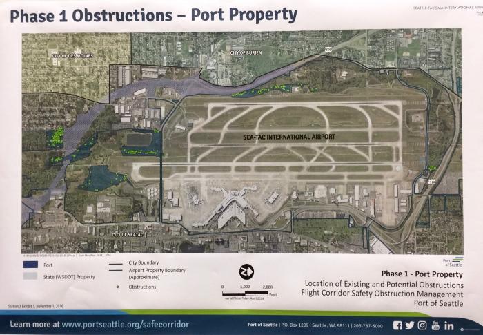
A Port of Seattle aerial map exhibit titled 'Phase 1 Obstructions – Port Property,' dated November 1, 2016, depicting the location of existing and potential flight corridor safety obstructions at Seattle-Tacoma International Airport. The map shows airport property boundaries, Port and State (WSDOT) property designations, obstruction markers, and surrounding city boundaries for Des Moines, Burien, and SeaTac, produced as part of the Flight Corridor Safety Obstruction Management program.Open full document
Notes
A Port of Seattle aerial map exhibit titled ‘Phase 1 Obstructions – Port Property,’ dated November 1, 2016, depicting the location of existing and potential flight corridor safety obstructions at Seattle-Tacoma International Airport. The map shows airport property boundaries, Port and State (WSDOT) property designations, obstruction markers, and surrounding city boundaries for Des Moines, Burien, and SeaTac, produced as part of the Flight Corridor Safety Obstruction Management program.