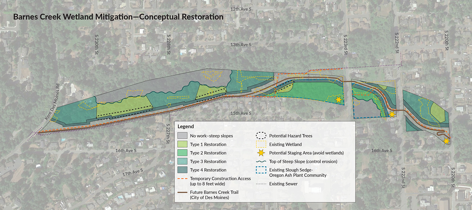
A conceptual restoration map for Barnes Creek Wetland Mitigation in Des Moines, Washington, showing four types of wetland restoration zones, temporary construction access routes, the future Barnes Creek Trail (City of Des Moines), existing sewer lines, potential hazard trees, staging areas, and steep slope erosion control measures. The project area spans between approximately S 220th St and Kent Des Moines Rd, bounded by 13th Ave S and 16th Ave S.Open full document
Notes
A conceptual restoration map for Barnes Creek Wetland Mitigation in Des Moines, Washington, showing four types of wetland restoration zones, temporary construction access routes, the future Barnes Creek Trail (City of Des Moines), existing sewer lines, potential hazard trees, staging areas, and steep slope erosion control measures. The project area spans between approximately S 220th St and Kent Des Moines Rd, bounded by 13th Ave S and 16th Ave S.