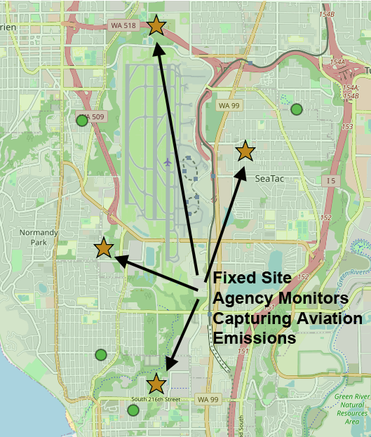
A map of the Sea-Tac Airport area showing four fixed-site agency air quality monitoring stations (marked with gold stars) positioned around Seattle-Tacoma International Airport to capture aviation emissions. Visible road labels include WA 518, WA 509, WA 99, and the SeaTac community label, with arrows indicating the monitoring locations near South 216th Street, Normandy Park, and northern airport boundaries.Open full document
Notes
A map of the Sea-Tac Airport area showing four fixed-site agency air quality monitoring stations (marked with gold stars) positioned around Seattle-Tacoma International Airport to capture aviation emissions. Visible road labels include WA 518, WA 509, WA 99, and the SeaTac community label, with arrows indicating the monitoring locations near South 216th Street, Normandy Park, and northern airport boundaries.