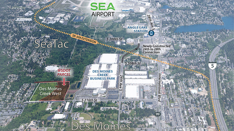
Aerial map showing the Des Moines Creek West development site and adjacent WSDOT Parcel in SeaTac/Des Moines, Washington, near Seattle-Tacoma International Airport. The map highlights the SR-509 Extension corridor, Des Moines Creek Business Park, Angle Lake Station, International Blvd, and a newly constructed 24th to 28th Street connection, with Interstate 5 visible to the east.Open full document
Notes
Aerial map showing the Des Moines Creek West development site and adjacent WSDOT Parcel in SeaTac/Des Moines, Washington, near Seattle-Tacoma International Airport. The map highlights the SR-509 Extension corridor, Des Moines Creek Business Park, Angle Lake Station, International Blvd, and a newly constructed 24th to 28th Street connection, with Interstate 5 visible to the east.