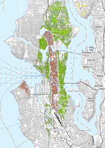
A color-coded map depicting what appears to be the Seattle/King County area, showing a north-south urban corridor with green, brown, and white zones likely representing land use categories or noise exposure contours. Radiating lines visible in the lower left suggest an airport noise or flight path overlay, consistent with Sea-Tac Airport noise planning documentation.Open full document
Notes
A color-coded map depicting what appears to be the Seattle/King County area, showing a north-south urban corridor with green, brown, and white zones likely representing land use categories or noise exposure contours. Radiating lines visible in the lower left suggest an airport noise or flight path overlay, consistent with Sea-Tac Airport noise planning documentation.