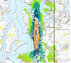
A GIS-style map showing noise impact contours radiating north-south from Seattle-Tacoma International Airport, with color-coded zones (orange, teal, green, yellow) indicating varying decibel levels across communities including Seattle, Renton, Burien, and surrounding areas. The dashed boundary lines and color gradient appear to represent DNL (Day-Night Average Sound Level) contours used in airport noise policy planning.Open full document
Notes
A GIS-style map showing noise impact contours radiating north-south from Seattle-Tacoma International Airport, with color-coded zones (orange, teal, green, yellow) indicating varying decibel levels across communities including Seattle, Renton, Burien, and surrounding areas. The dashed boundary lines and color gradient appear to represent DNL (Day-Night Average Sound Level) contours used in airport noise policy planning.