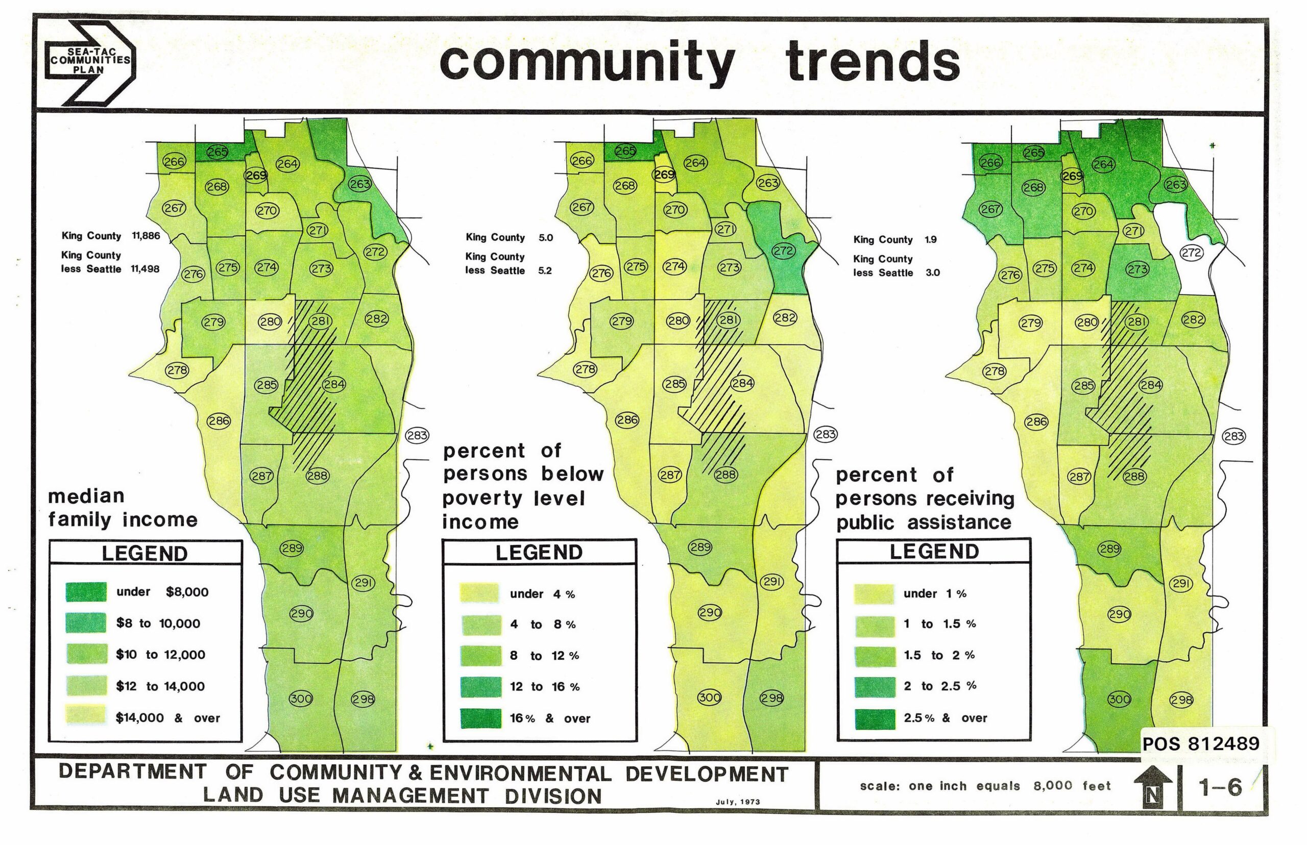
A July 1973 planning document from King County's Department of Community & Environmental Development, Land Use Management Division, showing three choropleth maps of the Sea-Tac communities area depicting median family income, percent of persons below poverty level income, and percent of persons receiving public assistance by census tract. King County median family income figures of $11,886 and $11,498 (less Seattle) are noted, with tract numbers ranging from 263 to 300.Open full document
Notes
A July 1973 planning document from King County’s Department of Community & Environmental Development, Land Use Management Division, showing three choropleth maps of the Sea-Tac communities area depicting median family income, percent of persons below poverty level income, and percent of persons receiving public assistance by census tract. King County median family income figures of $11,886 and $11,498 (less Seattle) are noted, with tract numbers ranging from 263 to 300.