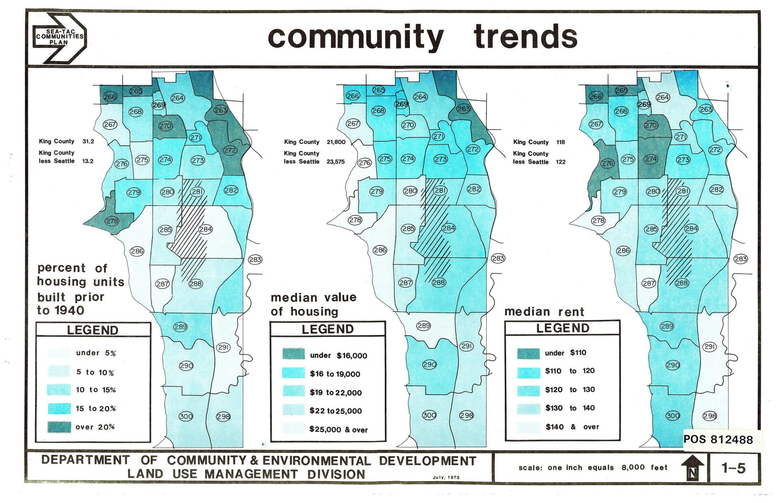
A July 1973 planning document (map sheet 1-5, POS 812488) produced by King County's Department of Community & Environmental Development, Land Use Management Division, showing three choropleth maps of Sea-Tac area census tracts (numbered 263–300) depicting percent of housing units built prior to 1940, median housing value, and median rent. King County figures cited are 31.2% pre-1940 housing, median housing value of $21,800, and median rent of $118.Open full document
Notes
A July 1973 planning document (map sheet 1-5, POS 812488) produced by King County’s Department of Community & Environmental Development, Land Use Management Division, showing three choropleth maps of Sea-Tac area census tracts (numbered 263–300) depicting percent of housing units built prior to 1940, median housing value, and median rent. King County figures cited are 31.2% pre-1940 housing, median housing value of $21,800, and median rent of $118.