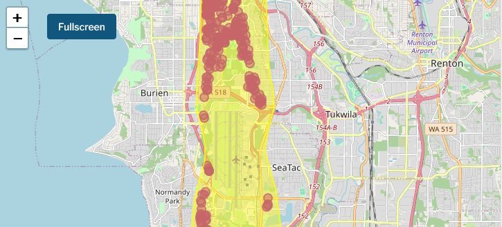
An interactive web map displaying aircraft noise impact zones around Seattle-Tacoma International Airport (Sea-Tac), with a heat map overlay showing high-intensity noise areas (dark red/maroon) concentrated along the north-south runway corridor. The affected communities visible include Burien, Normandy Park, SeaTac, and Tukwila, with highway routes including WA-518, WA-515, and I-5 corridor visible as reference points.Open full document
Notes
An interactive web map displaying aircraft noise impact zones around Seattle-Tacoma International Airport (Sea-Tac), with a heat map overlay showing high-intensity noise areas (dark red/maroon) concentrated along the north-south runway corridor. The affected communities visible include Burien, Normandy Park, SeaTac, and Tukwila, with highway routes including WA-518, WA-515, and I-5 corridor visible as reference points.