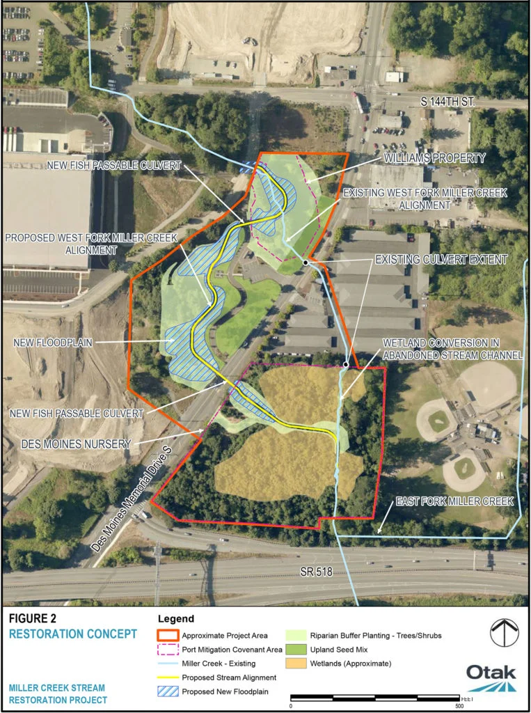
An aerial plan map produced by Otak engineering firm showing the Miller Creek Stream Restoration Project restoration concept near Des Moines Memorial Drive S and SR 518, in the vicinity of Sea-Tac Airport. The map depicts proposed West Fork Miller Creek realignment, new fish-passable culverts, new floodplain areas, wetland conversions, riparian buffer plantings, and the East Fork Miller Creek, with the Williams Property and S 144th Street visible to the north.Open full document
Notes
An aerial plan map produced by Otak engineering firm showing the Miller Creek Stream Restoration Project restoration concept near Des Moines Memorial Drive S and SR 518, in the vicinity of Sea-Tac Airport. The map depicts proposed West Fork Miller Creek realignment, new fish-passable culverts, new floodplain areas, wetland conversions, riparian buffer plantings, and the East Fork Miller Creek, with the Williams Property and S 144th Street visible to the north.