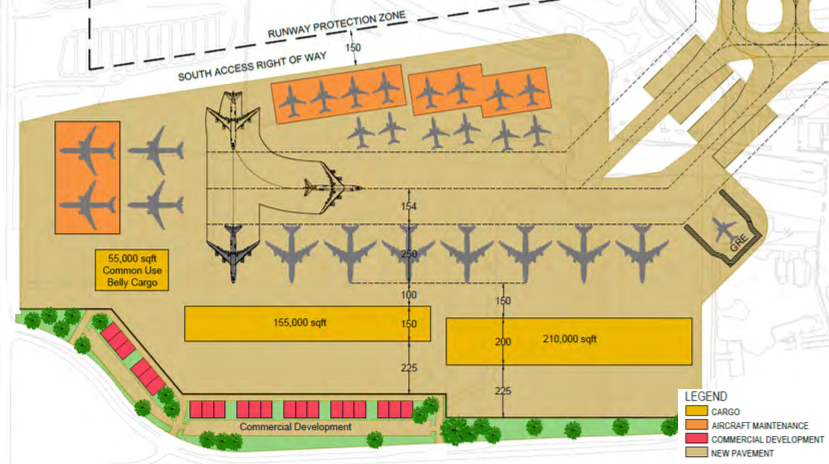
An airport site plan diagram for what appears to be Auburn/Seattle-Tacoma area airport (labeled 'GRE', indicating Renton Municipal or more likely Grant County Airport area), showing proposed cargo facilities (155,000 sqft and 210,000 sqft buildings), a 55,000 sqft Common Use Belly Cargo area, aircraft maintenance aprons, commercial development zones, and a Runway Protection Zone along the South Access Right of Way. Color-coded legend distinguishes cargo, aircraft maintenance, commercial development, and new pavement areas.Open full document
Notes
An airport site plan diagram for what appears to be Auburn/Seattle-Tacoma area airport (labeled ‘GRE’, indicating Renton Municipal or more likely Grant County Airport area), showing proposed cargo facilities (155,000 sqft and 210,000 sqft buildings), a 55,000 sqft Common Use Belly Cargo area, aircraft maintenance aprons, commercial development zones, and a Runway Protection Zone along the South Access Right of Way. Color-coded legend distinguishes cargo, aircraft maintenance, commercial development, and new pavement areas.