Tagproperty(41)
-
 2019-03-30 21:04
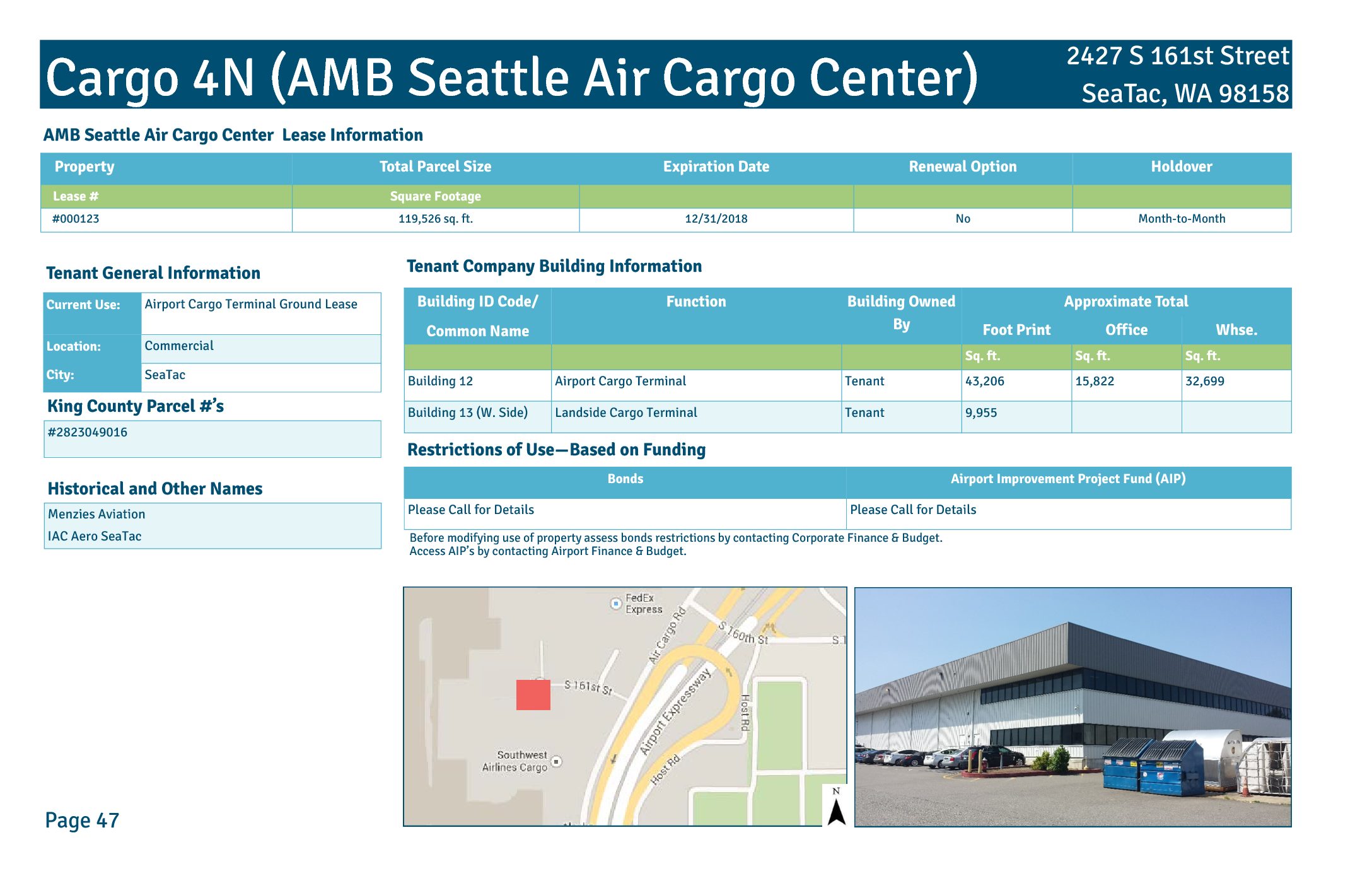
Cargo4N AMB Seattle Air Cargo Center
Property Total Parcel Size Expiration Date Renewal Option Holdover Lease # Square Footage #000123 119,526 sq. ft. 12/31/2018 No Month-to-Month Cargo 4N (AMB Seattle Air Cargo Center) Building ID Code/ Common Name Function Building Owned By Approximate Total Foot Print Office Whse. Sq. ft. Sq. ft. Sq. ft. Building 12 Airport Cargo Terminal Tenant 43,206 15,822 32,699 Building 13 (W. Side) Landside Cargo Terminal Tenant 9,955 AMB Seattle Air Cargo Center Lease Information Tenant Company Building Information 2427 S 161st Street SeaTac, WA 98158 Restrictions of Use—Based on Funding Bonds Airport Improvement Project Fund (AIP) Please Call for Details Please Call for Details Tenant General Information Current Use: Airport Cargo Terminal Ground Lease Location: Commercial City: SeaTac Page 47 King County Parcel #’s #2823049016 Before modifying use of property assess bonds restrictions by contacting Corporate Finance & Budget. Access AIP’s by contacting Airport Finance & Budget. Historical and Other Names Menzies Aviation IAC Aero SeaTac Cargo 4N (AMB Seattle Air Cargo Center) Lease #000123 Gate Gourmet Federal Express Alaska Cargo Cargo 4E Air Cargo Rd BT Property, LLC Hardstand 4 Bolanos Properties, LLC POS Maintenance Facility (Air Cargo 4) Cargo 4N United Airlines Maintenance C om m er ci al Aerial Photo Taken Spring 2012 100 20050 Feet inch = 100 feet Page 48 Port of Seattle Lease Boundary EasementDate Published: 12-31-2014 Disclaimer: This map is for general reference only. Data Layers that appear on this map may or may not be accurate, current, or otherwise reliable. THIS MAP IS… -
 2019-03-30 21:04
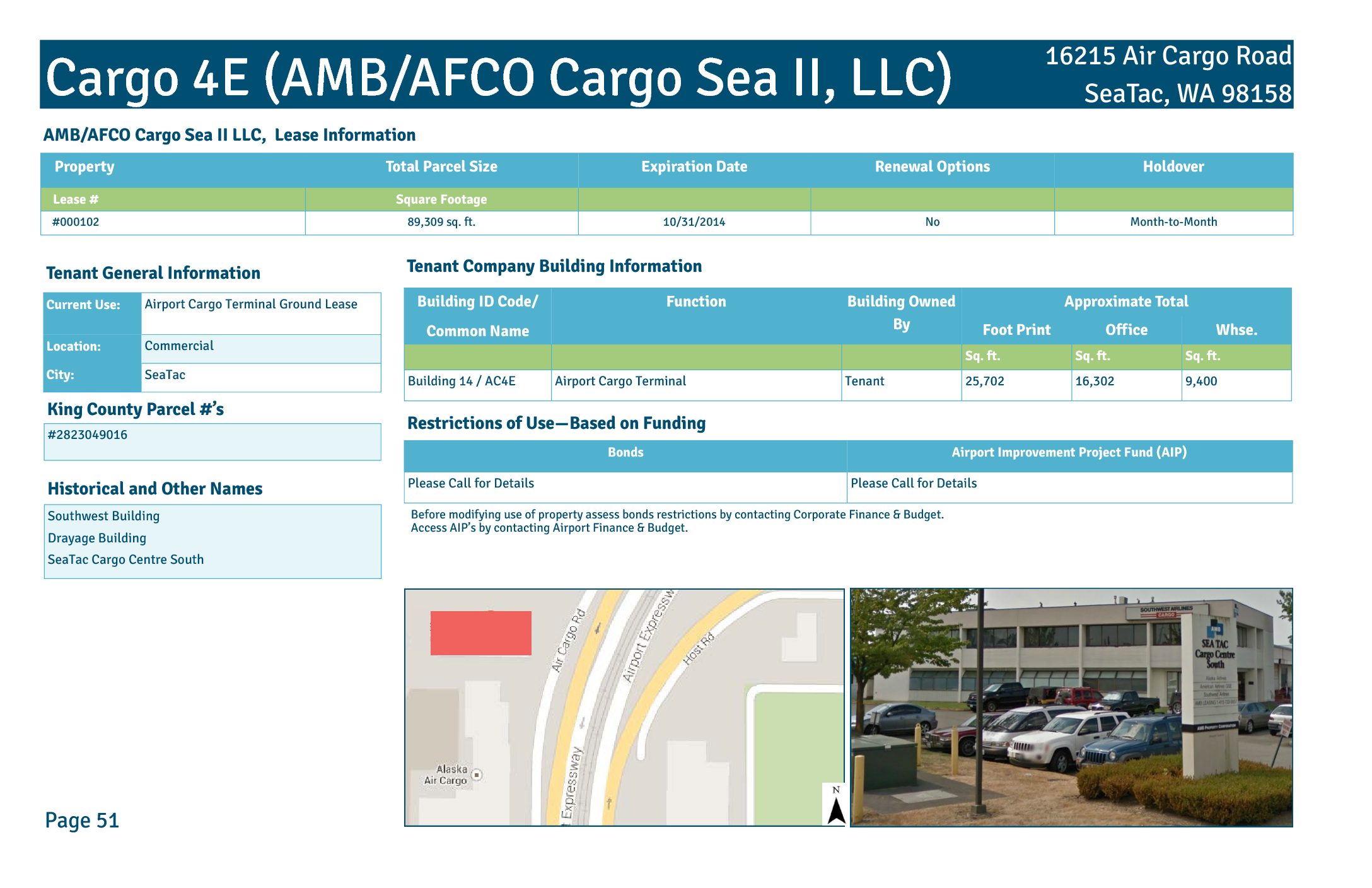
Cargo4E AMB-AFCO Cargo Sea II LLC
Property Total Parcel Size Expiration Date Holdover Renewal Options Lease # Square Footage #000102 89,309 sq. ft. 10/31/2014 Month-to-Month No Cargo 4E (AMB/AFCO Cargo Sea II, LLC) Building ID Code/ Common Name Function Building Owned By Approximate Total Foot Print Office Whse. Sq. ft. Sq. ft. Sq. ft. Building 14 / AC4E Airport Cargo Terminal Tenant 25,702 16,302 9,400 AMB/AFCO Cargo Sea II LLC, Lease Information Tenant Company Building Information 16215 Air Cargo Road SeaTac, WA 98158 Restrictions of Use—Based on Funding Bonds Airport Improvement Project Fund (AIP) Please Call for Details Please Call for Details Tenant General Information Current Use: Airport Cargo Terminal Ground Lease Location: Commercial City: SeaTac Page 51 King County Parcel #’s #2823049016 Before modifying use of property assess bonds restrictions by contacting Corporate Finance & Budget. Access AIP’s by contacting Airport Finance & Budget. Historical and Other Names Southwest Building Drayage Building SeaTac Cargo Centre South Cargo 4E (AMB/AFCO Cargo Sea II, LLC) Lease #000102 Air Cargo Rd Hardstand 4 Alaska Cargo BT Property, LLC FAA Tower POS Maintenance Facility (Air Cargo 4) Cargo 4N United Airlines Maintenance Bolanos Properties, LLC Cargo 4S Cargo 4E C om m er ci al Aerial Photo Taken Spring 2012 100 20050 Feet inch = 100 feet Page 52 Port of Seattle Lease Boundary EasementDate Published: 12-31-2014 Disclaimer: This map is for general reference only. Data Layers that appear on this map may or may not be accurate, current, or otherwise reliable. THIS MAP IS NOT TO BE USED… -
 2019-03-30 21:04
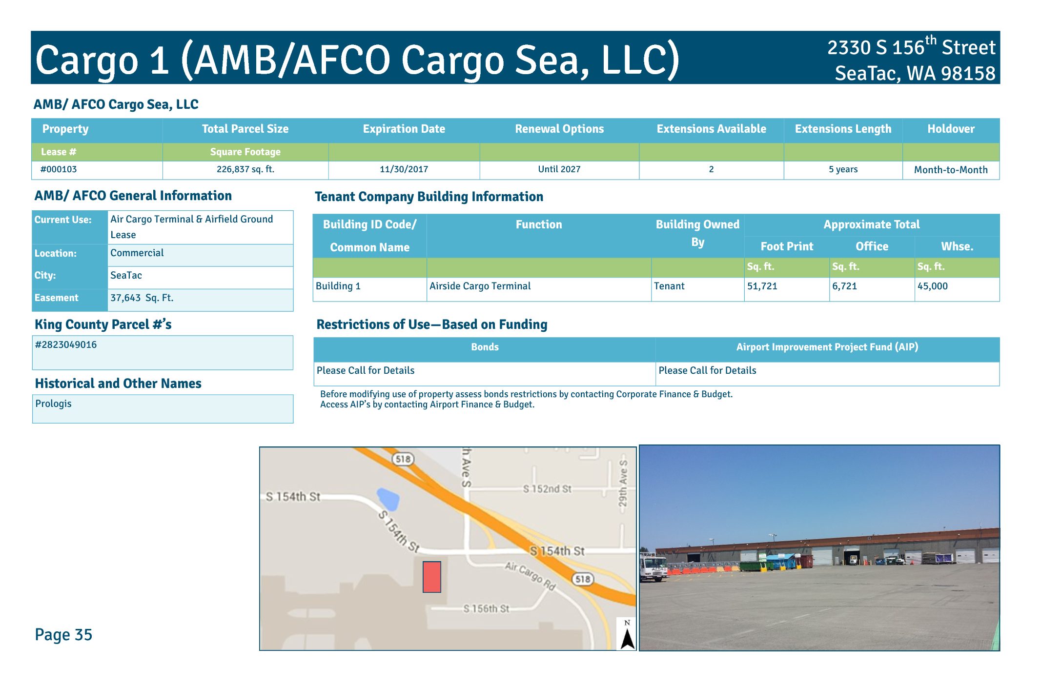
Cargo1 (AMB-AFCO Cargo Sea LLC)
Property Total Parcel Size Expiration Date Renewal Options Extensions Available Extensions Length Holdover Lease # Square Footage #000103 226,837 sq. ft. 11/30/2017 Until 2027 2 5 years Month-to-Month Cargo 1 (AMB/AFCO Cargo Sea, LLC) Building ID Code/ Common Name Function Building Owned By Approximate Total Foot Print Office Whse. Sq. ft. Sq. ft. Sq. ft. Building 1 Airside Cargo Terminal Tenant 51,721 6,721 45,000 AMB/ AFCO Cargo Sea, LLC Tenant Company Building Information 2330 S 156th Street SeaTac, WA 98158 Restrictions of Use—Based on Funding Bonds Airport Improvement Project Fund (AIP) Please Call for Details Please Call for Details AMB/ AFCO General Information Current Use: Air Cargo Terminal & Airfield Ground Lease Location: Commercial City: SeaTac Easement 37,643 Sq. Ft. Page 35 King County Parcel #’s #2823049016 Before modifying use of property assess bonds restrictions by contacting Corporate Finance & Budget. Access AIP’s by contacting Airport Finance & Budget. Historical and Other Names Prologis Cargo 1 (AMB/AFCO Cargo Sea, LLC) Lease #000103 Hardstand 3 Horizon Air Flying Food Fare TransiplexFederal Express Hardstand 2 SR5 24th Ave S S 1 th St S 1 th St S 1 nd St Air Ca rgo Rd Commercial Airfield North Employee Parking Lot L-Shape No rth of Ai rfie ld United Airlines Maintenance Cargo 1 Sky Chefs, Inc. Hardstand 1 Easement Port of Seattle Lease Boundary C om m er ci al Aerial Photo Taken Spring 2012 200 400100 Feet inch = 200 feet Page 36 Zone Matchline Boundary Date Published: 12-31-2014 Disclaimer: This… -
 2019-03-30 21:04
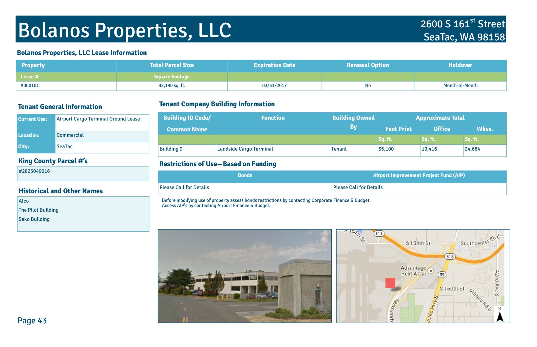
Bolanos Properties LLC
Property Total Parcel Size Expiration Date Renewal Option Holdover Lease # Square Footage #000101 92,190 sq. ft. 03/31/2017 No Month-to-Month Bolanos Properties, LLC Building ID Code/ Common Name Function Building Owned By Approximate Total Foot Print Office Whse. Sq. ft. Sq. ft. Sq. ft. Building 9 Landside Cargo Terminal Tenant 35,100 10,416 24,684 Bolanos Properties, LLC Lease Information Tenant Company Building Information 2600 S 161st Street SeaTac, WA 98158 Restrictions of Use—Based on Funding Bonds Airport Improvement Project Fund (AIP) Please Call for Details Please Call for Details Tenant General Information Current Use: Airport Cargo Terminal Ground Lease Location: Commercial City: SeaTac Page 43 King County Parcel #’s #2823049016 Before modifying use of property assess bonds restrictions by contacting Corporate Finance & Budget. Access AIP’s by contacting Airport Finance & Budget. Historical and Other Names Afco The Pilot Building Seko Building Bolanos Properties, LLC Lease #000101 Transiplex Gate Gourmet Cargo 1 Federal Express S 16 0th St Doug Fox Hardstand 2Air Cargo Rd Alaska Cargo Hardstand 4 Cargo 4E Cargo 4N United Airlines Maintenance Air Cargo Rd Water Tower BT Property, LLC FAA Tower Federal Express Hardstand 3 Bolanos Properties, LLC Cargo 4S C om m er ci al Aerial Photo Taken Spring 2012 200 400100 Feet inch = 200 feet Page 44 Easement Port of Seattle Lease Boundary Date Published: 12-31-2014 Disclaimer: This map is for general reference only. Data Layers that appear on this map may or may not be accurate, current, or otherwise reliable. THIS MAP IS… -
 2019-03-30 21:04
Port of Seattle Boeing Property Map
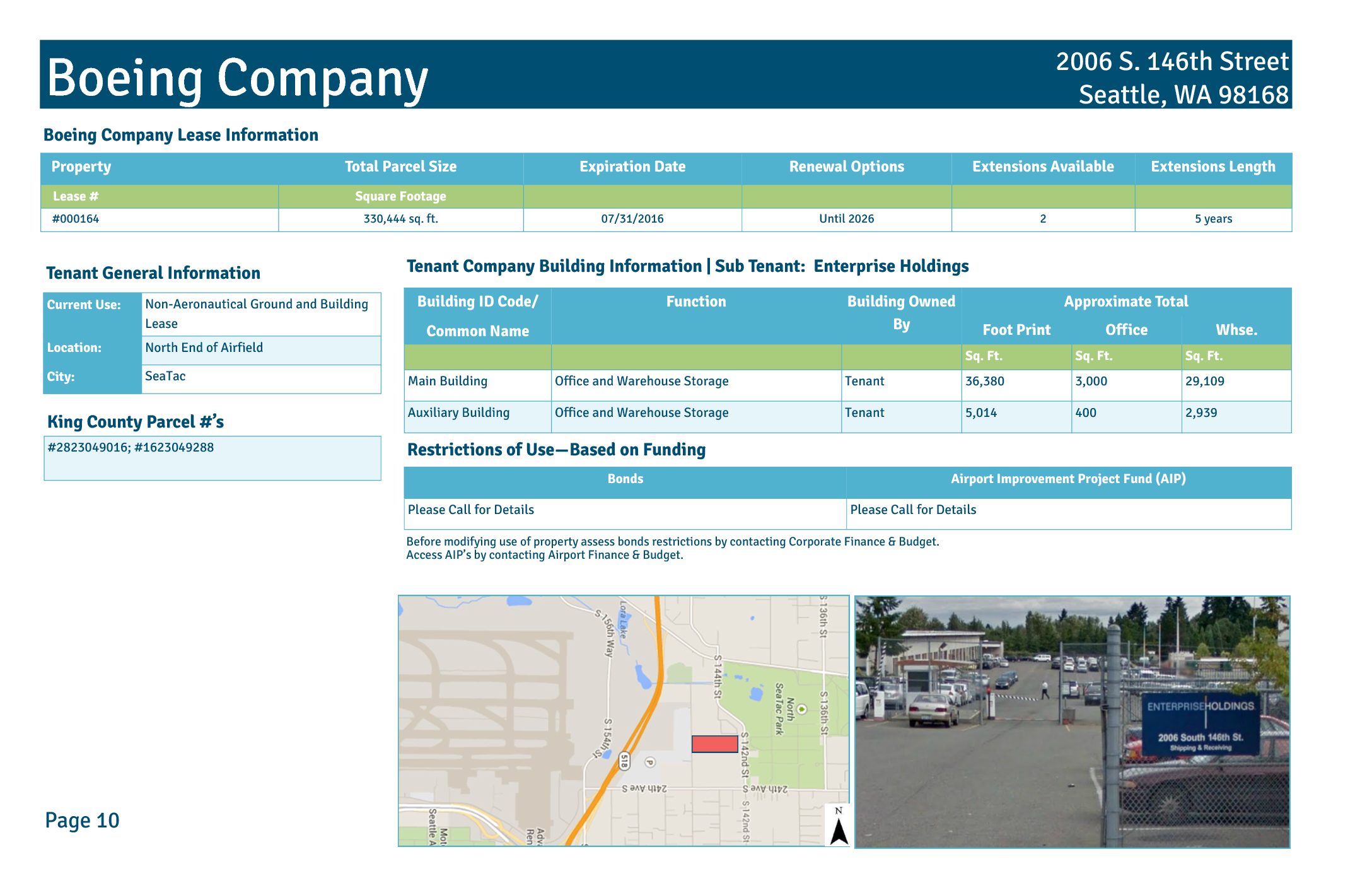
Property Total Parcel Size Expiration Date Renewal Options Extensions Available Extensions Length Lease # Square Footage #000164 330,444 sq. ft. 07/31/2016 Until 2026 2 5 years Boeing Company Building ID Code/ Common Name Function Building Owned By Approximate Total Foot Print Office Whse. Sq. Ft. Sq. Ft. Sq. Ft. Main Building Office and Warehouse Storage Tenant 36,380 3,000 29,109 Auxiliary Building Office and Warehouse Storage Tenant 5,014 400 2,939 Boeing Company Lease Information Tenant Company Building Information | Sub Tenant: Enterprise Holdings 2006 S. 146th Street Seattle, WA 98168 Restrictions of Use—Based on Funding Bonds Airport Improvement Project Fund (AIP) Please Call for Details Please Call for Details Tenant General Information Current Use: Non-Aeronautical Ground and Building Lease Location: North End of Airfield City: SeaTac King County Parcel #’s #2823049016; #1623049288 Before modifying use of property assess bonds restrictions by contacting Corporate Finance & Budget. Access AIP’s by contacting Airport Finance & Budget. 22nd Ave S S 1 th St S 1 th St S 1 nd St S 1 th St Lease #000164 Boeing Company Valley Kangaroo Rugby Football Club Boeing Buffer North SeaTac Park North SeaTac Park Ave S North Employee Parking Lot NEPL Pond S 142nd Pl Riverton Heights Reservoir Boeing Company -
 2019-03-30 21:04
BT Property LLC
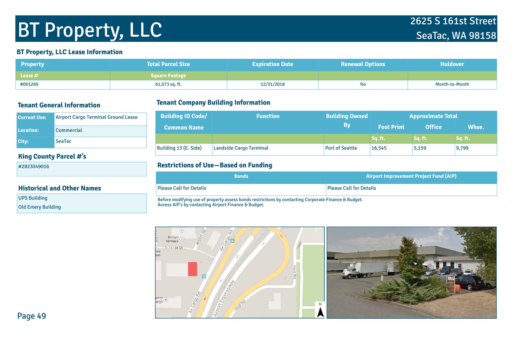
Property Total Parcel Size Expiration Date Renewal Options Holdover Lease # Square Footage #001269 61,073 sq. ft. 12/31/2018 No Month-to-Month BT Property, LLC Building ID Code/ Common Name Function Building Owned By Approximate Total Foot Print Office Whse. Sq. ft. Sq. ft. Sq. ft. Building 13 (E. Side) Landside Cargo Terminal Port of Seattle 16,545 5,159 9,799 BT Property, LLC Lease Information Tenant Company Building Information 2625 S 161st Street SeaTac, WA 98158 Restrictions of Use—Based on Funding Bonds Airport Improvement Project Fund (AIP) Please Call for Details Please Call for Details Tenant General Information Current Use: Airport Cargo Terminal Ground Lease Location: Commercial City: SeaTac Page 49 King County Parcel #’s #2823049016 Before modifying use of property assess bonds restrictions by contacting Corporate Finance & Budget. Access AIP’s by contacting Airport Finance & Budget. Historical and Other Names UPS Building Old Emery Building BT Property, LLC Lease #001269 Gate Gourmet Federal Express Alaska Cargo Cargo 4E Air Cargo Rd BT Property, LLC Bolanos Properties, LLC United Airlines Maintenance Cargo 4N Hardstand 4 C om m er ci al Aerial Photo Taken Spring 2012 100 20050 Feet inch = 100 feet Page 50 Port of Seattle Lease Boundary Easement Date Published: 12-31-2014 Disclaimer: This map is for general reference only. Data Layers that appear on this map may or may not be accurate, current, or otherwise reliable. THIS MAP IS NOT TO BE USED FOR NAVIGATION. -
 2019-03-30 21:03
Port of Seattle Auburn Property Map
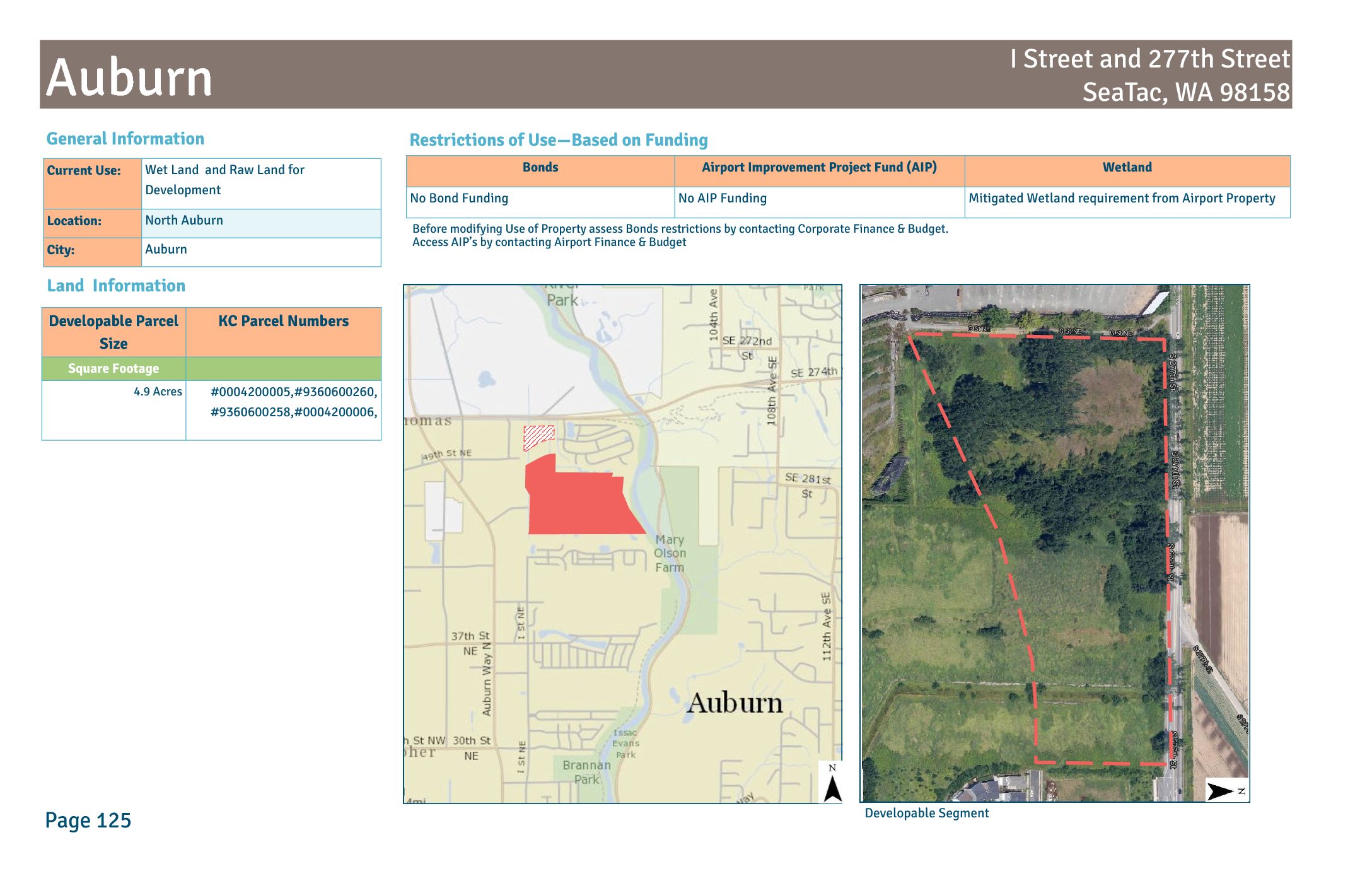
Bonds Airport Improvement Project Fund (AIP) Wetland No Bond Funding No AIP Funding Mitigated Wetland requirement from Airport Property General Information Current Use: Wet Land and Raw Land for Development Location: North Auburn City: Auburn Page 125 Before modifying Use of Property assess Bonds restrictions by contacting Corporate Finance & Budget. Access AIP’s by contacting Airport Finance & Budget Developable Segment Aerial Photo 2014 Google EarthAuburn S 277th St Gre en R iver A ub ur n Auburn L S t N E Gre en Ri ver Rd S t N E 42nd St NE No Lease Available for Development Date Published: 12-31-2014 I 400 800200 Feet inch = 400 feet Available for Development Port of Seattle Property Page 126Disclaimer: This map is for general reference only. Data Layers that appear on this map may or may not be accurate, current, or otherwise reliable. THIS MAP IS NOT TO BE USED FOR NAVIGATION. -
 2019-03-30 21:03
Alaska Parking Lot
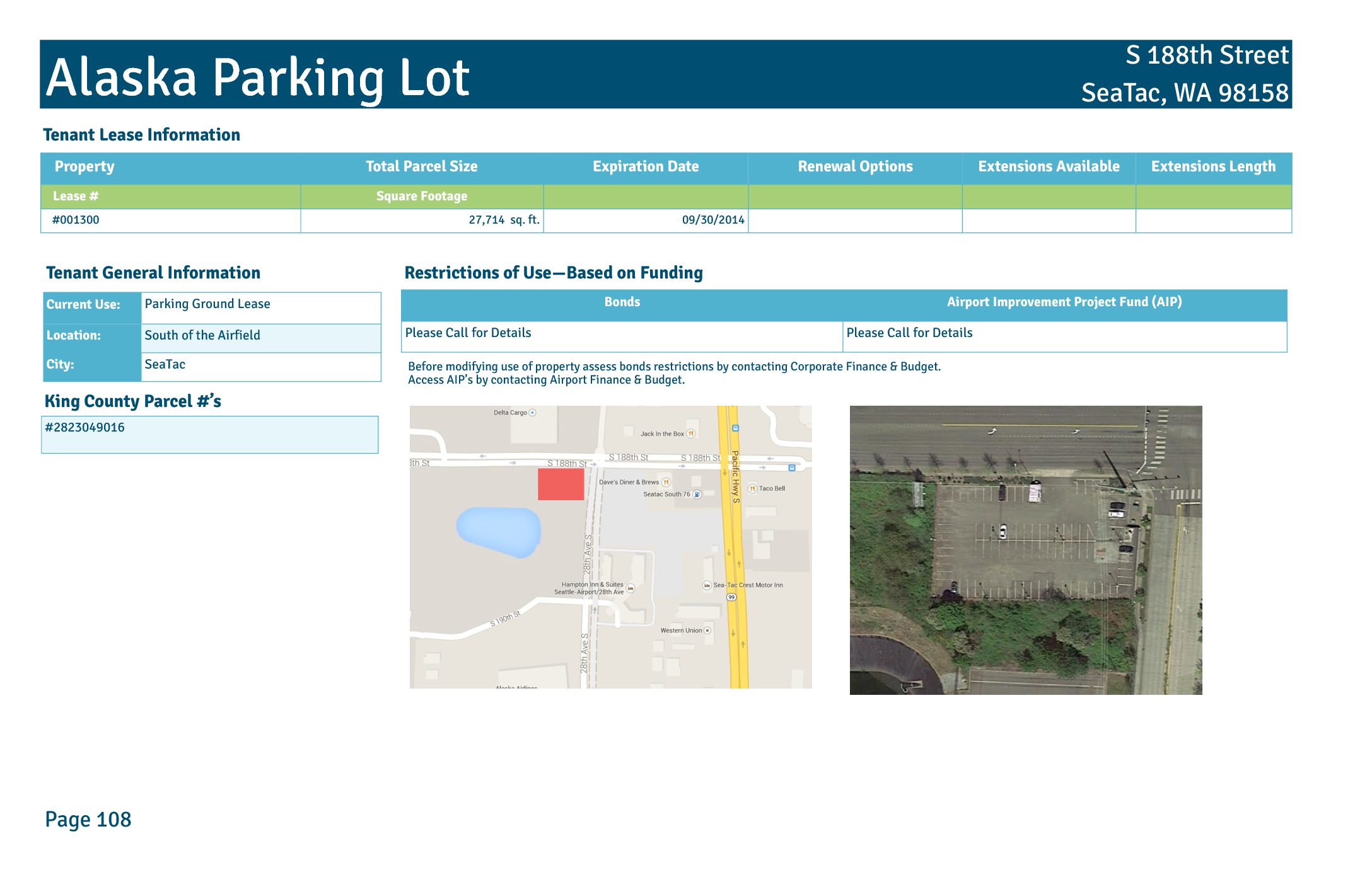
Property Total Parcel Size Expiration Date Renewal Options Extensions Available Extensions Length Lease # Square Footage #001300 27,714 sq. ft. 09/30/2014 Alaska Parking Lot Tenant Lease Information S 188th Street SeaTac, WA 98158 Tenant General Information Current Use: Parking Ground Lease Location: South of the Airfield City: SeaTac Page 108 Restrictions of Use—Based on Funding Bonds Airport Improvement Project Fund (AIP) Please Call for Details Please Call for Details King County Parcel #’s #2823049016 Before modifying use of property assess bonds restrictions by contacting Corporate Finance & Budget. Access AIP’s by contacting Airport Finance & Budget. Alaska Parking Lot Lease #001300 SDE4 Pond Alaska Parking Lot 28th Ave S S 1 th St Air Cargo Rd 100 20050 Feet inch = 100 feet Zone Matchline Boundary Port of Seattle Lease Boundary So ut h of A ir fi el d Page 109 Aerial Photo Taken Spring 2012 Delta Cargo/Hangar Sou th of Air fie ld Ter mi na l Date Published: 12-31-2014 Disclaimer: This map is for general reference only. Data Layers that appear on this map may or may not be accurate, current, or otherwise reliable. THIS MAP IS NOT TO BE USED FOR NAVIGATION. South Employee Parking Lot -
 2019-03-30 21:03
Alaska Hangar
Property Total Parcel Size Expiration Date Renewal Options Holdover Lease # Square Footage #000060 468,754 sq. ft. 12/31/2031 No Month-to-Month Alaska Hangar Building ID Code/ Common Name Function Building Owned By Approximate Total Foot Print Office Whse. Sq. ft. Sq. ft. Sq. ft. Maintenance Building Maintenance Facility Port of Seattle 3,866 6,434 Hangar 1 Port of Seattle 62,551 21,200 101,346 Hangar 2 w/Connector Port of Seattle 81,692 19,354 101,346 Alaska Hangar Lease Information Tenant Company Building Information 18650 Alaska Service Road SeaTac, WA 98158 Tenant General Information Current Use: Airline Maintenance Hanger Ground & Building Lease Location: South-end of Airfield (Inside the Fence) City: SeaTac Page 88 Restrictions of Use—Based on Funding Bonds Airport Improvement Project Fund (AIP) Please Call for Details Please Call for Details King County Parcel #’s #2823049016 Before modifying use of property assess bonds restrictions by contacting Corporate Finance & Budget. Access AIP’s by contacting Airport Finance & Budget. Alaska Hangar Lease #000060 Delta Cargo/Hangar Hardstand 7 Ter mi na l Sou th of Air fie ld Menzies Aviation Aircraft Services International, Inc. -
 2019-03-30 21:03
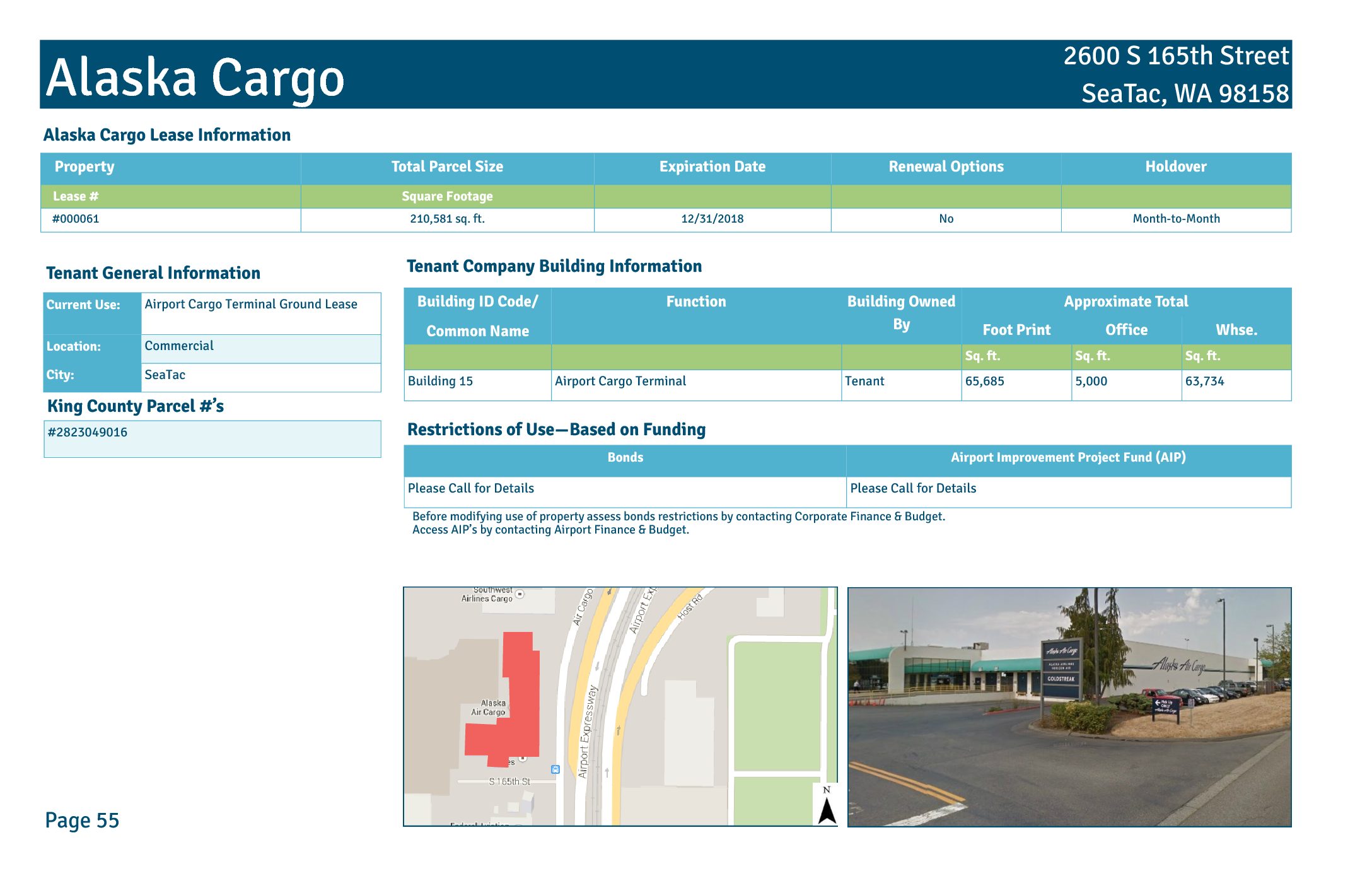
Alaska Cargo
Property Total Parcel Size Expiration Date Holdover Renewal Options Lease # Square Footage #000061 210,581 sq. ft. 12/31/2018 Month-to-Month No Alaska Cargo Building ID Code/ Common Name Function Building Owned By Approximate Total Foot Print Office Whse. Sq. ft. Sq. ft. Sq. ft. Building 15 Airport Cargo Terminal Tenant 65,685 5,000 63,734 Alaska Cargo Lease Information Tenant Company Building Information 2600 S 165th Street SeaTac, WA 98158 Tenant General Information Current Use: Airport Cargo Terminal Ground Lease Location: Commercial City: SeaTac Page 55 King County Parcel #’s #2823049016 Restrictions of Use—Based on Funding Bonds Airport Improvement Project Fund (AIP) Please Call for Details Please Call for Details Before modifying use of property assess bonds restrictions by contacting Corporate Finance & Budget. Access AIP’s by contacting Airport Finance & Budget. Alaska Cargo Lease #000061 Air Cargo Rd Hardstand 4 Cargo 4E BT Property, LLC FAA Tower POS Maintenance Facility (Air Cargo 4) Hardstand 5 Cargo 4N Cargo 4S Alaska Cargo C om m er ci al Aerial Photo Taken Spring 2012 100 20050 Feet inch = 100 feet Page 56 Port of Seattle Lease Boundary Date Published: 12-31-2014 Disclaimer: This map is for general reference only. Data Layers that appear on this map may or may not be accurate, current, or otherwise reliable. THIS MAP IS NOT TO BE USED FOR NAVIGATION.