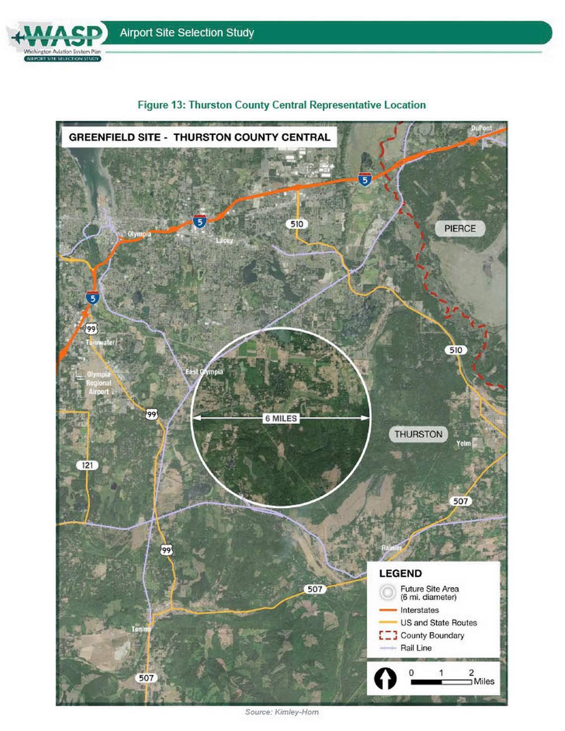
This map, produced by Kimley-Horn for the Washington Aviation System Plan (WASP) Airport Site Selection Study, depicts the Thurston County Central representative location as a potential greenfield airport site, marked by a 6-mile diameter circle near East Olympia, Washington. The map shows surrounding infrastructure including Interstate 5, State Routes 510 and 507, rail lines, the Pierce-Thurston county boundary, and the existing Olympia Regional Airport.Open full document
Notes
This map, produced by Kimley-Horn for the Washington Aviation System Plan (WASP) Airport Site Selection Study, depicts the Thurston County Central representative location as a potential greenfield airport site, marked by a 6-mile diameter circle near East Olympia, Washington. The map shows surrounding infrastructure including Interstate 5, State Routes 510 and 507, rail lines, the Pierce-Thurston county boundary, and the existing Olympia Regional Airport.