Notes
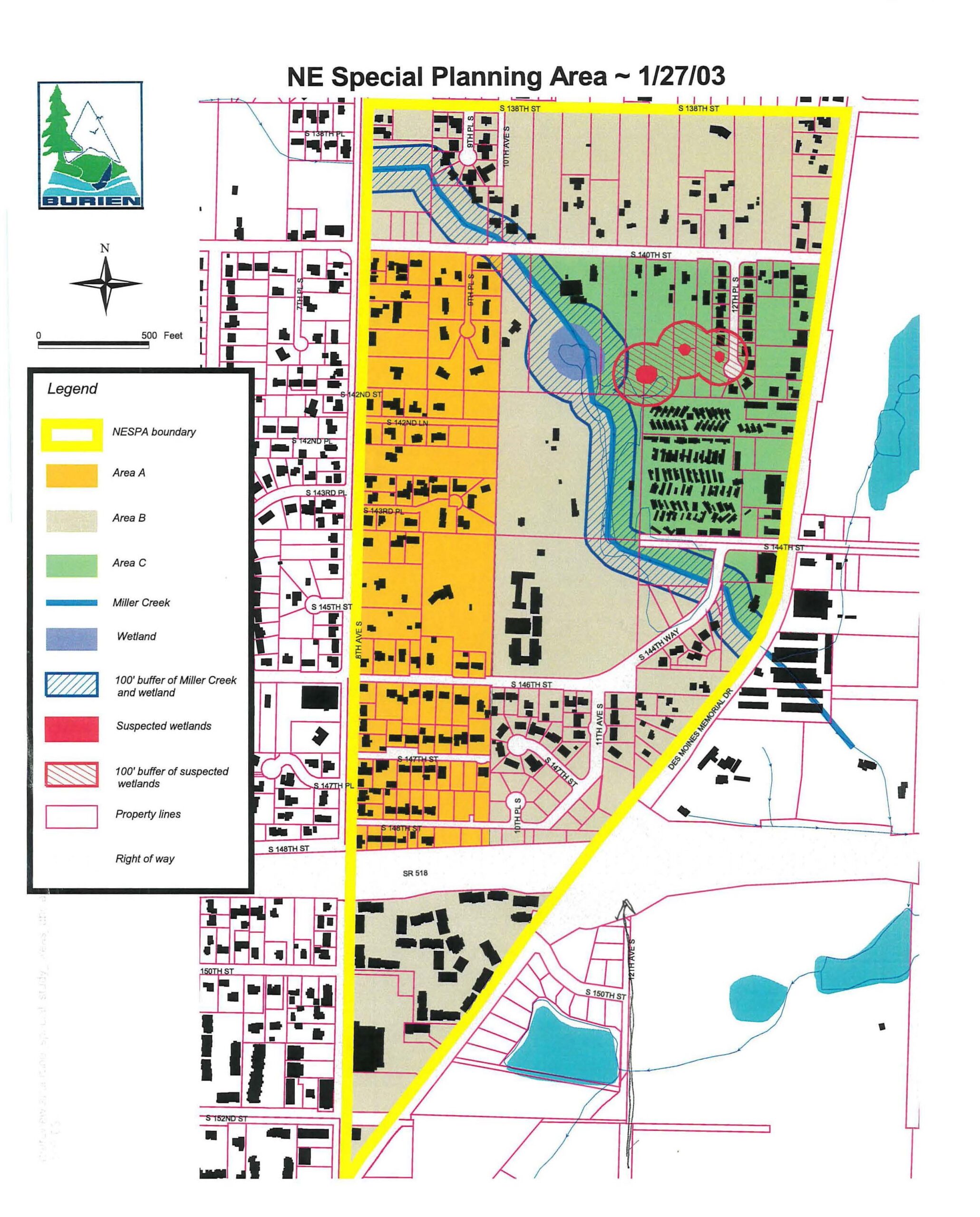
A planning map of the Northeast Special Planning Area dated January 27, 2003, showing different development areas (A, B, C), Miller Creek, wetlands, property boundaries, and buffers. The map includes a legend identifying NESPA boundary, various land use designations, waterways, and development constraints.