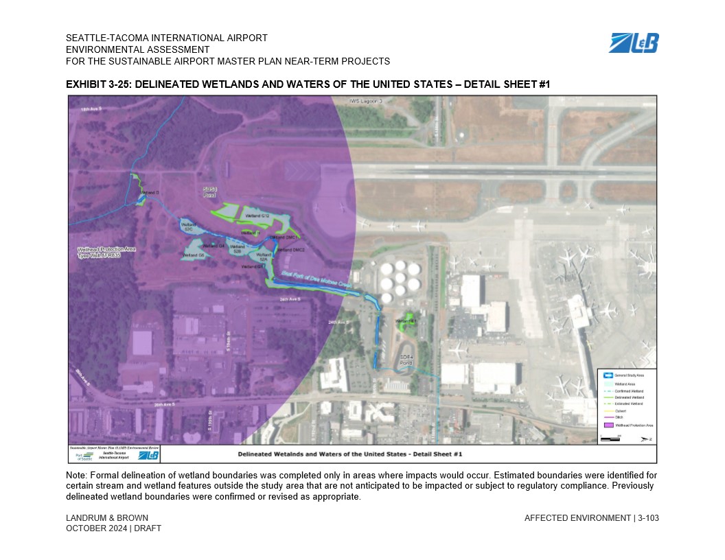
Exhibit 3-25 from the Seattle-Tacoma International Airport Environmental Assessment for the Sustainable Airport Master Plan Near-Term Projects, prepared by Landrum & Brown, dated October 2024 (Draft). The aerial map identifies delineated, confirmed, and estimated wetland boundaries, streams, ditches, and Wellhead Protection Areas in the vicinity of Sea-Tac Airport, including named wetlands (e.g., Wetland G12, Wetland DMC2) and the West Fork of Des Moines Creek.Open full document
Notes
Exhibit 3-25 from the Seattle-Tacoma International Airport Environmental Assessment for the Sustainable Airport Master Plan Near-Term Projects, prepared by Landrum & Brown, dated October 2024 (Draft). The aerial map identifies delineated, confirmed, and estimated wetland boundaries, streams, ditches, and Wellhead Protection Areas in the vicinity of Sea-Tac Airport, including named wetlands (e.g., Wetland G12, Wetland DMC2) and the West Fork of Des Moines Creek.